Beolgyo elevation
Beolgyo (Jeollanam-do), South Korea elevation is 64 meters and Beolgyo elevation in feet is 210 ft above sea level [src 1]. Beolgyo is a seat of a third-order administrative division (feature code) with elevation that is 8 meters (26 ft) smaller than average city elevation in South Korea.
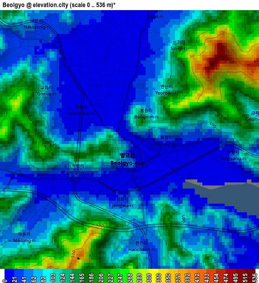
Below is the Elevation map of Beolgyo, which displays elevation range with different colors. Scale of the first map is from 0 to 536 m (0 to 1759 ft) with average elevation of 96.4 meters (=316 ft) [note 1]
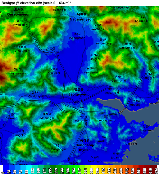
These maps also provides idea of topography and contour of this city, they are displayed at different zoom levels. More info about maps, scale and edge coordinates you can find below images.
| \ | Map #1 | Map #2 | Topo.Map |
| Scale [m] | 0..536 m | 0..634 m | × |
| Scale [ft] | 0..1759 ft | 0..2080 ft | × |
| Average | 96.4 m = 316 ft | 145.5 m = 477 ft | × |
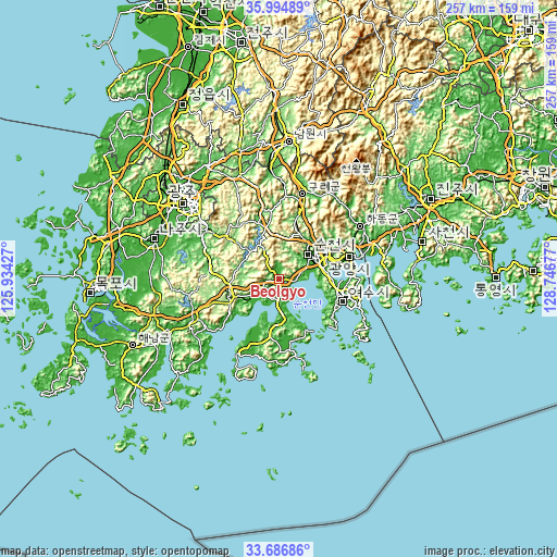
| Width | 8.02 km = 5 mi | 16.04 km = 10 mi | 256.6 km = 159.4 mi |
| Height | 8.02 km = 5 mi | 16.04 km = 10 mi | 256.6 km = 159.4 mi |
| ↑Max Latitude | 34.885026° | 34.921067° | 35.99489° |
| Latitude at center | 34.84897° | 34.84897° | 34.84897° |
| ↓Min Latitude | 34.812898° | 34.77681° | 33.68686° |
| ← Min Longitude | 127.296575° | 127.252629° | 125.93427° |
| Longitude center | 127.34052° | 127.34052° | 127.34052° |
| →Max Longitude | 127.384465° | 127.428411° | 128.74677° |
Nearby cities:
Cities around Beolgyo sort by population:
• Suncheon elevation 7 m
17.5 km,  49°
49°
• Bongnae 112 m
19.7 km,  284°
284°
• Haeryong 13 m
19.4 km,  68°
68°
• Seungju 111 m
19 km,  13°
13°
• Mundeok 131 m
17.8 km,  300°
300°
• Gyeombaek 119 m
17.4 km,  262°
262°
• Songgwang 139 m
15.7 km,  333°
333°
• Sangsa 11 m
14.5 km, 46°
• Yureo 135 m
14.2 km, 279°
• Byeollyang 33 m
10.5 km, 74°
• Joseong 16 m
9.6 km,  242°
242°
• Oeseo 214 m
9.3 km,  321°
321°
Multilingual:
 En español:
Beolgyo elevación 64 m.
 En France:
Beolgyo élévation 64 m.


Sources and notes:
- [note 1] Map square and city borders are not equal. Map elevation data is calculated only from area inside that square.
- [src 1] Elevation data from geonames database provided with same terms of usage.
- [src 2] The elevation map of Beolgyo is generated using elevation data from NASA's 3 arcsec (90m) resolution SRTM data.
- [src 3] Base (background) map © OpenStreetMap contributors tiles are generated by Geofabrik and OpenTopoMap.
Copyright & License:
This Beolgyo Elevation Map is licensed under CC BY-SA. You may reuse any part from this page, if you give a proper credit by linking to this URL:
 More info on terms of use page.