Sokcho elevation
Sokcho (Gangwon-do), South Korea elevation is 20 meters and Sokcho elevation in feet is 66 ft above sea level [src 1]. Sokcho is a seat of a second-order administrative division (feature code) with elevation that is 52 meters (171 ft) smaller than average city elevation in South Korea.
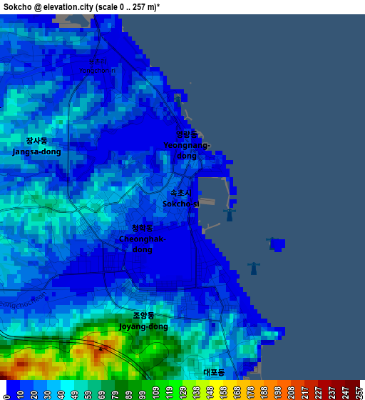
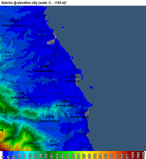
Below is the Elevation map of Sokcho, which displays elevation range with different colors. Scale of the first map is from 0 to 257 m (0 to 843 ft) with average elevation of 33.3 meters (=109 ft) [note 1]
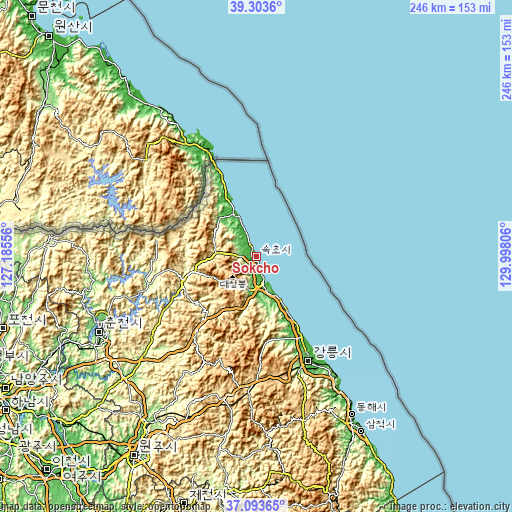
These maps also provides idea of topography and contour of this city, they are displayed at different zoom levels. More info about maps, scale and edge coordinates you can find below images.
| \ | Map #1 | Map #2 | Topo.Map |
| Scale [m] | 0..257 m | -2..1105 m | × |
| Scale [ft] | 0..843 ft | -7..3625 ft | × |
| Average | 33.3 m = 109 ft | 106.7 m = 350 ft | × |
| Width | 7.68 km = 4.8 mi | 15.36 km = 9.5 mi | 245.7 km = 152.7 mi |
| Height | 7.68 km = 4.8 mi | 15.36 km = 9.5 mi | 245.7 km = 152.7 mi |
| ↑Max Latitude | 38.241533° | 38.27604° | 39.3036° |
| Latitude at center | 38.20701° | 38.20701° | 38.20701° |
| ↓Min Latitude | 38.17247° | 38.137914° | 37.09365° |
| ← Min Longitude | 128.547865° | 128.503919° | 127.18556° |
| Longitude center | 128.59181° | 128.59181° | 128.59181° |
| →Max Longitude | 128.635755° | 128.679701° | 129.99806° |
Nearby cities:
Cities around Sokcho sort by population:
• Gangneung elevation 42 m
56.2 km,  154°
154°
• Kosong 17 m
22 km,  330°
330°
• Yanggu 192 m
53.9 km,  257°
257°
• Hwacheon 115 m
78.2 km, 261°
• Dongnae 99 m
83 km,  241°
241°
• Seoseok 325 m
65.5 km,  212°
212°
• Gangdong 21 m
61.9 km, 149°
• Gujeong 48 m
59.8 km,  155°
155°
• Bangsan 257 m
56.1 km,  270°
270°
• Dongmyeon 293 m
47.9 km, 269°
• Haean 434 m
40.6 km,  282°
282°
• Toseong 9 m
6.2 km, 333°
Multilingual:
 En español:
Sokcho elevación 20 m.
 En France:
Sokcho élévation 20 m.


Sources and notes:
- [note 1] Map square and city borders are not equal. Map elevation data is calculated only from area inside that square.
- [src 1] Elevation data from geonames database provided with same terms of usage.
- [src 2] The elevation map of Sokcho is generated using elevation data from NASA's 3 arcsec (90m) resolution SRTM data.
- [src 3] Base (background) map © OpenStreetMap contributors tiles are generated by Geofabrik and OpenTopoMap.
Copyright & License:
This Sokcho Elevation Map is licensed under CC BY-SA. You may reuse any part from this page, if you give a proper credit by linking to this URL:
 More info on terms of use page.