Yesan elevation
Yesan (Chungcheongnam-do), South Korea elevation is 23 meters and Yesan elevation in feet is 75 ft above sea level [src 1]. Yesan is a populated place (feature code) with elevation that is 49 meters (161 ft) smaller than average city elevation in South Korea.
Below is the Elevation map of Yesan, which displays elevation range with different colors. Scale of the first map is from 4 to 413 m (13 to 1355 ft) with average elevation of 85.3 meters (=280 ft) [note 1]
These maps also provides idea of topography and contour of this city, they are displayed at different zoom levels. More info about maps, scale and edge coordinates you can find below images.
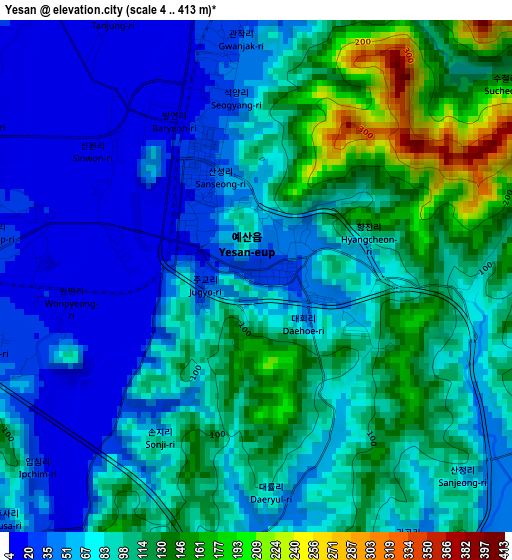
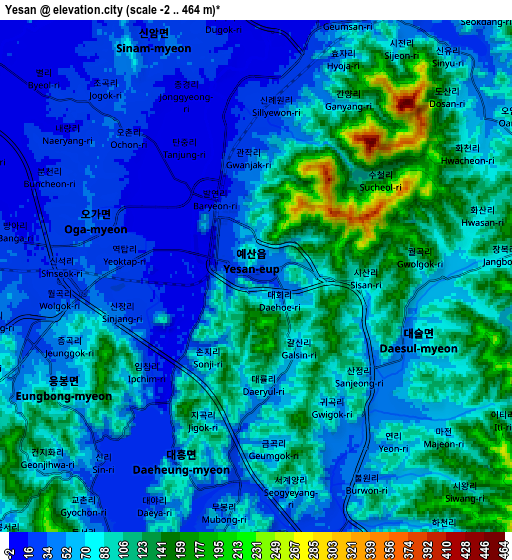
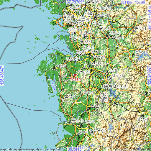
| \ | Map #1 | Map #2 | Topo.Map |
| Scale [m] | 4..413 m | -2..464 m | × |
| Scale [ft] | 13..1355 ft | -7..1522 ft | × |
| Average | 85.3 m = 280 ft | 76.3 m = 250 ft | × |
| Width | 7.84 km = 4.9 mi | 15.68 km = 9.7 mi | 250.8 km = 155.8 mi |
| Height | 7.84 km = 4.9 mi | 15.68 km = 9.7 mi | 250.8 km = 155.8 mi |
| ↑Max Latitude | 36.712796° | 36.748017° | 37.79709° |
| Latitude at center | 36.67756° | 36.67756° | 36.67756° |
| ↓Min Latitude | 36.642307° | 36.607039° | 35.5415° |
| ← Min Longitude | 126.798775° | 126.754829° | 125.43647° |
| Longitude center | 126.84272° | 126.84272° | 126.84272° |
| →Max Longitude | 126.886665° | 126.930611° | 128.24897° |
Nearby cities:
Cities around Yesan sort by population:
• Cheonan elevation 40 m
31.1 km,  62°
62°
• Sejong 49 m
41.2 km,  103°
103°
• Asan 27 m
18.6 km,  50°
50°
• Hongseong 31 m
18 km,  241°
241°
• Seosan 33 m
36.7 km,  288°
288°
• Gongju 23 m
35.3 km,  134°
134°
• Boryeong 11 m
42.6 km,  210°
210°
• Tangjin 20 m
30.7 km,  321°
321°
• Seonghwan 38 m
36.9 km,  44°
44°
• Jangpyeong 21 m
37.6 km,  173°
173°
• Cheongnam 10 m
37.4 km,  164°
164°
• Cheongyang 93 m
25.4 km,  187°
187°
Multilingual:
 En español:
Yesan elevación 23 m.
 En France:
Yesan élévation 23 m.


Sources and notes:
- [note 1] Map square and city borders are not equal. Map elevation data is calculated only from area inside that square.
- [src 1] Elevation data from geonames database provided with same terms of usage.
- [src 2] The elevation map of Yesan is generated using elevation data from NASA's 3 arcsec (90m) resolution SRTM data.
- [src 3] Base (background) map © OpenStreetMap contributors tiles are generated by Geofabrik and OpenTopoMap.
Copyright & License:
This Yesan Elevation Map is licensed under CC BY-SA. You may reuse any part from this page, if you give a proper credit by linking to this URL:
 More info on terms of use page.