Heunghae elevation
Heunghae (Gyeongsangbuk-do), South Korea elevation is 22 meters and Heunghae elevation in feet is 72 ft above sea level [src 1]. Heunghae is a seat of a third-order administrative division (feature code) with elevation that is 50 meters (164 ft) smaller than average city elevation in South Korea.
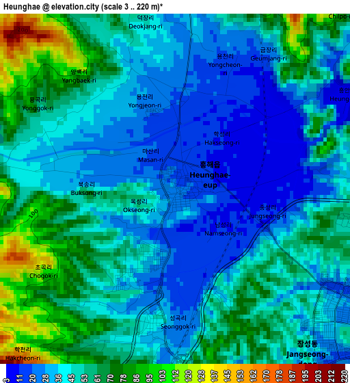
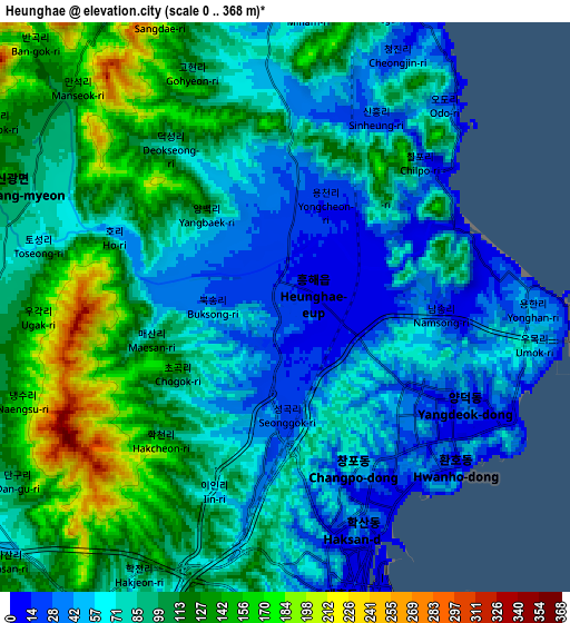
Below is the Elevation map of Heunghae, which displays elevation range with different colors. Scale of the first map is from 3 to 220 m (10 to 722 ft) with average elevation of 48.1 meters (=158 ft) [note 1]
These maps also provides idea of topography and contour of this city, they are displayed at different zoom levels. More info about maps, scale and edge coordinates you can find below images.
| \ | Map #1 | Map #2 | Topo.Map |
| Scale [m] | 3..220 m | 0..368 m | × |
| Scale [ft] | 10..722 ft | 0..1207 ft | × |
| Average | 48.1 m = 158 ft | 88.6 m = 291 ft | × |
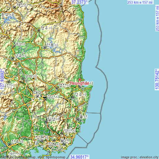
| Width | 7.9 km = 4.9 mi | 15.79 km = 9.8 mi | 252.6 km = 157 mi |
| Height | 7.9 km = 4.9 mi | 15.79 km = 9.8 mi | 252.6 km = 157 mi |
| ↑Max Latitude | 36.144945° | 36.180424° | 37.2373° |
| Latitude at center | 36.10945° | 36.10945° | 36.10945° |
| ↓Min Latitude | 36.073939° | 36.038412° | 34.96517° |
| ← Min Longitude | 129.301225° | 129.257279° | 127.93892° |
| Longitude center | 129.34517° | 129.34517° | 129.34517° |
| →Max Longitude | 129.389115° | 129.433061° | 130.75142° |
Nearby cities:
Cities around Heunghae sort by population:
• Pohang elevation 5 m
9.1 km,  168°
168°
• Gyeongju 45 m
32 km,  202°
202°
• Eisen 85 m
40.5 km,  247°
247°
• Yeonil 4 m
12.7 km,  177°
177°
• Hayang 57 m
52 km, 245°
• Cheongsong gun 197 m
44.3 km,  324°
324°
• Gampo 13 m
36.6 km,  157°
157°
• Yeongdeok 17 m
33.9 km,  3°
3°
• Guryongpo 7 m
23 km,  125°
125°
• Ocheon 22 m
16.6 km, 158°
• Cheongha 47 m
9.9 km,  356°
356°
• Singwang 82 m
7.6 km,  286°
286°
Multilingual:
 En español:
Heunghae elevación 22 m.
 En France:
Heunghae élévation 22 m.


Sources and notes:
- [note 1] Map square and city borders are not equal. Map elevation data is calculated only from area inside that square.
- [src 1] Elevation data from geonames database provided with same terms of usage.
- [src 2] The elevation map of Heunghae is generated using elevation data from NASA's 3 arcsec (90m) resolution SRTM data.
- [src 3] Base (background) map © OpenStreetMap contributors tiles are generated by Geofabrik and OpenTopoMap.
Copyright & License:
This Heunghae Elevation Map is licensed under CC BY-SA. You may reuse any part from this page, if you give a proper credit by linking to this URL:
 More info on terms of use page.