Hau-ri elevation
Hau-ri (Hamgyŏng-bukto), North Korea elevation is 124 meters and Hau-ri elevation in feet is 407 ft above sea level [src 1]. Hau-ri is a populated locality (feature code) with elevation that is 7 meters (23 ft) smaller than average city elevation in North Korea.
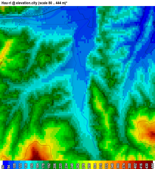
Below is the Elevation map of Hau-ri, which displays elevation range with different colors. Scale of the first map is from 80 to 444 m (262 to 1457 ft) with average elevation of 182.2 meters (=598 ft) [note 1]
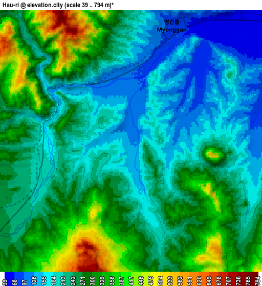
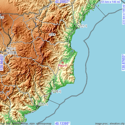
These maps also provides idea of topography and contour of this city, they are displayed at different zoom levels. More info about maps, scale and edge coordinates you can find below images.
| \ | Map #1 | Map #2 | Topo.Map |
| Scale [m] | 80..444 m | 39..794 m | × |
| Scale [ft] | 262..1457 ft | 128..2605 ft | × |
| Average | 182.2 m = 598 ft | 248.3 m = 815 ft | × |
| Width | 7.35 km = 4.6 mi | 14.71 km = 9.1 mi | 235.3 km = 146.2 mi |
| Height | 7.35 km = 4.6 mi | 14.71 km = 9.1 mi | 235.3 km = 146.2 mi |
| ↑Max Latitude | 41.233616° | 41.266656° | 42.25007° |
| Latitude at center | 41.20056° | 41.20056° | 41.20056° |
| ↓Min Latitude | 41.167487° | 41.134397° | 40.13395° |
| ← Min Longitude | 129.426335° | 129.382389° | 128.06403° |
| Longitude center | 129.47028° | 129.47028° | 129.47028° |
| →Max Longitude | 129.514225° | 129.558171° | 130.87653° |
Nearby cities:
Cities around Hau-ri sort by population:
• Chongjin elevation 5 m
70.9 km,  21°
21°
• Hyesan-dong 736 m
110.1 km,  281°
281°
• Kilju 129 m
28.9 km,  204°
204°
• Kyŏngsŏng 18 m
44.5 km,  14°
14°
• Nanam 24 m
59.8 km, 17°
• Kapsan-ŭp 813 m
99.3 km,  262°
262°
• Puryŏng 168 m
97.7 km, 11°
• Komusan Il-tong 221 m
102.8 km, 10°
• Sŭngjibaegam 1466 m
56.3 km,  274°
274°
• Hoemul-li 3 m
30.8 km,  32°
32°
• Sŭngam-nodongjagu 12 m
54.7 km, 17°
• Kimch’aek-si 5 m
63.6 km, 201°
Multilingual:
 En español:
Hau-ri elevación 124 m.
 En France:
Hau-ri élévation 124 m.


Sources and notes:
- [note 1] Map square and city borders are not equal. Map elevation data is calculated only from area inside that square.
- [src 1] Elevation data from geonames database provided with same terms of usage.
- [src 2] The elevation map of Hau-ri is generated using elevation data from NASA's 3 arcsec (90m) resolution SRTM data.
- [src 3] Base (background) map © OpenStreetMap contributors tiles are generated by Geofabrik and OpenTopoMap.
Copyright & License:
This Hau-ri Elevation Map is licensed under CC BY-SA. You may reuse any part from this page, if you give a proper credit by linking to this URL:
 More info on terms of use page.