Fomboni elevation
Fomboni (Mohéli), Comoros elevation is 18 meters and Fomboni elevation in feet is 59 ft above sea level [src 1]. Fomboni is a seat of a first-order administrative division (feature code) with elevation that is 176 meters (577 ft) smaller than average city elevation in Comoros.
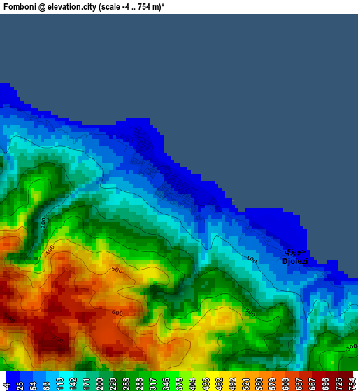
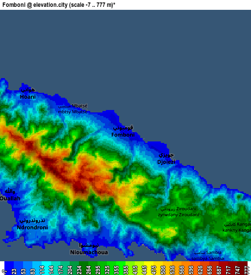
Below is the Elevation map of Fomboni, which displays elevation range with different colors. Scale of the first map is from -4 to 754 m (-13 to 2474 ft) with average elevation of 281.4 meters (=923 ft) [note 1]
These maps also provides idea of topography and contour of this city, they are displayed at different zoom levels. More info about maps, scale and edge coordinates you can find below images.
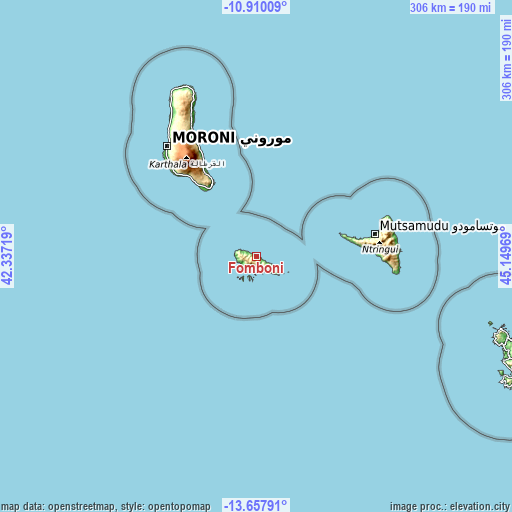
| \ | Map #1 | Map #2 | Topo.Map |
| Scale [m] | -4..754 m | -7..777 m | × |
| Scale [ft] | -13..2474 ft | -23..2549 ft | × |
| Average | 281.4 m = 923 ft | 233.4 m = 766 ft | × |
| Width | 9.55 km = 5.9 mi | 19.1 km = 11.9 mi | 305.5 km = 189.8 mi |
| Height | 9.55 km = 5.9 mi | 19.1 km = 11.9 mi | 305.6 km = 189.9 mi |
| ↑Max Latitude | -12.244648° | -12.201699° | -10.91009° |
| Latitude at center | -12.28759° | -12.28759° | -12.28759° |
| ↓Min Latitude | -12.330525° | -12.373453° | -13.65791° |
| ← Min Longitude | 43.699495° | 43.655549° | 42.33719° |
| Longitude center | 43.74344° | 43.74344° | 43.74344° |
| →Max Longitude | 43.787385° | 43.831331° | 45.14969° |
Nearby cities:
Cities around Fomboni sort by population:
• Foumbouni elevation 14 m
54.1 km,  330°
330°
• Nioumachoua 14 m
8.8 km,  200°
200°
• Djoyézi 15 m
3.9 km,  121°
121°
• Ouanani 217 m
8.1 km,  133°
133°
• Kavani 160 m
58.1 km,  79°
79°
• Bimbini 151 m
54.6 km, 78°
• Chindini 1 m
48.9 km, 325°
• Ourovéni 10 m
49.4 km, 327°
• Mtakoudja 39 m
5.2 km,  304°
304°
• Ziroudani 268 m
6.2 km,  143°
143°
• Hoani 19 m
8.5 km, 298°
• Nioumamilima 519 m
58 km, 326°
Multilingual:
 En español:
Fomboni elevación 18 m.
 En France:
Fomboni élévation 18 m.


Sources and notes:
- [note 1] Map square and city borders are not equal. Map elevation data is calculated only from area inside that square.
- [src 1] Elevation data from geonames database provided with same terms of usage.
- [src 2] The elevation map of Fomboni is generated using elevation data from NASA's 3 arcsec (90m) resolution SRTM data.
- [src 3] Base (background) map © OpenStreetMap contributors tiles are generated by Geofabrik and OpenTopoMap.
Copyright & License:
This Fomboni Elevation Map is licensed under CC BY-SA. You may reuse any part from this page, if you give a proper credit by linking to this URL:
 More info on terms of use page.