Kampong Speu elevation
Kampong Speu, Cambodia elevation is 35 meters and Kampong Speu elevation in feet is 115 ft above sea level [src 1]. Kampong Speu is a seat of a first-order administrative division (feature code) with elevation that is 17 meters (56 ft) smaller than average city elevation in Cambodia.
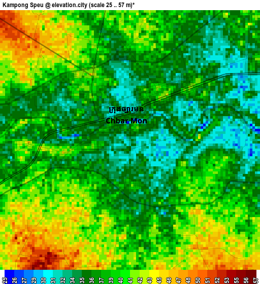
Below is the Elevation map of Kampong Speu, which displays elevation range with different colors. Scale of the first map is from 25 to 57 m (82 to 187 ft) with average elevation of 38.4 meters (=126 ft) [note 1]
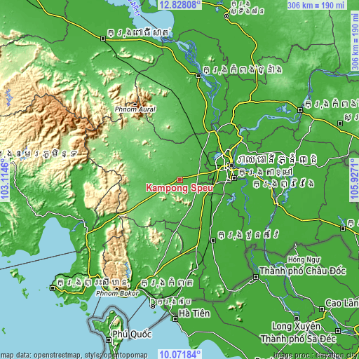
These maps also provides idea of topography and contour of this city, they are displayed at different zoom levels. More info about maps, scale and edge coordinates you can find below images.
| \ | Map #1 | Map #2 | Topo.Map |
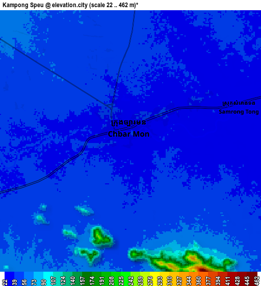
| Scale [m] | 25..57 m | 22..462 m | × |
| Scale [ft] | 82..187 ft | 72..1516 ft | × |
| Average | 38.4 m = 126 ft | 47.6 m = 156 ft | × |
| Width | 9.58 km = 6 mi | 19.16 km = 11.9 mi | 306.5 km = 190.4 mi |
| Height | 9.58 km = 6 mi | 19.16 km = 11.9 mi | 306.5 km = 190.4 mi |
| ↑Max Latitude | 11.496387° | 11.539447° | 12.82808° |
| Latitude at center | 11.45332° | 11.45332° | 11.45332° |
| ↓Min Latitude | 11.410247° | 11.367166° | 10.07184° |
| ← Min Longitude | 104.476905° | 104.432959° | 103.1146° |
| Longitude center | 104.52085° | 104.52085° | 104.52085° |
| →Max Longitude | 104.564795° | 104.608741° | 105.9271° |
Nearby cities:
Cities around Kampong Speu sort by population:
• Phnom Penh elevation 20 m
44.7 km,  74°
74°
• Ta Khmau 7 m
46.9 km,  85°
85°
• Ruessei Kaev 18 m
46.4 km, 65°
• Ta Khmau 8 m
46.3 km, 90°
• Mean Chey 18 m
46.2 km,  78°
78°
• Ponhea Lueu 16 m
43.9 km,  59°
59°
• Dangkao 18 m
38.4 km, 71°
• Thpong 74 m
34.9 km,  343°
343°
• Basedth 44 m
33.9 km,  177°
177°
• Kandal Stueng 16 m
33.6 km,  97°
97°
• Odongk 29 m
32.1 km,  37°
37°
• Phnum Sruoch 65 m
17.9 km,  244°
244°
Multilingual:
 En español:
Kampong Speu elevación 35 m.
 En France:
Kampong Speu élévation 35 m.
 Auf Deutsch:
Kampong Speu höhe über dem Meeresspiegel ist 35 m.

Sources and notes:
- [note 1] Map square and city borders are not equal. Map elevation data is calculated only from area inside that square.
- [src 1] Elevation data from geonames database provided with same terms of usage.
- [src 2] The elevation map of Kampong Speu is generated using elevation data from NASA's 3 arcsec (90m) resolution SRTM data.
- [src 3] Base (background) map © OpenStreetMap contributors tiles are generated by Geofabrik and OpenTopoMap.
Copyright & License:
This Kampong Speu Elevation Map is licensed under CC BY-SA. You may reuse any part from this page, if you give a proper credit by linking to this URL:
 More info on terms of use page.