Kampot elevation
Kampot, Cambodia elevation is 7 meters and Kampot elevation in feet is 23 ft above sea level [src 1]. Kampot is a seat of a first-order administrative division (feature code) with elevation that is 45 meters (148 ft) smaller than average city elevation in Cambodia.
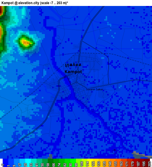
Below is the Elevation map of Kampot, which displays elevation range with different colors. Scale of the first map is from -7 to 203 m (-23 to 666 ft) with average elevation of 7.4 meters (=24 ft) [note 1]
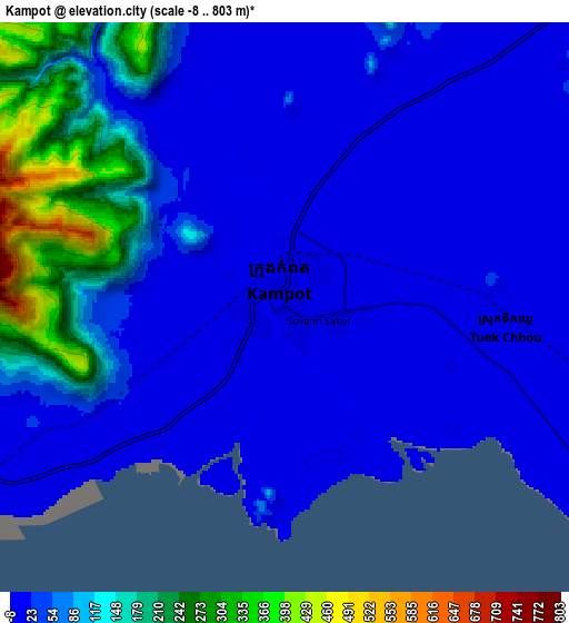
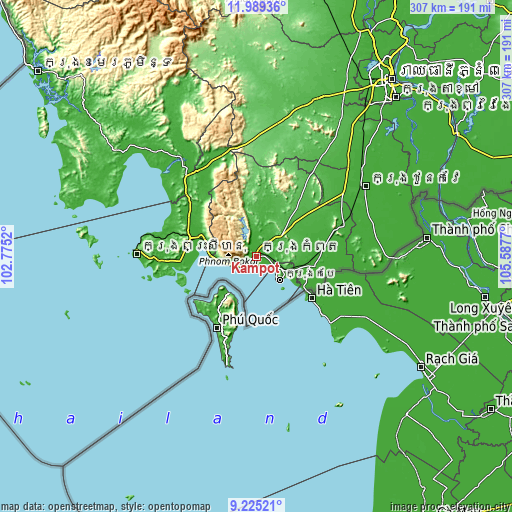
These maps also provides idea of topography and contour of this city, they are displayed at different zoom levels. More info about maps, scale and edge coordinates you can find below images.
| \ | Map #1 | Map #2 | Topo.Map |
| Scale [m] | -7..203 m | -8..803 m | × |
| Scale [ft] | -23..666 ft | -26..2635 ft | × |
| Average | 7.4 m = 24 ft | 66 m = 217 ft | × |
| Width | 9.61 km = 6 mi | 19.21 km = 11.9 mi | 307.3 km = 190.9 mi |
| Height | 9.61 km = 6 mi | 19.21 km = 11.9 mi | 307.4 km = 191 mi |
| ↑Max Latitude | 10.653601° | 10.696786° | 11.98936° |
| Latitude at center | 10.61041° | 10.61041° | 10.61041° |
| ↓Min Latitude | 10.567213° | 10.52401° | 9.22521° |
| ← Min Longitude | 104.137505° | 104.093559° | 102.7752° |
| Longitude center | 104.18145° | 104.18145° | 104.18145° |
| →Max Longitude | 104.225395° | 104.269341° | 105.5877° |
Nearby cities:
Cities around Kampot sort by population:
• Sihanoukville elevation 6 m
71.2 km,  269°
269°
• Krong Kep 8 m
20.5 km,  133°
133°
• Basedth 44 m
71.4 km,  32°
32°
• Tram Kak 14 m
70.1 km,  50°
50°
• Kampong Seila 9 m
61.7 km,  330°
330°
• Chum Kiri 52 m
43.8 km,  36°
36°
• Banteay Meas 9 m
41.9 km,  81°
81°
• Prey Nob 7 m
40.9 km,  285°
285°
• Chhuk 32 m
39.1 km, 49°
• Kampong Trach 7 m
31.8 km,  100°
100°
• Damnak Chang’aeur 15 m
22.3 km,  113°
113°
• Kampot 7 m
8.2 km,  94°
94°
Multilingual:
 En español:
Kampot elevación 7 m.
 En France:
Kampot élévation 7 m.


Sources and notes:
- [note 1] Map square and city borders are not equal. Map elevation data is calculated only from area inside that square.
- [src 1] Elevation data from geonames database provided with same terms of usage.
- [src 2] The elevation map of Kampot is generated using elevation data from NASA's 3 arcsec (90m) resolution SRTM data.
- [src 3] Base (background) map © OpenStreetMap contributors tiles are generated by Geofabrik and OpenTopoMap.
Copyright & License:
This Kampot Elevation Map is licensed under CC BY-SA. You may reuse any part from this page, if you give a proper credit by linking to this URL:
 More info on terms of use page.