Iradan elevation
Iradan (Batken), Kyrgyzstan elevation is 933 meters and Iradan elevation in feet is 3061 ft above sea level [src 1]. Iradan is a populated place (feature code) with elevation that is 263 meters (863 ft) smaller than average city elevation in Kyrgyzstan.
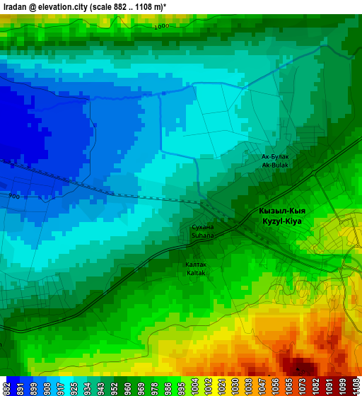
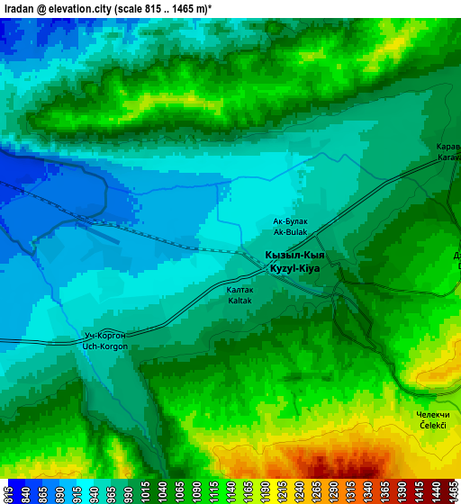
Below is the Elevation map of Iradan, which displays elevation range with different colors. Scale of the first map is from 882 to 1108 m (2894 to 3635 ft) with average elevation of 955.6 meters (=3135 ft) [note 1]
These maps also provides idea of topography and contour of this city, they are displayed at different zoom levels. More info about maps, scale and edge coordinates you can find below images.
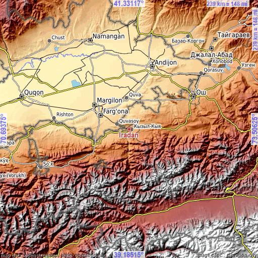
| \ | Map #1 | Map #2 | Topo.Map |
| Scale [m] | 882..1108 m | 815..1465 m | × |
| Scale [ft] | 2894..3635 ft | 2674..4806 ft | × |
| Average | 955.6 m = 3135 ft | 1020.4 m = 3348 ft | × |
| Width | 7.46 km = 4.6 mi | 14.91 km = 9.3 mi | 238.6 km = 148.3 mi |
| Height | 7.46 km = 4.6 mi | 14.91 km = 9.3 mi | 238.6 km = 148.3 mi |
| ↑Max Latitude | 40.300194° | 40.333701° | 41.33117° |
| Latitude at center | 40.26667° | 40.26667° | 40.26667° |
| ↓Min Latitude | 40.233129° | 40.199572° | 39.18515° |
| ← Min Longitude | 72.056055° | 72.012109° | 70.69375° |
| Longitude center | 72.1° | 72.1° | 72.1° |
| →Max Longitude | 72.143945° | 72.187891° | 73.50625° |
Nearby cities:
Cities around Iradan sort by population:
• Kyzyl-Kyya elevation 999 m
2.6 km,  114°
114°
• Nookat 1295 m
44 km,  90°
90°
• Karavan 1013 m
8 km,  66°
66°
• Aravan 760 m
43.8 km,  50°
50°
• Orozbekovo 1242 m
43.4 km,  237°
237°
• Khalmion 756 m
40.1 km,  261°
261°
• Kyzyl-Bulak 1222 m
39 km,  232°
232°
• Pulgon 982 m
34.1 km,  247°
247°
• Markaz 808 m
17.2 km, 260°
• Kara-Dzhygach 1165 m
16.1 km,  182°
182°
• Uch-Korgon 971 m
5.4 km,  219°
219°
• Kara-Dëbë 938 m
5.3 km, 242°
Multilingual:
 En español:
Iradan elevación 933 m.
 En France:
Iradan élévation 933 m.


Sources and notes:
- [note 1] Map square and city borders are not equal. Map elevation data is calculated only from area inside that square.
- [src 1] Elevation data from geonames database provided with same terms of usage.
- [src 2] The elevation map of Iradan is generated using elevation data from NASA's 3 arcsec (90m) resolution SRTM data.
- [src 3] Base (background) map © OpenStreetMap contributors tiles are generated by Geofabrik and OpenTopoMap.
Copyright & License:
This Iradan Elevation Map is licensed under CC BY-SA. You may reuse any part from this page, if you give a proper credit by linking to this URL:
 More info on terms of use page.