Suluktu elevation
Suluktu (Batken), Kyrgyzstan elevation is 1251 meters and Suluktu elevation in feet is 4104 ft above sea level [src 1]. Suluktu is a populated place (feature code) with elevation that is 55 meters (180 ft) bigger than average city elevation in Kyrgyzstan.
Below is the Elevation map of Suluktu, which displays elevation range with different colors. Scale of the first map is from 1016 to 1718 m (3333 to 5636 ft) with average elevation of 1347.2 meters (=4420 ft) [note 1]
These maps also provides idea of topography and contour of this city, they are displayed at different zoom levels. More info about maps, scale and edge coordinates you can find below images.
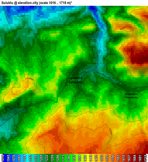
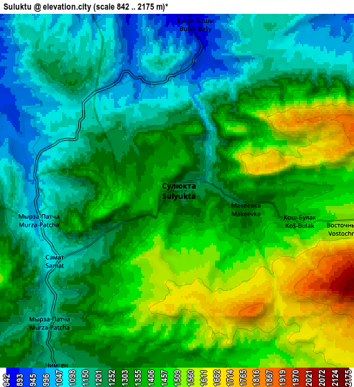
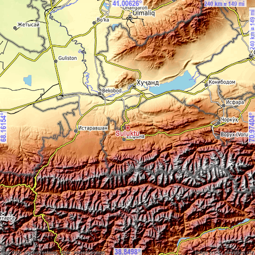
| \ | Map #1 | Map #2 | Topo.Map |
| Scale [m] | 1016..1718 m | 842..2175 m | × |
| Scale [ft] | 3333..5636 ft | 2762..7136 ft | × |
| Average | 1347.2 m = 4420 ft | 1314.6 m = 4313 ft | × |
| Width | 7.49 km = 4.7 mi | 14.99 km = 9.3 mi | 239.8 km = 149 mi |
| Height | 7.49 km = 4.7 mi | 14.99 km = 9.3 mi | 239.8 km = 149 mi |
| ↑Max Latitude | 39.970207° | 40.003877° | 41.00626° |
| Latitude at center | 39.93652° | 39.93652° | 39.93652° |
| ↓Min Latitude | 39.902816° | 39.869096° | 38.8498° |
| ← Min Longitude | 69.523845° | 69.479899° | 68.16154° |
| Longitude center | 69.56779° | 69.56779° | 69.56779° |
| →Max Longitude | 69.611735° | 69.655681° | 70.97404° |
Nearby cities:
Cities around Suluktu sort by population:
• Isfana elevation 1302 m
11.4 km,  197°
197°
• Batken 1038 m
107.5 km,  82°
82°
• Samarkandyk 1100 m
83.6 km,  85°
85°
• Ak-Say 1280 m
81.7 km, 94°
• Ak-Tatyr 1181 m
78.2 km, 88°
• Katran 1209 m
39.5 km,  105°
105°
• Korgon 1061 m
31.8 km,  99°
99°
• Beshkent 790 m
23.8 km,  63°
63°
• Andarak 1601 m
20.7 km,  205°
205°
• Kulundu 642 m
19.9 km,  18°
18°
• Ak-Suu 909 m
17.2 km,  255°
255°
• Toguz-Bulak 1509 m
16.2 km,  129°
129°
Multilingual:
 En español:
Suluktu elevación 1251 m.
 En France:
Suluktu élévation 1251 m.
 Auf Deutsch:
Suluktu höhe über dem Meeresspiegel ist 1251 m.

Sources and notes:
- [note 1] Map square and city borders are not equal. Map elevation data is calculated only from area inside that square.
- [src 1] Elevation data from geonames database provided with same terms of usage.
- [src 2] The elevation map of Suluktu is generated using elevation data from NASA's 3 arcsec (90m) resolution SRTM data.
- [src 3] Base (background) map © OpenStreetMap contributors tiles are generated by Geofabrik and OpenTopoMap.
Copyright & License:
This Suluktu Elevation Map is licensed under CC BY-SA. You may reuse any part from this page, if you give a proper credit by linking to this URL:
 More info on terms of use page.