Bungoma elevation
Bungoma, Kenya elevation is 1427 meters and Bungoma elevation in feet is 4682 ft above sea level [src 1]. Bungoma is a seat of a first-order administrative division (feature code) with elevation that is 81 meters (266 ft) bigger than average city elevation in Kenya.
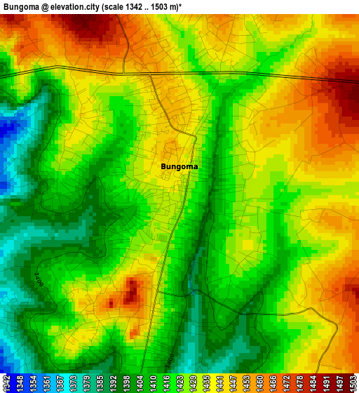
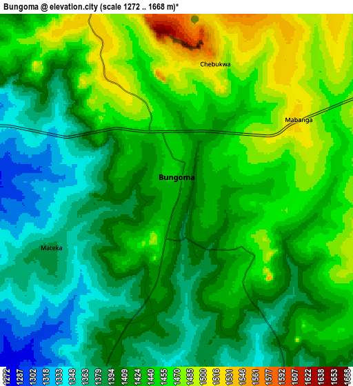
Below is the Elevation map of Bungoma, which displays elevation range with different colors. Scale of the first map is from 1342 to 1503 m (4403 to 4931 ft) with average elevation of 1426.3 meters (=4679 ft) [note 1]
These maps also provides idea of topography and contour of this city, they are displayed at different zoom levels. More info about maps, scale and edge coordinates you can find below images.
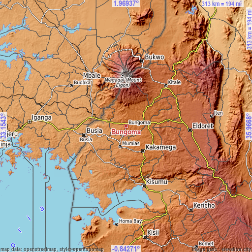
| \ | Map #1 | Map #2 | Topo.Map |
| Scale [m] | 1342..1503 m | 1272..1668 m | × |
| Scale [ft] | 4403..4931 ft | 4173..5472 ft | × |
| Average | 1426.3 m = 4679 ft | 1423.8 m = 4671 ft | × |
| Width | 9.77 km = 6.1 mi | 19.54 km = 12.1 mi | 312.7 km = 194.3 mi |
| Height | 9.77 km = 6.1 mi | 19.54 km = 12.1 mi | 312.7 km = 194.3 mi |
| ↑Max Latitude | 0.607443° | 0.651386° | 1.96937° |
| Latitude at center | 0.5635° | 0.5635° | 0.5635° |
| ↓Min Latitude | 0.519557° | 0.475613° | -0.84271° |
| ← Min Longitude | 34.516605° | 34.472659° | 33.1543° |
| Longitude center | 34.56055° | 34.56055° | 34.56055° |
| →Max Longitude | 34.604495° | 34.648441° | 35.9668° |
Nearby cities:
Cities around Bungoma sort by population:
• Kakamega elevation 1563 m
37.7 km,  145°
145°
• Busia 1222 m
51.2 km,  257°
257°
• Mumias 1258 m
26.7 km,  197°
197°
• Lugulu 1220 m
34.2 km,  236°
236°
• Webuye 1502 m
23.8 km,  80°
80°
• Butere 1316 m
40.4 km,  191°
191°
• Bondo 1223 m
48 km,  220°
220°
• Malaba 1193 m
32 km,  284°
284°
• Malikisi 1343 m
19.9 km,  309°
309°
• Yala 1371 m
52.2 km,  182°
182°
• Nambare 1194 m
36.1 km,  251°
251°
• Bungoma 1452 m
3.4 km,  48°
48°
Multilingual:
 En español:
Bungoma elevación 1427 m.
 En France:
Bungoma élévation 1427 m.
 Auf Deutsch:
Bungoma höhe über dem Meeresspiegel ist 1427 m.

Sources and notes:
- [note 1] Map square and city borders are not equal. Map elevation data is calculated only from area inside that square.
- [src 1] Elevation data from geonames database provided with same terms of usage.
- [src 2] The elevation map of Bungoma is generated using elevation data from NASA's 3 arcsec (90m) resolution SRTM data.
- [src 3] Base (background) map © OpenStreetMap contributors tiles are generated by Geofabrik and OpenTopoMap.
Copyright & License:
This Bungoma Elevation Map is licensed under CC BY-SA. You may reuse any part from this page, if you give a proper credit by linking to this URL:
 More info on terms of use page.