Sūf elevation
Sūf (Jerash), Jordan elevation is 965 meters and Sūf elevation in feet is 3166 ft above sea level [src 1]. Sūf is a populated place (feature code) with elevation that is 273 meters (896 ft) bigger than average city elevation in Jordan.
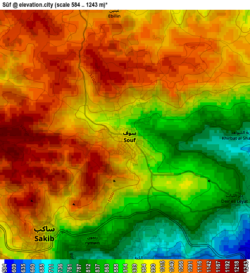
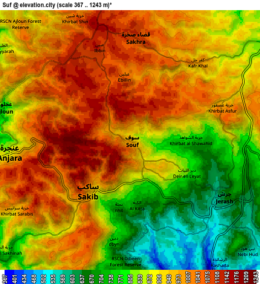
Below is the Elevation map of Sūf, which displays elevation range with different colors. Scale of the first map is from 584 to 1243 m (1916 to 4078 ft) with average elevation of 990.9 meters (=3251 ft) [note 1]
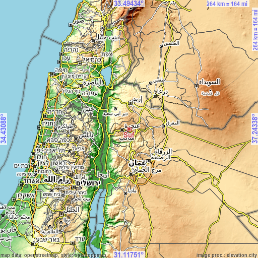
These maps also provides idea of topography and contour of this city, they are displayed at different zoom levels. More info about maps, scale and edge coordinates you can find below images.
| \ | Map #1 | Map #2 | Topo.Map |
| Scale [m] | 584..1243 m | 367..1243 m | × |
| Scale [ft] | 1916..4078 ft | 1204..4078 ft | × |
| Average | 990.9 m = 3251 ft | 910.3 m = 2987 ft | × |
| Width | 8.26 km = 5.1 mi | 16.52 km = 10.3 mi | 264.3 km = 164.2 mi |
| Height | 8.26 km = 5.1 mi | 16.52 km = 10.3 mi | 264.3 km = 164.2 mi |
| ↑Max Latitude | 32.350852° | 32.387969° | 33.49434° |
| Latitude at center | 32.31372° | 32.31372° | 32.31372° |
| ↓Min Latitude | 32.276573° | 32.23941° | 31.11751° |
| ← Min Longitude | 35.793185° | 35.749239° | 34.43088° |
| Longitude center | 35.83713° | 35.83713° | 35.83713° |
| →Max Longitude | 35.881075° | 35.925021° | 37.24338° |
Nearby cities:
Cities around Sūf sort by population:
• ‘Ajlūn elevation 769 m
8.2 km,  285°
285°
• Jarash 620 m
6.9 km,  122°
122°
• ‘Anjarah 890 m
7.6 km,  263°
263°
• Sakib 862 m
4.2 km,  218°
218°
• Şakhrah 1083 m
6.4 km,  4°
4°
• ‘Ayn Jannah 871 m
7.3 km, 288°
• Raymūn 773 m
3.6 km,  193°
193°
• Al Kittah 698 m
4.1 km,  174°
174°
• Balīlā 796 m
12.8 km,  47°
47°
• Burmā 571 m
11.6 km,  204°
204°
• Qafqafā 998 m
10.3 km,  67°
67°
• Kufrinjah 618 m
12.8 km, 261°
Multilingual:
 En español:
Sūf elevación 965 m.
 En France:
Sūf élévation 965 m.


Sources and notes:
- [note 1] Map square and city borders are not equal. Map elevation data is calculated only from area inside that square.
- [src 1] Elevation data from geonames database provided with same terms of usage.
- [src 2] The elevation map of Sūf is generated using elevation data from NASA's 3 arcsec (90m) resolution SRTM data.
- [src 3] Base (background) map © OpenStreetMap contributors tiles are generated by Geofabrik and OpenTopoMap.
Copyright & License:
This Sūf Elevation Map is licensed under CC BY-SA. You may reuse any part from this page, if you give a proper credit by linking to this URL:
 More info on terms of use page.