Bamboo elevation
Bamboo (St Ann), Jamaica elevation is 628 meters and Bamboo elevation in feet is 2060 ft above sea level [src 1]. Bamboo is a populated place (feature code) with elevation that is 413 meters (1355 ft) bigger than average city elevation in Jamaica.
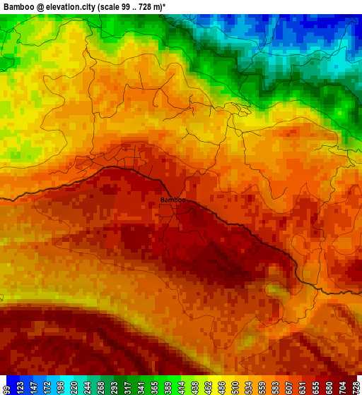
Below is the Elevation map of Bamboo, which displays elevation range with different colors. Scale of the first map is from 99 to 728 m (325 to 2388 ft) with average elevation of 538.2 meters (=1766 ft) [note 1]
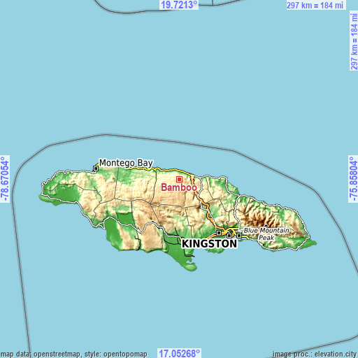
These maps also provides idea of topography and contour of this city, they are displayed at different zoom levels. More info about maps, scale and edge coordinates you can find below images.
| \ | Map #1 | Map #2 | Topo.Map |
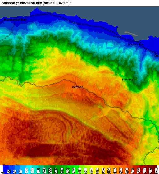
| Scale [m] | 99..728 m | 0..829 m | × |
| Scale [ft] | 325..2388 ft | 0..2720 ft | × |
| Average | 538.2 m = 1766 ft | 466.7 m = 1531 ft | × |
| Width | 9.27 km = 5.8 mi | 18.55 km = 11.5 mi | 296.7 km = 184.4 mi |
| Height | 9.27 km = 5.8 mi | 18.55 km = 11.5 mi | 296.7 km = 184.4 mi |
| ↑Max Latitude | 18.433856° | 18.475541° | 19.7213° |
| Latitude at center | 18.39216° | 18.39216° | 18.39216° |
| ↓Min Latitude | 18.350454° | 18.308739° | 17.05268° |
| ← Min Longitude | -77.308235° | -77.352181° | -78.67054° |
| Longitude center | -77.26429° | -77.26429° | -77.26429° |
| →Max Longitude | -77.220345° | -77.176399° | -75.85804° |
Nearby cities:
Cities around Bamboo sort by population:
• Saint Ann’s Bay elevation 14 m
8.3 km,  53°
53°
• Ewarton 226 m
29.9 km,  140°
140°
• Ocho Rios 42 m
17.1 km,  84°
84°
• Runaway Bay 13 m
10.6 km,  314°
314°
• Albert Town 622 m
31.3 km,  249°
249°
• Moneague 360 m
20.7 km,  128°
128°
• Gayle 262 m
27.8 km,  105°
105°
• Kellits 721 m
25.6 km,  181°
181°
• Discovery Bay 29 m
16.1 km,  297°
297°
• Alexandria 608 m
13.3 km,  225°
225°
• Duncans 130 m
29.9 km,  286°
286°
• Ulster Spring 444 m
28.4 km, 252°
Multilingual:
 En español:
Bamboo elevación 628 m.
 En France:
Bamboo élévation 628 m.


Sources and notes:
- [note 1] Map square and city borders are not equal. Map elevation data is calculated only from area inside that square.
- [src 1] Elevation data from geonames database provided with same terms of usage.
- [src 2] The elevation map of Bamboo is generated using elevation data from NASA's 3 arcsec (90m) resolution SRTM data.
- [src 3] Base (background) map © OpenStreetMap contributors tiles are generated by Geofabrik and OpenTopoMap.
Copyright & License:
This Bamboo Elevation Map is licensed under CC BY-SA. You may reuse any part from this page, if you give a proper credit by linking to this URL:
 More info on terms of use page.