Morant Bay elevation
Morant Bay (St. Thomas), Jamaica elevation is 22 meters and Morant Bay elevation in feet is 72 ft above sea level [src 1]. Morant Bay is a seat of a first-order administrative division (feature code) with elevation that is 193 meters (633 ft) smaller than average city elevation in Jamaica.
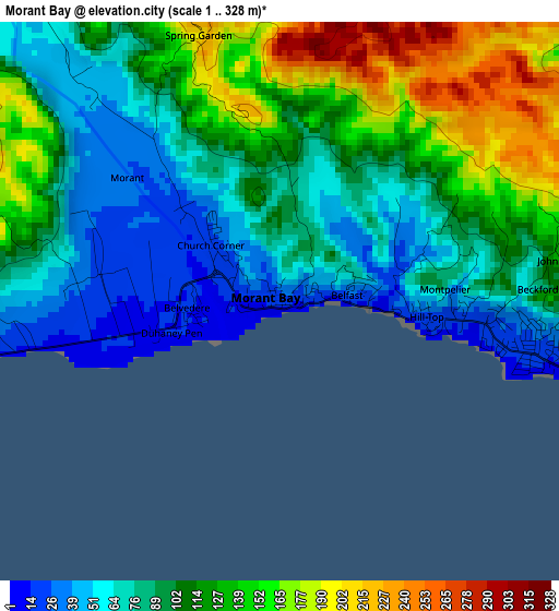
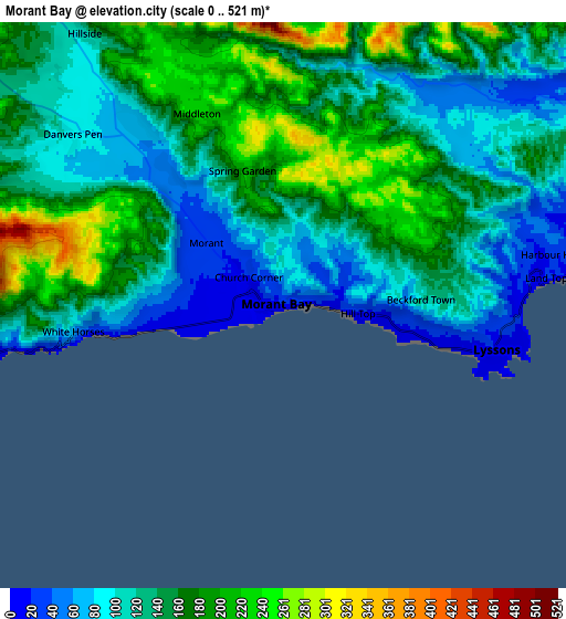
Below is the Elevation map of Morant Bay, which displays elevation range with different colors. Scale of the first map is from 1 to 328 m (3 to 1076 ft) with average elevation of 103.9 meters (=341 ft) [note 1]
These maps also provides idea of topography and contour of this city, they are displayed at different zoom levels. More info about maps, scale and edge coordinates you can find below images.
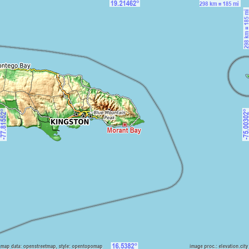
| \ | Map #1 | Map #2 | Topo.Map |
| Scale [m] | 1..328 m | 0..521 m | × |
| Scale [ft] | 3..1076 ft | 0..1709 ft | × |
| Average | 103.9 m = 341 ft | 141.3 m = 464 ft | × |
| Width | 9.3 km = 5.8 mi | 18.6 km = 11.6 mi | 297.6 km = 184.9 mi |
| Height | 9.3 km = 5.8 mi | 18.6 km = 11.6 mi | 297.6 km = 184.9 mi |
| ↑Max Latitude | 17.923268° | 17.965075° | 19.21462° |
| Latitude at center | 17.88145° | 17.88145° | 17.88145° |
| ↓Min Latitude | 17.839623° | 17.797785° | 16.5382° |
| ← Min Longitude | -76.453215° | -76.497161° | -77.81552° |
| Longitude center | -76.40927° | -76.40927° | -76.40927° |
| →Max Longitude | -76.365325° | -76.321379° | -75.00302° |
Nearby cities:
Cities around Morant Bay sort by population:
• Port Antonio elevation 13 m
33.1 km,  352°
352°
• Yallahs 29 m
16.2 km,  267°
267°
• Seaforth 72 m
7.9 km,  319°
319°
• Golden Grove 15 m
15.6 km,  68°
68°
• Dalvey 49 m
17.3 km,  78°
78°
• Trinity Ville 269 m
14.2 km,  308°
308°
• Easington 92 m
19.5 km,  284°
284°
• Bath 57 m
9.8 km,  40°
40°
• Manchioneal 9 m
22.9 km, 37°
• Mavis Bank 933 m
32 km,  301°
301°
• Moore Town 113 m
21.9 km,  355°
355°
• Gordon Town 353 m
36.9 km, 297°
Multilingual:
 En español:
Morant Bay elevación 22 m.
 En France:
Morant Bay élévation 22 m.
 Auf Deutsch:
Morant Bay höhe über dem Meeresspiegel ist 22 m.

Sources and notes:
- [note 1] Map square and city borders are not equal. Map elevation data is calculated only from area inside that square.
- [src 1] Elevation data from geonames database provided with same terms of usage.
- [src 2] The elevation map of Morant Bay is generated using elevation data from NASA's 3 arcsec (90m) resolution SRTM data.
- [src 3] Base (background) map © OpenStreetMap contributors tiles are generated by Geofabrik and OpenTopoMap.
Copyright & License:
This Morant Bay Elevation Map is licensed under CC BY-SA. You may reuse any part from this page, if you give a proper credit by linking to this URL:
 More info on terms of use page.