Port Erin elevation
Port Erin, Isle of Man elevation is 24 meters and Port Erin elevation in feet is 79 ft above sea level [src 1]. Port Erin is a seat of a first-order administrative division (feature code) with elevation that is 16 meters (52 ft) smaller than average city elevation in Isle of Man.
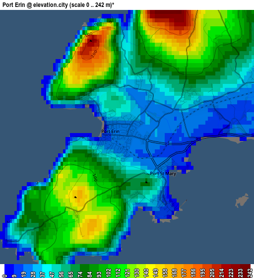
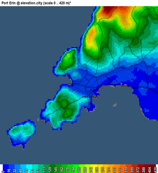
Below is the Elevation map of Port Erin, which displays elevation range with different colors. Scale of the first map is from 0 to 242 m (0 to 794 ft) with average elevation of 74.9 meters (=246 ft) [note 1]
These maps also provides idea of topography and contour of this city, they are displayed at different zoom levels. More info about maps, scale and edge coordinates you can find below images.
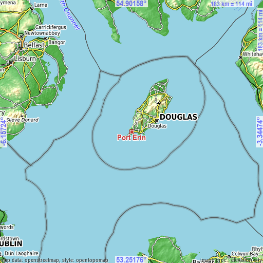
| \ | Map #1 | Map #2 | Topo.Map |
| Scale [m] | 0..242 m | 0..420 m | × |
| Scale [ft] | 0..794 ft | 0..1378 ft | × |
| Average | 74.9 m = 246 ft | 96.9 m = 318 ft | × |
| Width | 5.73 km = 3.6 mi | 11.46 km = 7.1 mi | 183.4 km = 114 mi |
| Height | 5.73 km = 3.6 mi | 11.46 km = 7.1 mi | 183.4 km = 114 mi |
| ↑Max Latitude | 54.11064° | 54.136393° | 54.90158° |
| Latitude at center | 54.08487° | 54.08487° | 54.08487° |
| ↓Min Latitude | 54.059084° | 54.033283° | 53.25176° |
| ← Min Longitude | -4.794935° | -4.838881° | -6.15724° |
| Longitude center | -4.75099° | -4.75099° | -4.75099° |
| →Max Longitude | -4.707045° | -4.663099° | -3.34474° |
Nearby cities:
Cities around Port Erin sort by population:
• Douglas elevation 31 m
18.9 km,  67°
67°
• Peel 22 m
15.7 km,  14°
14°
• Castletown 13 m
6.5 km,  100°
100°
• Kirkmichael 32 m
24.7 km,  25°
25°
• Onchan 58 m
21.7 km,  63°
63°
• Kirk Braddan 35 m
17.8 km, 59°
• Crosby 47 m
16.2 km,  47°
47°
• Patrick 32 m
13.8 km,  15°
15°
• Santon 71 m
11.5 km, 72°
• Ballasalla 26 m
8 km,  81°
81°
• Ballabeg 35 m
4.7 km, 69°
• Port Saint Mary 15 m
1.5 km,  146°
146°
Multilingual:
 En español:
Port Erin elevación 24 m.
 En France:
Port Erin élévation 24 m.
 Auf Deutsch:
Port Erin höhe über dem Meeresspiegel ist 24 m.

Sources and notes:
- [note 1] Map square and city borders are not equal. Map elevation data is calculated only from area inside that square.
- [src 1] Elevation data from geonames database provided with same terms of usage.
- [src 2] The elevation map of Port Erin is generated using elevation data from NASA's 3 arcsec (90m) resolution SRTM data.
- [src 3] Base (background) map © OpenStreetMap contributors tiles are generated by Geofabrik and OpenTopoMap.
Copyright & License:
This Port Erin Elevation Map is licensed under CC BY-SA. You may reuse any part from this page, if you give a proper credit by linking to this URL:
 More info on terms of use page.