Qalansuwa elevation
Qalansuwa (Central District), Israel elevation is 39 meters and Qalansuwa elevation in feet is 128 ft above sea level [src 1]. Qalansuwa is a populated place (feature code) with elevation that is 172 meters (564 ft) smaller than average city elevation in Israel.
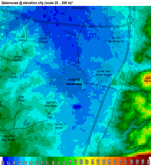
Below is the Elevation map of Qalansuwa, which displays elevation range with different colors. Scale of the first map is from 20 to 206 m (66 to 676 ft) with average elevation of 54.2 meters (=178 ft) [note 1]
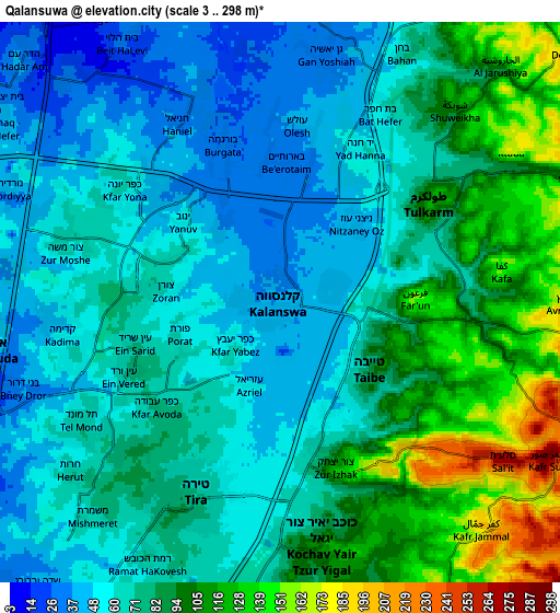
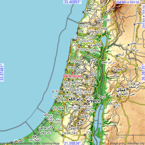
These maps also provides idea of topography and contour of this city, they are displayed at different zoom levels. More info about maps, scale and edge coordinates you can find below images.
| \ | Map #1 | Map #2 | Topo.Map |
| Scale [m] | 20..206 m | 3..298 m | × |
| Scale [ft] | 66..676 ft | 10..978 ft | × |
| Average | 54.2 m = 178 ft | 77.1 m = 253 ft | × |
| Width | 8.26 km = 5.1 mi | 16.52 km = 10.3 mi | 264.4 km = 164.3 mi |
| Height | 8.26 km = 5.1 mi | 16.52 km = 10.3 mi | 264.4 km = 164.3 mi |
| ↑Max Latitude | 32.322074° | 32.359202° | 33.46593° |
| Latitude at center | 32.28493° | 32.28493° | 32.28493° |
| ↓Min Latitude | 32.247771° | 32.210597° | 31.08834° |
| ← Min Longitude | 34.937115° | 34.893169° | 33.57481° |
| Longitude center | 34.98106° | 34.98106° | 34.98106° |
| →Max Longitude | 35.025005° | 35.068951° | 36.38731° |
Nearby cities:
Cities around Qalansuwa sort by population:
• Netanya elevation 38 m
12.6 km,  295°
295°
• Kfar Saba 57 m
14.1 km,  209°
209°
• Eṭ Ṭaiyiba 86 m
3.3 km,  128°
128°
• Kefar Yona 59 m
5.6 km,  309°
309°
• Tirah 78 m
6.4 km, 207°
• Even Yehuda 49 m
9 km,  259°
259°
• Tel Mond 68 m
7.1 km,  236°
236°
• Jaljūlya 51 m
14.7 km,  190°
190°
• Pardesiyya 53 m
7.1 km,  288°
288°
• Ẕur Moshe 65 m
6.6 km,  283°
283°
• Nordiyya 45 m
8.6 km, 292°
• Bet Yiẕẖaq 38 m
9.9 km, 298°
Multilingual:
 En español:
Qalansuwa elevación 39 m.
 En France:
Qalansuwa élévation 39 m.
 Auf Deutsch:
Qalansuwa höhe über dem Meeresspiegel ist 39 m.

Sources and notes:
- [note 1] Map square and city borders are not equal. Map elevation data is calculated only from area inside that square.
- [src 1] Elevation data from geonames database provided with same terms of usage.
- [src 2] The elevation map of Qalansuwa is generated using elevation data from NASA's 3 arcsec (90m) resolution SRTM data.
- [src 3] Base (background) map © OpenStreetMap contributors tiles are generated by Geofabrik and OpenTopoMap.
Copyright & License:
This Qalansuwa Elevation Map is licensed under CC BY-SA. You may reuse any part from this page, if you give a proper credit by linking to this URL:
 More info on terms of use page.