Qiryat Gat elevation
Qiryat Gat (Southern District), Israel elevation is 133 meters and Qiryat Gat elevation in feet is 436 ft above sea level [src 1]. Qiryat Gat is a populated place (feature code) with elevation that is 78 meters (256 ft) smaller than average city elevation in Israel.
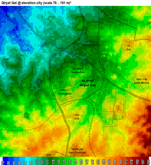
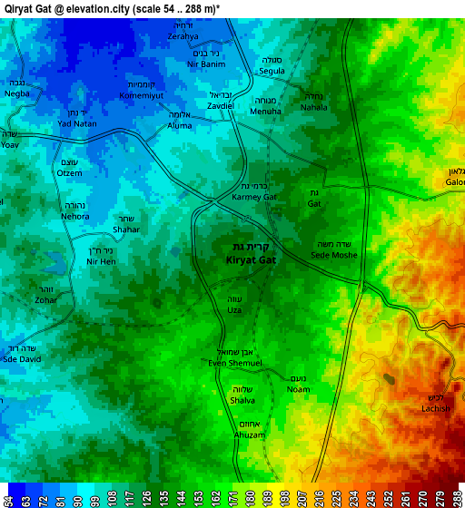
Below is the Elevation map of Qiryat Gat, which displays elevation range with different colors. Scale of the first map is from 76 to 191 m (249 to 627 ft) with average elevation of 127.8 meters (=419 ft) [note 1]
These maps also provides idea of topography and contour of this city, they are displayed at different zoom levels. More info about maps, scale and edge coordinates you can find below images.
| \ | Map #1 | Map #2 | Topo.Map |
| Scale [m] | 76..191 m | 54..288 m | × |
| Scale [ft] | 249..627 ft | 177..945 ft | × |
| Average | 127.8 m = 419 ft | 137.1 m = 450 ft | × |
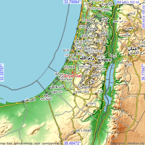
| Width | 8.32 km = 5.2 mi | 16.65 km = 10.3 mi | 266.3 km = 165.5 mi |
| Height | 8.32 km = 5.2 mi | 16.65 km = 10.3 mi | 266.3 km = 165.5 mi |
| ↑Max Latitude | 31.647398° | 31.684801° | 32.79984° |
| Latitude at center | 31.60998° | 31.60998° | 31.60998° |
| ↓Min Latitude | 31.572547° | 31.535099° | 30.40472° |
| ← Min Longitude | 34.720275° | 34.676329° | 33.35797° |
| Longitude center | 34.76422° | 34.76422° | 34.76422° |
| →Max Longitude | 34.808165° | 34.852111° | 36.17047° |
Nearby cities:
Cities around Qiryat Gat sort by population:
• Ashdod elevation 27 m
23 km,  331°
331°
• Ashkelon 42 m
19.4 km,  289°
289°
• Bet Shemesh 282 m
25.5 km,  58°
58°
• Yavné 37 m
29.9 km,  355°
355°
• Gedera 64 m
22.8 km,  3°
3°
• Netivot 151 m
26.6 km,  218°
218°
• Gan Yavne 52 m
20.5 km,  344°
344°
• Sederot 90 m
18.5 km,  239°
239°
• Rahat 228 m
23.9 km,  181°
181°
• Mazkeret Batya 75 m
28.2 km,  16°
16°
• Bnei Ayish 61 m
19.3 km, 356°
• Lehavim 317 m
26.8 km,  169°
169°
Multilingual:
 En español:
Qiryat Gat elevación 133 m.
 En France:
Qiryat Gat élévation 133 m.
 Auf Deutsch:
Kirjat Gat höhe über dem Meeresspiegel ist 133 m.

Sources and notes:
- [note 1] Map square and city borders are not equal. Map elevation data is calculated only from area inside that square.
- [src 1] Elevation data from geonames database provided with same terms of usage.
- [src 2] The elevation map of Qiryat Gat is generated using elevation data from NASA's 3 arcsec (90m) resolution SRTM data.
- [src 3] Base (background) map © OpenStreetMap contributors tiles are generated by Geofabrik and OpenTopoMap.
Copyright & License:
This Qiryat Gat Elevation Map is licensed under CC BY-SA. You may reuse any part from this page, if you give a proper credit by linking to this URL:
 More info on terms of use page.