Shelomi elevation
Shelomi (Northern District), Israel elevation is 82 meters and Shelomi elevation in feet is 269 ft above sea level [src 1]. Shelomi is a populated place (feature code) with elevation that is 129 meters (423 ft) smaller than average city elevation in Israel.
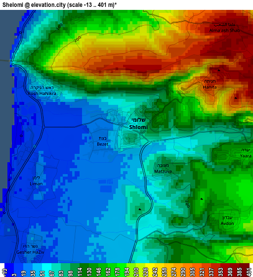
Below is the Elevation map of Shelomi, which displays elevation range with different colors. Scale of the first map is from -13 to 401 m (-43 to 1316 ft) with average elevation of 124.4 meters (=408 ft) [note 1]
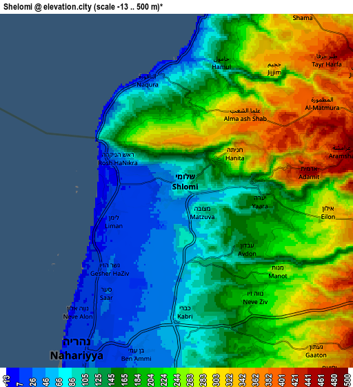
These maps also provides idea of topography and contour of this city, they are displayed at different zoom levels. More info about maps, scale and edge coordinates you can find below images.
| \ | Map #1 | Map #2 | Topo.Map |
| Scale [m] | -13..401 m | -13..500 m | × |
| Scale [ft] | -43..1316 ft | -43..1640 ft | × |
| Average | 124.4 m = 408 ft | 187.4 m = 615 ft | × |
| Width | 8.19 km = 5.1 mi | 16.38 km = 10.2 mi | 262 km = 162.8 mi |
| Height | 8.19 km = 5.1 mi | 16.38 km = 10.2 mi | 262 km = 162.8 mi |
| ↑Max Latitude | 33.108978° | 33.14578° | 34.24264° |
| Latitude at center | 33.07216° | 33.07216° | 33.07216° |
| ↓Min Latitude | 33.035327° | 32.998478° | 31.8859° |
| ← Min Longitude | 35.100575° | 35.056629° | 33.73827° |
| Longitude center | 35.14452° | 35.14452° | 35.14452° |
| →Max Longitude | 35.188465° | 35.232411° | 36.55077° |
Nearby cities:
Cities around Shelomi sort by population:
• Nahariyya elevation 15 m
8.3 km,  211°
211°
• Acre 8 m
17.2 km,  201°
201°
• maalot Tarshīhā 484 m
12.9 km,  118°
118°
• Judeida Makr 82 m
16 km,  175°
175°
• Kfar Yasif 59 m
13.2 km,  172°
172°
• Kefar Weradim 629 m
15.2 km, 124°
• Ḥurfeish 657 m
20 km,  107°
107°
• El Mazra‘a 28 m
10.8 km, 203°
• Pasuta 639 m
15.5 km,  99°
99°
• Mi‘ilyā 525 m
11.5 km, 115°
• Esh Sheikh Dannūn 102 m
8.7 km, 177°
• Kefar Rosh HaNiqra 44 m
3.3 km,  298°
298°
Multilingual:
 En español:
Shelomi elevación 82 m.
 En France:
Shelomi élévation 82 m.


Sources and notes:
- [note 1] Map square and city borders are not equal. Map elevation data is calculated only from area inside that square.
- [src 1] Elevation data from geonames database provided with same terms of usage.
- [src 2] The elevation map of Shelomi is generated using elevation data from NASA's 3 arcsec (90m) resolution SRTM data.
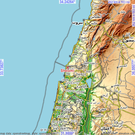
- [src 3] Base (background) map © OpenStreetMap contributors tiles are generated by Geofabrik and OpenTopoMap.
Copyright & License:
This Shelomi Elevation Map is licensed under CC BY-SA. You may reuse any part from this page, if you give a proper credit by linking to this URL:
 More info on terms of use page.