Cabinteely elevation
Cabinteely (Leinster, Dún Laoghaire-Rathdown), Ireland elevation is 41 meters and Cabinteely elevation in feet is 135 ft above sea level [src 1]. Cabinteely is a populated place (feature code) with elevation that is 10 meters (33 ft) smaller than average city elevation in Ireland.
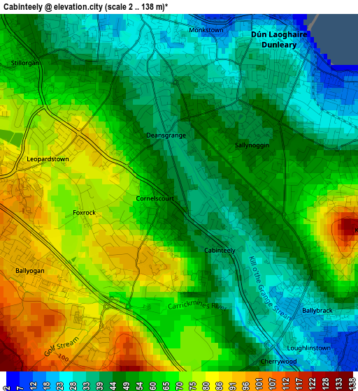
Below is the Elevation map of Cabinteely, which displays elevation range with different colors. Scale of the first map is from 2 to 138 m (7 to 453 ft) with average elevation of 56.9 meters (=187 ft) [note 1]
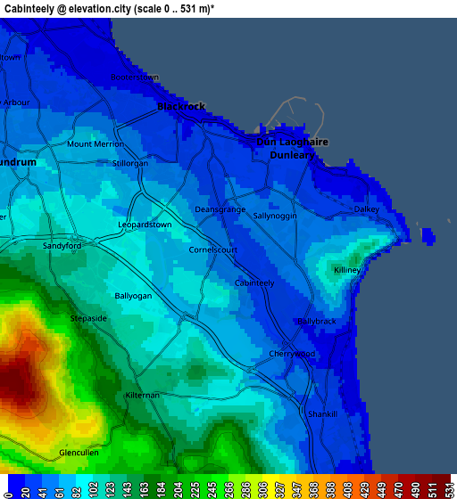
These maps also provides idea of topography and contour of this city, they are displayed at different zoom levels. More info about maps, scale and edge coordinates you can find below images.
| \ | Map #1 | Map #2 | Topo.Map |
| Scale [m] | 2..138 m | 0..531 m | × |
| Scale [ft] | 7..453 ft | 0..1742 ft | × |
| Average | 56.9 m = 187 ft | 101.4 m = 333 ft | × |
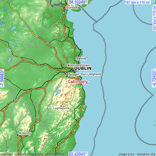
| Width | 5.84 km = 3.6 mi | 11.69 km = 7.3 mi | 187 km = 116.2 mi |
| Height | 5.84 km = 3.6 mi | 11.69 km = 7.3 mi | 187 km = 116.2 mi |
| ↑Max Latitude | 53.296003° | 53.322261° | 54.10249° |
| Latitude at center | 53.26973° | 53.26973° | 53.26973° |
| ↓Min Latitude | 53.24344° | 53.217135° | 52.42043° |
| ← Min Longitude | -6.204525° | -6.248471° | -7.56683° |
| Longitude center | -6.16058° | -6.16058° | -6.16058° |
| →Max Longitude | -6.116635° | -6.072689° | -4.75433° |
Nearby cities:
Cities around Cabinteely sort by population:
• Dún Laoghaire elevation 16 m
3.2 km,  31°
31°
• Sandyford 100 m
4.3 km,  277°
277°
• Foxrock 71 m
1 km,  249°
249°
• Shankill 33 m
5.4 km,  153°
153°
• Balally 96 m
5 km, 276°
• Blackrock 15 m
3.7 km,  342°
342°
• Mount Merrion 44 m
4.9 km,  312°
312°
• Booterstown 26 m
4.7 km,  325°
325°
• Sallynoggin 42 m
1.7 km,  51°
51°
• Dalkey 19 m
4.1 km,  76°
76°
• Monkstown 15 m
2.6 km,  10°
10°
• Loughlinstown 17 m
3.4 km, 147°
Multilingual:
 En español:
Cabinteely elevación 41 m.
 En France:
Cabinteely élévation 41 m.
 Auf Deutsch:
Cabinteely höhe über dem Meeresspiegel ist 41 m.

Sources and notes:
- [note 1] Map square and city borders are not equal. Map elevation data is calculated only from area inside that square.
- [src 1] Elevation data from geonames database provided with same terms of usage.
- [src 2] The elevation map of Cabinteely is generated using elevation data from NASA's 3 arcsec (90m) resolution SRTM data.
- [src 3] Base (background) map © OpenStreetMap contributors tiles are generated by Geofabrik and OpenTopoMap.
Copyright & License:
This Cabinteely Elevation Map is licensed under CC BY-SA. You may reuse any part from this page, if you give a proper credit by linking to this URL:
 More info on terms of use page.