Mountmellick elevation
Mountmellick (Leinster, Laois), Ireland elevation is 76 meters and Mountmellick elevation in feet is 249 ft above sea level [src 1]. Mountmellick is a populated place (feature code) with elevation that is 25 meters (82 ft) bigger than average city elevation in Ireland.
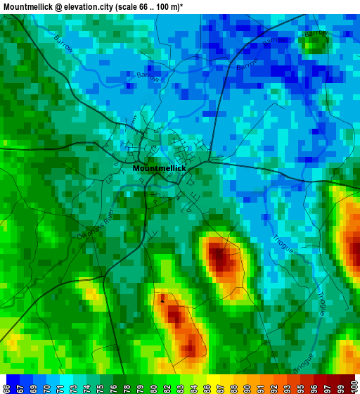
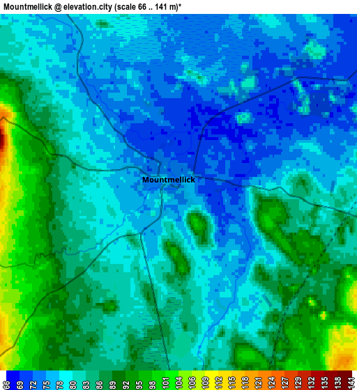
Below is the Elevation map of Mountmellick, which displays elevation range with different colors. Scale of the first map is from 66 to 100 m (217 to 328 ft) with average elevation of 75.8 meters (=249 ft) [note 1]
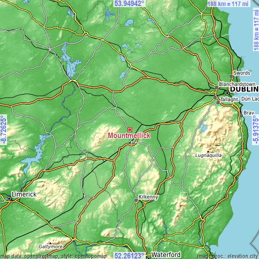
These maps also provides idea of topography and contour of this city, they are displayed at different zoom levels. More info about maps, scale and edge coordinates you can find below images.
| \ | Map #1 | Map #2 | Topo.Map |
| Scale [m] | 66..100 m | 66..141 m | × |
| Scale [ft] | 217..328 ft | 217..463 ft | × |
| Average | 75.8 m = 249 ft | 82 m = 269 ft | × |
| Width | 5.87 km = 3.6 mi | 11.73 km = 7.3 mi | 187.7 km = 116.6 mi |
| Height | 5.87 km = 3.6 mi | 11.73 km = 7.3 mi | 187.7 km = 116.6 mi |
| ↑Max Latitude | 53.139979° | 53.166332° | 53.94942° |
| Latitude at center | 53.11361° | 53.11361° | 53.11361° |
| ↓Min Latitude | 53.087225° | 53.060823° | 52.26123° |
| ← Min Longitude | -7.363945° | -7.407891° | -8.72625° |
| Longitude center | -7.32° | -7.32° | -7.32° |
| →Max Longitude | -7.276055° | -7.232109° | -5.91375° |
Nearby cities:
Cities around Mountmellick sort by population:
• Portlaoise elevation 101 m
8.9 km,  171°
171°
• Athy 62 m
26.5 km,  120°
120°
• Tullamore 60 m
21.1 km,  327°
327°
• Portarlington 67 m
10.2 km,  57°
57°
• Cherryville 99 m
24.1 km,  78°
78°
• Monasterevin 63 m
17.2 km, 79°
• Rathangan 74 m
24.8 km, 61°
• Abbeyleix 111 m
22.3 km,  184°
184°
• Mountrath 100 m
16.3 km,  218°
218°
• Stradbally 87 m
15.6 km,  134°
134°
• Ballylinan 81 m
26.5 km,  135°
135°
• Daingean 79 m
20.4 km,  5°
5°
Multilingual:
 En español:
Mountmellick elevación 76 m.
 En France:
Mountmellick élévation 76 m.
 Auf Deutsch:
Mountmellick höhe über dem Meeresspiegel ist 76 m.

Sources and notes:
- [note 1] Map square and city borders are not equal. Map elevation data is calculated only from area inside that square.
- [src 1] Elevation data from geonames database provided with same terms of usage.
- [src 2] The elevation map of Mountmellick is generated using elevation data from NASA's 3 arcsec (90m) resolution SRTM data.
- [src 3] Base (background) map © OpenStreetMap contributors tiles are generated by Geofabrik and OpenTopoMap.
Copyright & License:
This Mountmellick Elevation Map is licensed under CC BY-SA. You may reuse any part from this page, if you give a proper credit by linking to this URL:
 More info on terms of use page.