Wicklow elevation
Wicklow (Leinster), Ireland elevation is 53 meters and Wicklow elevation in feet is 174 ft above sea level [src 1]. Wicklow is a seat of a second-order administrative division (feature code) with elevation that is 2 meters (7 ft) bigger than average city elevation in Ireland.
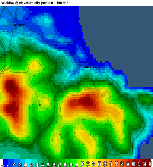
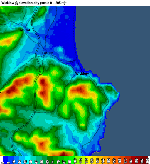
Below is the Elevation map of Wicklow, which displays elevation range with different colors. Scale of the first map is from 0 to 190 m (0 to 623 ft) with average elevation of 70.3 meters (=231 ft) [note 1]
These maps also provides idea of topography and contour of this city, they are displayed at different zoom levels. More info about maps, scale and edge coordinates you can find below images.
| \ | Map #1 | Map #2 | Topo.Map |
| Scale [m] | 0..190 m | 0..205 m | × |
| Scale [ft] | 0..623 ft | 0..673 ft | × |
| Average | 70.3 m = 231 ft | 62.6 m = 205 ft | × |
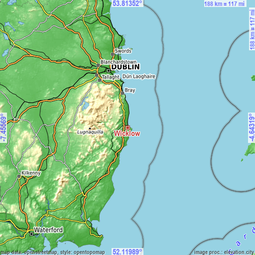
| Width | 5.88 km = 3.7 mi | 11.77 km = 7.3 mi | 188.3 km = 117 mi |
| Height | 5.88 km = 3.7 mi | 11.77 km = 7.3 mi | 188.3 km = 117 mi |
| ↑Max Latitude | 53.001454° | 53.027892° | 53.81352° |
| Latitude at center | 52.975° | 52.975° | 52.975° |
| ↓Min Latitude | 52.94853° | 52.922043° | 52.11989° |
| ← Min Longitude | -6.093385° | -6.137331° | -7.45569° |
| Longitude center | -6.04944° | -6.04944° | -6.04944° |
| →Max Longitude | -6.005495° | -5.961549° | -4.64319° |
Nearby cities:
Cities around Wicklow sort by population:
• Kilquade elevation 57 m
13.8 km,  350°
350°
• Greystones 19 m
18.5 km,  357°
357°
• Arklow 0 m
21.1 km,  196°
196°
• Kilcoole 18 m
14.2 km, 355°
• Rathnew 28 m
3 km,  305°
305°
• Newtownmountkennedy 81 m
13.5 km,  342°
342°
• Charlesland 12 m
17 km, 356°
• Rathdrum 145 m
13.6 km,  246°
246°
• Ashford 81 m
5.6 km, 311°
• Aughrim 72 m
23 km,  234°
234°
• Kilpedder 93 m
15.4 km, 345°
• Kilmacanoge 90 m
22.1 km, 345°
Multilingual:
 En español:
Wicklow elevación 53 m.
 En France:
Wicklow élévation 53 m.


Sources and notes:
- [note 1] Map square and city borders are not equal. Map elevation data is calculated only from area inside that square.
- [src 1] Elevation data from geonames database provided with same terms of usage.
- [src 2] The elevation map of Wicklow is generated using elevation data from NASA's 3 arcsec (90m) resolution SRTM data.
- [src 3] Base (background) map © OpenStreetMap contributors tiles are generated by Geofabrik and OpenTopoMap.
Copyright & License:
This Wicklow Elevation Map is licensed under CC BY-SA. You may reuse any part from this page, if you give a proper credit by linking to this URL:
 More info on terms of use page.