Les Anglais elevation
Les Anglais (Sud, Arrondissement des Chardonnières), Haiti elevation is 12 meters and Les Anglais elevation in feet is 39 ft above sea level [src 1]. Les Anglais is a populated place (feature code) with elevation that is 131 meters (430 ft) smaller than average city elevation in Haiti.
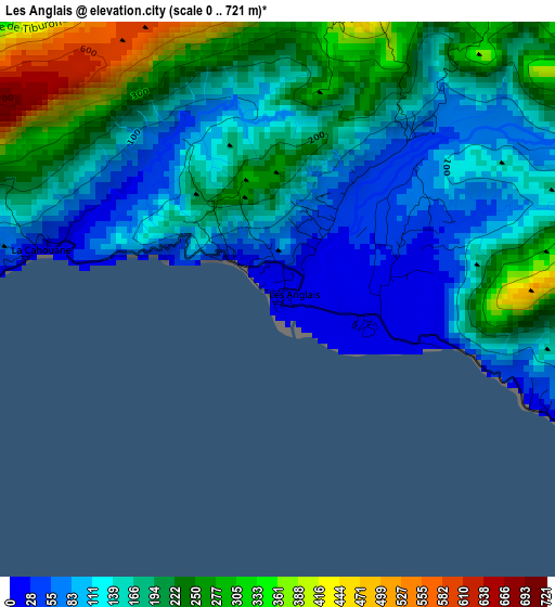
Below is the Elevation map of Les Anglais, which displays elevation range with different colors. Scale of the first map is from 0 to 721 m (0 to 2365 ft) with average elevation of 175.5 meters (=576 ft) [note 1]
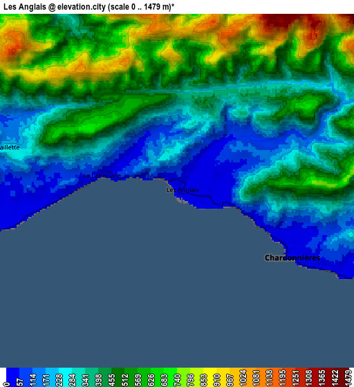
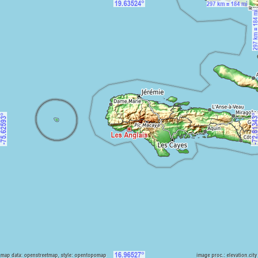
These maps also provides idea of topography and contour of this city, they are displayed at different zoom levels. More info about maps, scale and edge coordinates you can find below images.
| \ | Map #1 | Map #2 | Topo.Map |
| Scale [m] | 0..721 m | 0..1479 m | × |
| Scale [ft] | 0..2365 ft | 0..4852 ft | × |
| Average | 175.5 m = 576 ft | 426.4 m = 1399 ft | × |
| Width | 9.28 km = 5.8 mi | 18.56 km = 11.5 mi | 296.9 km = 184.5 mi |
| Height | 9.28 km = 5.8 mi | 18.56 km = 11.5 mi | 296.9 km = 184.5 mi |
| ↑Max Latitude | 18.347116° | 18.388823° | 19.63524° |
| Latitude at center | 18.3054° | 18.3054° | 18.3054° |
| ↓Min Latitude | 18.263673° | 18.221937° | 16.96527° |
| ← Min Longitude | -74.263625° | -74.307571° | -75.62593° |
| Longitude center | -74.21968° | -74.21968° | -74.21968° |
| →Max Longitude | -74.175735° | -74.131789° | -72.81343° |
Nearby cities:
Cities around Les Anglais sort by population:
• Jérémie elevation 12 m
39.8 km,  15°
15°
• Dame-Marie 17 m
35.5 km,  323°
323°
• Chardonnière 12 m
6.6 km,  121°
121°
• Port-à-Piment 12 m
14.4 km, 115°
• Tiburon 12 m
18.7 km,  276°
276°
• Les Irois 14 m
27 km,  294°
294°
• Koto 11 m
21.9 km, 120°
• Chantal 56 m
36.7 km,  108°
108°
• Moron 85 m
28.6 km,  351°
351°
• Roche-à-Bateau 16 m
26.6 km, 121°
• Chambellan 69 m
29 km,  340°
340°
• Les Abricots 11 m
39.3 km, 346°
Multilingual:
 En español:
Les Anglais elevación 12 m.
 En France:
Les Anglais élévation 12 m.
 Auf Deutsch:
Les Anglais höhe über dem Meeresspiegel ist 12 m.

Sources and notes:
- [note 1] Map square and city borders are not equal. Map elevation data is calculated only from area inside that square.
- [src 1] Elevation data from geonames database provided with same terms of usage.
- [src 2] The elevation map of Les Anglais is generated using elevation data from NASA's 3 arcsec (90m) resolution SRTM data.
- [src 3] Base (background) map © OpenStreetMap contributors tiles are generated by Geofabrik and OpenTopoMap.
Copyright & License:
This Les Anglais Elevation Map is licensed under CC BY-SA. You may reuse any part from this page, if you give a proper credit by linking to this URL:
 More info on terms of use page.