Mayisad elevation
Mayisad (Centre, Arrondissement de Hinche), Haiti elevation is 282 meters and Mayisad elevation in feet is 925 ft above sea level [src 1]. Mayisad is a populated place (feature code) with elevation that is 139 meters (456 ft) bigger than average city elevation in Haiti.
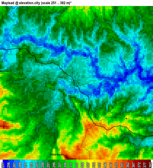
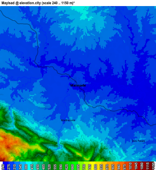
Below is the Elevation map of Mayisad, which displays elevation range with different colors. Scale of the first map is from 251 to 382 m (823 to 1253 ft) with average elevation of 294.2 meters (=965 ft) [note 1]
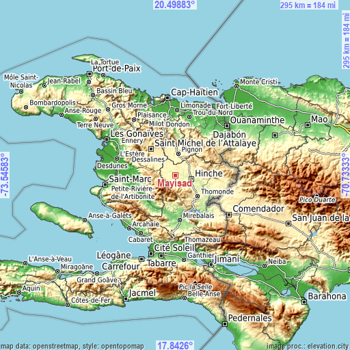
These maps also provides idea of topography and contour of this city, they are displayed at different zoom levels. More info about maps, scale and edge coordinates you can find below images.
| \ | Map #1 | Map #2 | Topo.Map |
| Scale [m] | 251..382 m | 240..1150 m | × |
| Scale [ft] | 823..1253 ft | 787..3773 ft | × |
| Average | 294.2 m = 965 ft | 346.2 m = 1136 ft | × |
| Width | 9.23 km = 5.7 mi | 18.46 km = 11.5 mi | 295.3 km = 183.5 mi |
| Height | 9.23 km = 5.7 mi | 18.46 km = 11.5 mi | 295.4 km = 183.6 mi |
| ↑Max Latitude | 19.217572° | 19.259063° | 20.49883° |
| Latitude at center | 19.17607° | 19.17607° | 19.17607° |
| ↓Min Latitude | 19.134558° | 19.093035° | 17.8426° |
| ← Min Longitude | -72.183525° | -72.227471° | -73.54583° |
| Longitude center | -72.13958° | -72.13958° | -72.13958° |
| →Max Longitude | -72.095635° | -72.051689° | -70.73333° |
Nearby cities:
Cities around Mayisad sort by population:
• Verrettes elevation 72 m
37 km,  247°
247°
• Saint-Raphaël 377 m
29.9 km,  347°
347°
• Hinche 237 m
13.2 km,  102°
102°
• Désarmes 81 m
33.3 km,  232°
232°
• Mirebalais 121 m
38.1 km,  174°
174°
• Pignon 346 m
17.9 km,  7°
7°
• Thomassique 294 m
33.3 km,  108°
108°
• Thomonde 283 m
25.7 km,  133°
133°
• Cerca la Source 370 m
36.7 km,  91°
91°
• Carice 626 m
39.5 km,  55°
55°
• Bahon 119 m
32.7 km,  4°
4°
• Ranquitte 403 m
27.1 km, 13°
Multilingual:
 En español:
Mayisad elevación 282 m.
 En France:
Mayisad élévation 282 m.


Sources and notes:
- [note 1] Map square and city borders are not equal. Map elevation data is calculated only from area inside that square.
- [src 1] Elevation data from geonames database provided with same terms of usage.
- [src 2] The elevation map of Mayisad is generated using elevation data from NASA's 3 arcsec (90m) resolution SRTM data.
- [src 3] Base (background) map © OpenStreetMap contributors tiles are generated by Geofabrik and OpenTopoMap.
Copyright & License:
This Mayisad Elevation Map is licensed under CC BY-SA. You may reuse any part from this page, if you give a proper credit by linking to this URL:
 More info on terms of use page.