Bjelovar elevation
Bjelovar (Bjelovarsko-Bilogorska), Croatia elevation is 128 meters and Bjelovar elevation in feet is 420 ft above sea level [src 1]. Bjelovar is a seat of a first-order administrative division (feature code) with elevation that is 26 meters (85 ft) smaller than average city elevation in Croatia.
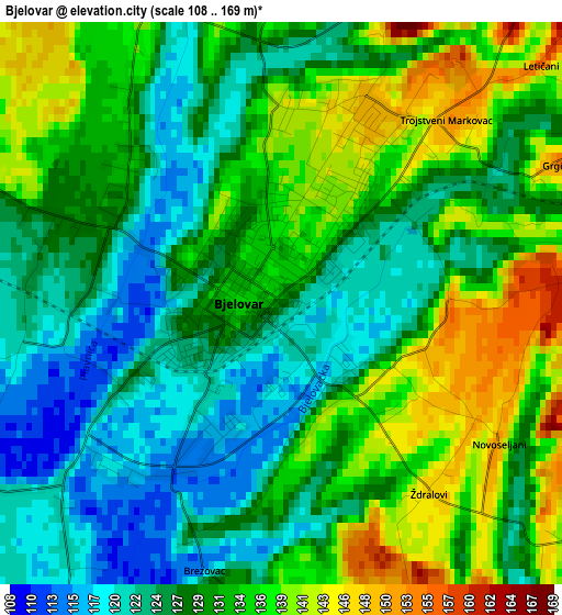
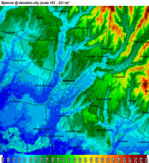
Below is the Elevation map of Bjelovar, which displays elevation range with different colors. Scale of the first map is from 108 to 169 m (354 to 554 ft) with average elevation of 130.6 meters (=428 ft) [note 1]
These maps also provides idea of topography and contour of this city, they are displayed at different zoom levels. More info about maps, scale and edge coordinates you can find below images.
| \ | Map #1 | Map #2 | Topo.Map |
| Scale [m] | 108..169 m | 103..221 m | × |
| Scale [ft] | 354..554 ft | 338..725 ft | × |
| Average | 130.6 m = 428 ft | 133.2 m = 437 ft | × |
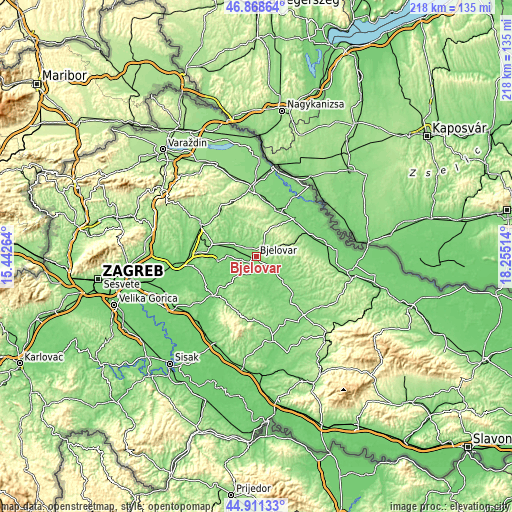
| Width | 6.8 km = 4.2 mi | 13.6 km = 8.5 mi | 217.6 km = 135.2 mi |
| Height | 6.8 km = 4.2 mi | 13.6 km = 8.5 mi | 217.6 km = 135.2 mi |
| ↑Max Latitude | 45.929184° | 45.959742° | 46.86864° |
| Latitude at center | 45.89861° | 45.89861° | 45.89861° |
| ↓Min Latitude | 45.868019° | 45.837411° | 44.91133° |
| ← Min Longitude | 16.804945° | 16.760999° | 15.44264° |
| Longitude center | 16.84889° | 16.84889° | 16.84889° |
| →Max Longitude | 16.892835° | 16.936781° | 18.25514° |
Nearby cities:
Cities around Bjelovar sort by population:
• Ždralovi elevation 145 m
3.2 km,  140°
140°
• Rovišće 128 m
10.2 km,  300°
300°
• Predavac 121 m
6.5 km,  309°
309°
• Gudovac 115 m
5.6 km,  248°
248°
• Brezovac 133 m
3.5 km,  190°
190°
• Šandrovac 147 m
13.3 km,  86°
86°
• Ivanska 132 m
13.6 km, 192°
• Farkaševac 112 m
16.2 km,  262°
262°
• Štefanje 157 m
14.4 km,  223°
223°
• Nova Rača 128 m
13.9 km, 144°
• Kapela 206 m
10 km,  1°
1°
• Veliko Trojstvo 144 m
7.8 km,  58°
58°
Multilingual:
 En español:
Bjelovar elevación 128 m.
 En France:
Bjelovar élévation 128 m.
 Auf Deutsch:
Bjelovar höhe über dem Meeresspiegel ist 128 m.

Sources and notes:
- [note 1] Map square and city borders are not equal. Map elevation data is calculated only from area inside that square.
- [src 1] Elevation data from geonames database provided with same terms of usage.
- [src 2] The elevation map of Bjelovar is generated using elevation data from NASA's 3 arcsec (90m) resolution SRTM data.
- [src 3] Base (background) map © OpenStreetMap contributors tiles are generated by Geofabrik and OpenTopoMap.
Copyright & License:
This Bjelovar Elevation Map is licensed under CC BY-SA. You may reuse any part from this page, if you give a proper credit by linking to this URL:
 More info on terms of use page.