Čepin elevation
Čepin (Osječko-Baranjska), Croatia elevation is 88 meters and Čepin elevation in feet is 289 ft above sea level [src 1]. Čepin is a seat of a second-order administrative division (feature code) with elevation that is 66 meters (217 ft) smaller than average city elevation in Croatia.
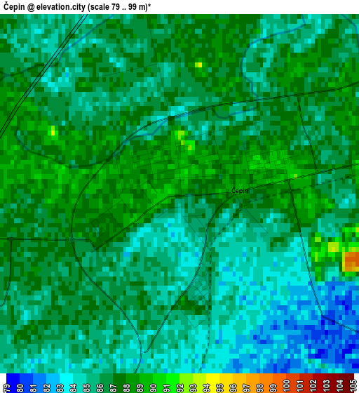
Below is the Elevation map of Čepin, which displays elevation range with different colors. Scale of the first map is from 79 to 99 m (259 to 325 ft) with average elevation of 85.8 meters (=281 ft) [note 1]
These maps also provides idea of topography and contour of this city, they are displayed at different zoom levels. More info about maps, scale and edge coordinates you can find below images.
| \ | Map #1 | Map #2 | Topo.Map |
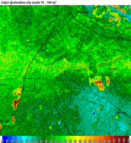
| Scale [m] | 79..99 m | 74..104 m | × |
| Scale [ft] | 259..325 ft | 243..341 ft | × |
| Average | 85.8 m = 281 ft | 85.4 m = 280 ft | × |
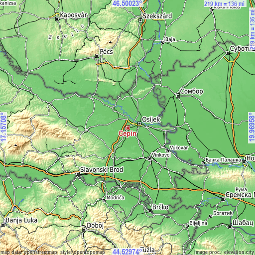
| Width | 6.85 km = 4.3 mi | 13.69 km = 8.5 mi | 219.1 km = 136.1 mi |
| Height | 6.85 km = 4.3 mi | 13.69 km = 8.5 mi | 219.1 km = 136.1 mi |
| ↑Max Latitude | 45.55439° | 45.585154° | 46.50023° |
| Latitude at center | 45.52361° | 45.52361° | 45.52361° |
| ↓Min Latitude | 45.492813° | 45.461999° | 44.52974° |
| ← Min Longitude | 18.519385° | 18.475439° | 17.15708° |
| Longitude center | 18.56333° | 18.56333° | 18.56333° |
| →Max Longitude | 18.607275° | 18.651221° | 19.96958° |
Nearby cities:
Cities around Čepin sort by population:
• Osijek elevation 87 m
10.6 km,  73°
73°
• Višnjevac 86 m
6.4 km,  38°
38°
• Josipovac 87 m
6.7 km,  12°
12°
• Petrijevci 89 m
10.2 km,  347°
347°
• Antunovac 86 m
9.4 km,  112°
112°
• Bizovac 88 m
11.2 km,  313°
313°
• Šodolovci 86 m
14.4 km,  162°
162°
• Ladimirevci 86 m
14.4 km,  321°
321°
• Vladislavci 85 m
7.2 km,  173°
173°
• Brijest 88 m
8.5 km,  92°
92°
• Ernestinovo 84 m
10.9 km,  136°
136°
• Vuka 89 m
11 km,  204°
204°
Multilingual:
 En español:
Čepin elevación 88 m.
 En France:
Čepin élévation 88 m.


Sources and notes:
- [note 1] Map square and city borders are not equal. Map elevation data is calculated only from area inside that square.
- [src 1] Elevation data from geonames database provided with same terms of usage.
- [src 2] The elevation map of Čepin is generated using elevation data from NASA's 3 arcsec (90m) resolution SRTM data.
- [src 3] Base (background) map © OpenStreetMap contributors tiles are generated by Geofabrik and OpenTopoMap.
Copyright & License:
This Čepin Elevation Map is licensed under CC BY-SA. You may reuse any part from this page, if you give a proper credit by linking to this URL:
 More info on terms of use page.