Đakovo elevation
Đakovo (Osječko-Baranjska, Grad Đakovo), Croatia elevation is 107 meters and Đakovo elevation in feet is 351 ft above sea level [src 1]. Đakovo is a populated place (feature code) with elevation that is 47 meters (154 ft) smaller than average city elevation in Croatia.
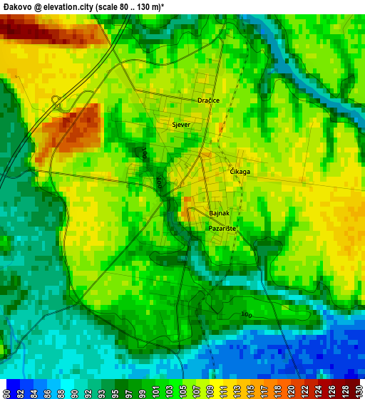
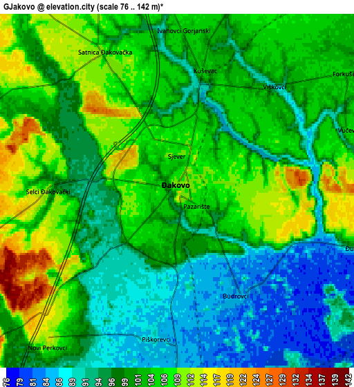
Below is the Elevation map of Đakovo, which displays elevation range with different colors. Scale of the first map is from 80 to 130 m (262 to 427 ft) with average elevation of 101.7 meters (=334 ft) [note 1]
These maps also provides idea of topography and contour of this city, they are displayed at different zoom levels. More info about maps, scale and edge coordinates you can find below images.
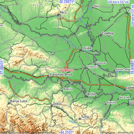
| \ | Map #1 | Map #2 | Topo.Map |
| Scale [m] | 80..130 m | 76..142 m | × |
| Scale [ft] | 262..427 ft | 249..466 ft | × |
| Average | 101.7 m = 334 ft | 100.5 m = 330 ft | × |
| Width | 6.87 km = 4.3 mi | 13.75 km = 8.5 mi | 219.9 km = 136.6 mi |
| Height | 6.87 km = 4.3 mi | 13.75 km = 8.5 mi | 219.9 km = 136.6 mi |
| ↑Max Latitude | 45.339228° | 45.370109° | 46.28871° |
| Latitude at center | 45.30833° | 45.30833° | 45.30833° |
| ↓Min Latitude | 45.277415° | 45.246484° | 44.3107° |
| ← Min Longitude | 18.366615° | 18.322669° | 17.00431° |
| Longitude center | 18.41056° | 18.41056° | 18.41056° |
| →Max Longitude | 18.454505° | 18.498451° | 19.81681° |
Nearby cities:
Cities around Đakovo sort by population:
• Strizivojna elevation 84 m
9.2 km,  173°
173°
• Vrpolje 86 m
10.9 km,  182°
182°
• Piškorevci 87 m
5.9 km, 184°
• Semeljci 95 m
11.9 km,  60°
60°
• Budrovci 82 m
5.1 km,  144°
144°
• Viškovci 92 m
5.7 km,  44°
44°
• Gorjani 112 m
10.5 km,  343°
343°
• Stari Perkovci 93 m
11.2 km,  205°
205°
• Kuševac 103 m
4.6 km,  18°
18°
• Široko Polje 89 m
11.8 km, 24°
• Stari Mikanovci 85 m
10.7 km,  106°
106°
• Satnica Ðakovačka 108 m
5.9 km,  334°
334°
Multilingual:
 En español:
Đakovo elevación 107 m.
 En France:
Đakovo élévation 107 m.


Sources and notes:
- [note 1] Map square and city borders are not equal. Map elevation data is calculated only from area inside that square.
- [src 1] Elevation data from geonames database provided with same terms of usage.
- [src 2] The elevation map of Đakovo is generated using elevation data from NASA's 3 arcsec (90m) resolution SRTM data.
- [src 3] Base (background) map © OpenStreetMap contributors tiles are generated by Geofabrik and OpenTopoMap.
Copyright & License:
This Đakovo Elevation Map is licensed under CC BY-SA. You may reuse any part from this page, if you give a proper credit by linking to this URL:
 More info on terms of use page.