Đurđevac elevation
Đurđevac (Koprivničko-Križevačka, Grad Đurđevac), Croatia elevation is 119 meters and Đurđevac elevation in feet is 390 ft above sea level [src 1]. Đurđevac is a populated place (feature code) with elevation that is 35 meters (115 ft) smaller than average city elevation in Croatia.
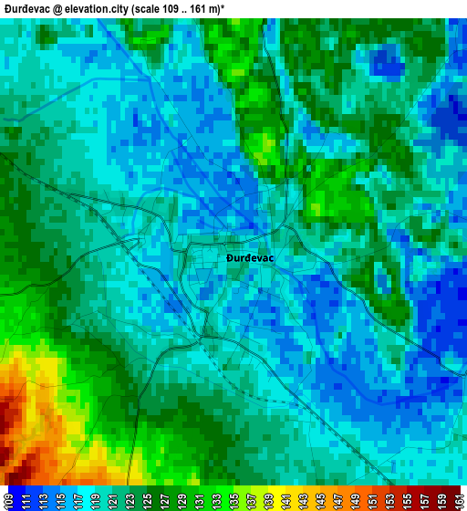
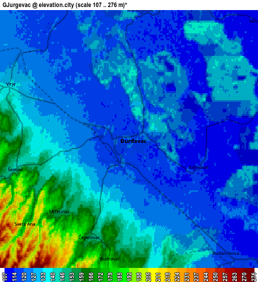
Below is the Elevation map of Đurđevac, which displays elevation range with different colors. Scale of the first map is from 109 to 161 m (358 to 528 ft) with average elevation of 121.5 meters (=399 ft) [note 1]
These maps also provides idea of topography and contour of this city, they are displayed at different zoom levels. More info about maps, scale and edge coordinates you can find below images.
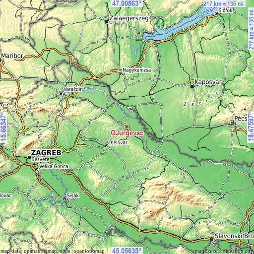
| \ | Map #1 | Map #2 | Topo.Map |
| Scale [m] | 109..161 m | 107..276 m | × |
| Scale [ft] | 358..528 ft | 351..906 ft | × |
| Average | 121.5 m = 399 ft | 132.7 m = 435 ft | × |
| Width | 6.78 km = 4.2 mi | 13.57 km = 8.4 mi | 217.1 km = 134.9 mi |
| Height | 6.78 km = 4.2 mi | 13.57 km = 8.4 mi | 217.1 km = 134.9 mi |
| ↑Max Latitude | 46.071606° | 46.102085° | 47.00863° |
| Latitude at center | 46.04111° | 46.04111° | 46.04111° |
| ↓Min Latitude | 46.010597° | 45.980068° | 45.05635° |
| ← Min Longitude | 17.025775° | 16.981829° | 15.66347° |
| Longitude center | 17.06972° | 17.06972° | 17.06972° |
| →Max Longitude | 17.113665° | 17.157611° | 18.47597° |
Nearby cities:
Cities around Đurđevac sort by population:
• Pitomača elevation 111 m
15.9 km,  129°
129°
• Virje 136 m
6.8 km,  295°
295°
• Ferdinandovac 108 m
10.1 km,  84°
84°
• Kalinovac 115 m
3.8 km,  110°
110°
• Molve 127 m
8.1 km,  338°
338°
• Hlebine 122 m
15.3 km,  327°
327°
• Šandrovac 147 m
15.5 km,  193°
193°
• Veliko Trojstvo 144 m
15.7 km,  221°
221°
• Podravske Sesvete 112 m
11.7 km, 110°
• Novigrad Podravski 134 m
9.8 km,  294°
294°
• Kloštar Podravski 117 m
9.4 km,  135°
135°
• Novo Virje 111 m
8.4 km,  48°
48°
Multilingual:
 En español:
Đurđevac elevación 119 m.
 En France:
Đurđevac élévation 119 m.
 Auf Deutsch:
Đurđevac höhe über dem Meeresspiegel ist 119 m.

Sources and notes:
- [note 1] Map square and city borders are not equal. Map elevation data is calculated only from area inside that square.
- [src 1] Elevation data from geonames database provided with same terms of usage.
- [src 2] The elevation map of Đurđevac is generated using elevation data from NASA's 3 arcsec (90m) resolution SRTM data.
- [src 3] Base (background) map © OpenStreetMap contributors tiles are generated by Geofabrik and OpenTopoMap.
Copyright & License:
This Đurđevac Elevation Map is licensed under CC BY-SA. You may reuse any part from this page, if you give a proper credit by linking to this URL:
 More info on terms of use page.