Garešnica elevation
Garešnica (Bjelovarsko-Bilogorska, Grad Garešnica), Croatia elevation is 118 meters and Garešnica elevation in feet is 387 ft above sea level [src 1]. Garešnica is a seat of a second-order administrative division (feature code) with elevation that is 36 meters (118 ft) smaller than average city elevation in Croatia.
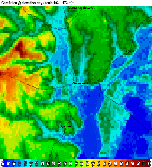
Below is the Elevation map of Garešnica, which displays elevation range with different colors. Scale of the first map is from 103 to 173 m (338 to 568 ft) with average elevation of 125 meters (=410 ft) [note 1]
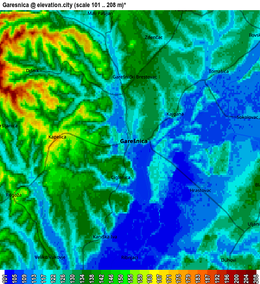
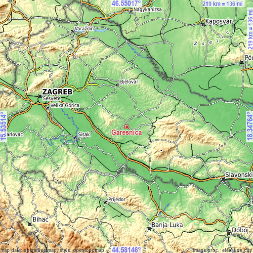
These maps also provides idea of topography and contour of this city, they are displayed at different zoom levels. More info about maps, scale and edge coordinates you can find below images.
| \ | Map #1 | Map #2 | Topo.Map |
| Scale [m] | 103..173 m | 101..208 m | × |
| Scale [ft] | 338..568 ft | 331..682 ft | × |
| Average | 125 m = 410 ft | 128.1 m = 420 ft | × |
| Width | 6.84 km = 4.3 mi | 13.68 km = 8.5 mi | 218.9 km = 136 mi |
| Height | 6.84 km = 4.3 mi | 13.68 km = 8.5 mi | 218.9 km = 136 mi |
| ↑Max Latitude | 45.605193° | 45.635928° | 46.55017° |
| Latitude at center | 45.57444° | 45.57444° | 45.57444° |
| ↓Min Latitude | 45.543671° | 45.512884° | 44.58146° |
| ← Min Longitude | 16.897445° | 16.853499° | 15.53514° |
| Longitude center | 16.94139° | 16.94139° | 16.94139° |
| →Max Longitude | 16.985335° | 17.029281° | 18.34764° |
Nearby cities:
Cities around Garešnica sort by population:
• Kutina elevation 104 m
16.6 km,  228°
228°
• Daruvar 160 m
22.1 km,  85°
85°
• Grubišno Polje 165 m
22.9 km,  51°
51°
• Lipovljani 130 m
20.2 km,  191°
191°
• Voloder 129 m
20.6 km,  261°
261°
• Repušnica 110 m
18.7 km,  241°
241°
• Veliki Grđevac 137 m
21.2 km,  22°
22°
• Hercegovac 139 m
10.9 km,  30°
30°
• Dežanovac 156 m
11.3 km, 92°
• Končanica 152 m
18.8 km,  68°
68°
• Berek 148 m
20.2 km,  334°
334°
• Velika Trnovitica 139 m
12.1 km,  4°
4°
Multilingual:
 En español:
Garešnica elevación 118 m.
 En France:
Garešnica élévation 118 m.
 Auf Deutsch:
Garešnica höhe über dem Meeresspiegel ist 118 m.

Sources and notes:
- [note 1] Map square and city borders are not equal. Map elevation data is calculated only from area inside that square.
- [src 1] Elevation data from geonames database provided with same terms of usage.
- [src 2] The elevation map of Garešnica is generated using elevation data from NASA's 3 arcsec (90m) resolution SRTM data.
- [src 3] Base (background) map © OpenStreetMap contributors tiles are generated by Geofabrik and OpenTopoMap.
Copyright & License:
This Garešnica Elevation Map is licensed under CC BY-SA. You may reuse any part from this page, if you give a proper credit by linking to this URL:
 More info on terms of use page.