Labin elevation
Labin (Istria, Grad Labin), Croatia elevation is 214 meters and Labin elevation in feet is 702 ft above sea level [src 1]. Labin is a seat of a second-order administrative division (feature code) with elevation that is 60 meters (197 ft) bigger than average city elevation in Croatia.
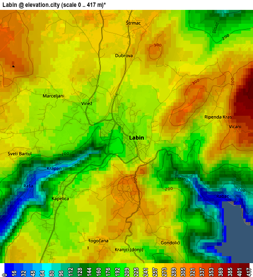
Below is the Elevation map of Labin, which displays elevation range with different colors. Scale of the first map is from 0 to 417 m (0 to 1368 ft) with average elevation of 230.6 meters (=757 ft) [note 1]
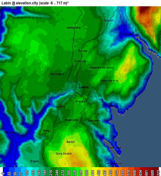
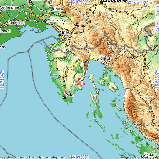
These maps also provides idea of topography and contour of this city, they are displayed at different zoom levels. More info about maps, scale and edge coordinates you can find below images.
| \ | Map #1 | Map #2 | Topo.Map |
| Scale [m] | 0..417 m | -6..717 m | × |
| Scale [ft] | 0..1368 ft | -20..2352 ft | × |
| Average | 230.6 m = 757 ft | 229.7 m = 754 ft | × |
| Width | 6.9 km = 4.3 mi | 13.8 km = 8.6 mi | 220.8 km = 137.2 mi |
| Height | 6.9 km = 4.3 mi | 13.8 km = 8.6 mi | 220.7 km = 137.1 mi |
| ↑Max Latitude | 45.126014° | 45.157011° | 46.07909° |
| Latitude at center | 45.095° | 45.095° | 45.095° |
| ↓Min Latitude | 45.063969° | 45.032921° | 44.09365° |
| ← Min Longitude | 14.075775° | 14.031829° | 12.71347° |
| Longitude center | 14.11972° | 14.11972° | 14.11972° |
| →Max Longitude | 14.163665° | 14.207611° | 15.52597° |
Nearby cities:
Cities around Labin sort by population:
• Raša elevation 96 m
3.6 km,  242°
242°
• Rabac 19 m
3.4 km,  120°
120°
• Vinež 216 m
1.1 km,  288°
288°
• Marčana 159 m
20.3 km,  219°
219°
• Žminj 370 m
17.4 km, 287°
• Mošćenička Draga 5 m
19 km,  33°
33°
• Svetvinčenat 311 m
18.6 km,  267°
267°
• Gračišće 443 m
16.2 km,  328°
328°
• Pićan 296 m
13.7 km, 333°
• Barban 233 m
9 km,  247°
247°
• Kršan 135 m
8.8 km,  9°
9°
• Nedeščina 298 m
5 km,  353°
353°
Multilingual:
 En español:
Labin elevación 214 m.
 En France:
Labin élévation 214 m.


Sources and notes:
- [note 1] Map square and city borders are not equal. Map elevation data is calculated only from area inside that square.
- [src 1] Elevation data from geonames database provided with same terms of usage.
- [src 2] The elevation map of Labin is generated using elevation data from NASA's 3 arcsec (90m) resolution SRTM data.
- [src 3] Base (background) map © OpenStreetMap contributors tiles are generated by Geofabrik and OpenTopoMap.
Copyright & License:
This Labin Elevation Map is licensed under CC BY-SA. You may reuse any part from this page, if you give a proper credit by linking to this URL:
 More info on terms of use page.