Mursko Središće elevation
Mursko Središće (Međimurska), Croatia elevation is 167 meters and Mursko Središće elevation in feet is 548 ft above sea level [src 1]. Mursko Središće is a seat of a second-order administrative division (feature code) with elevation that is 13 meters (43 ft) bigger than average city elevation in Croatia.
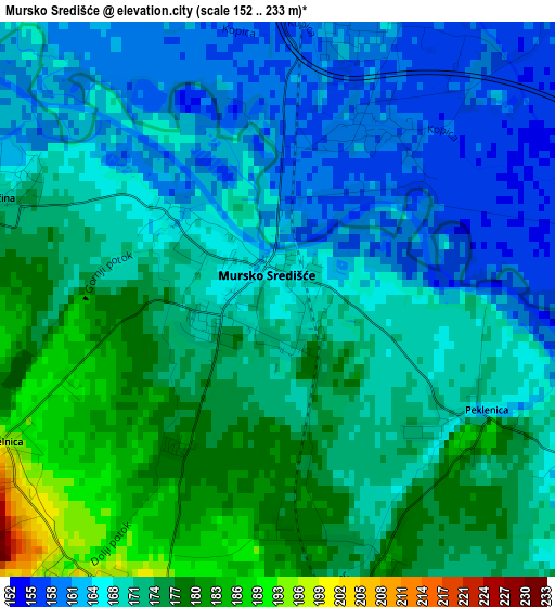
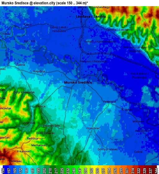
Below is the Elevation map of Mursko Središće, which displays elevation range with different colors. Scale of the first map is from 152 to 233 m (499 to 764 ft) with average elevation of 170.1 meters (=558 ft) [note 1]
These maps also provides idea of topography and contour of this city, they are displayed at different zoom levels. More info about maps, scale and edge coordinates you can find below images.
| \ | Map #1 | Map #2 | Topo.Map |
| Scale [m] | 152..233 m | 150..344 m | × |
| Scale [ft] | 499..764 ft | 492..1129 ft | × |
| Average | 170.1 m = 558 ft | 186 m = 610 ft | × |
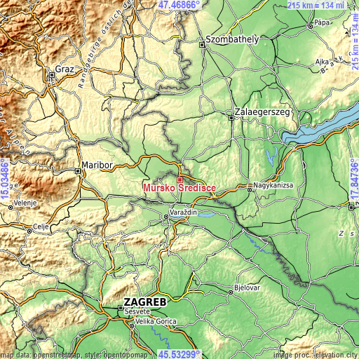
| Width | 6.73 km = 4.2 mi | 13.45 km = 8.4 mi | 215.2 km = 133.7 mi |
| Height | 6.73 km = 4.2 mi | 13.45 km = 8.4 mi | 215.2 km = 133.7 mi |
| ↑Max Latitude | 46.539676° | 46.569896° | 47.46866° |
| Latitude at center | 46.50944° | 46.50944° | 46.50944° |
| ↓Min Latitude | 46.479187° | 46.448917° | 45.53299° |
| ← Min Longitude | 16.397165° | 16.353219° | 15.03486° |
| Longitude center | 16.44111° | 16.44111° | 16.44111° |
| →Max Longitude | 16.485055° | 16.529001° | 17.84736° |
Nearby cities:
Cities around Mursko Središće sort by population:
• Šenkovec elevation 188 m
11.3 km,  187°
187°
• Podturen 156 m
9.3 km,  122°
122°
• Vratišinec 180 m
3.7 km,  159°
159°
• Novo Selo Rok 198 m
9.2 km,  169°
169°
• Mihovljan 182 m
11.2 km,  177°
177°
• Mačkovec 200 m
9.5 km, 183°
• Peklenica 183 m
3.1 km, 120°
• Lopatinec 240 m
9.5 km,  207°
207°
• Gornji Mihaljevec 224 m
12.2 km,  222°
222°
• Štrigova 213 m
11.7 km,  266°
266°
• Sveti Martin na Muri 171 m
5.4 km,  291°
291°
• Selnica 196 m
4.4 km,  245°
245°
Multilingual:
 En español:
Mursko Središće elevación 167 m.
 En France:
Mursko Središće élévation 167 m.
 Auf Deutsch:
Mursko Središće höhe über dem Meeresspiegel ist 167 m.

Sources and notes:
- [note 1] Map square and city borders are not equal. Map elevation data is calculated only from area inside that square.
- [src 1] Elevation data from geonames database provided with same terms of usage.
- [src 2] The elevation map of Mursko Središće is generated using elevation data from NASA's 3 arcsec (90m) resolution SRTM data.
- [src 3] Base (background) map © OpenStreetMap contributors tiles are generated by Geofabrik and OpenTopoMap.
Copyright & License:
This Mursko Središće Elevation Map is licensed under CC BY-SA. You may reuse any part from this page, if you give a proper credit by linking to this URL:
 More info on terms of use page.