Otok elevation
Otok (Vukovar-Sirmium), Croatia elevation is 90 meters and Otok elevation in feet is 295 ft above sea level [src 1]. Otok is a seat of a second-order administrative division (feature code) with elevation that is 64 meters (210 ft) smaller than average city elevation in Croatia.
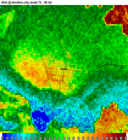
Below is the Elevation map of Otok, which displays elevation range with different colors. Scale of the first map is from 72 to 99 m (236 to 325 ft) with average elevation of 83 meters (=272 ft) [note 1]
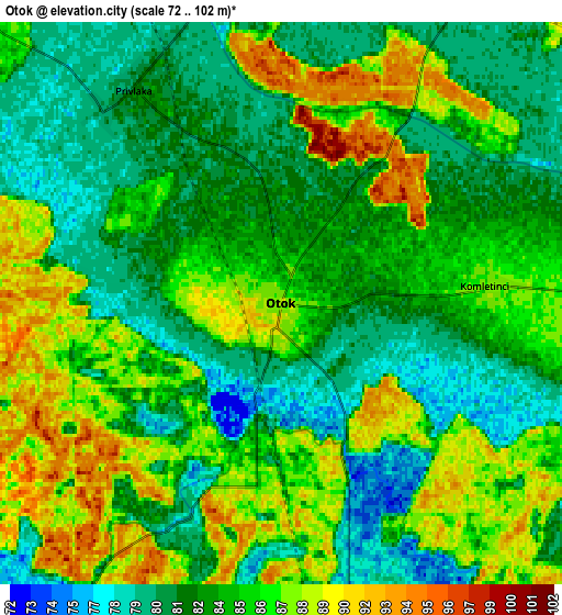
These maps also provides idea of topography and contour of this city, they are displayed at different zoom levels. More info about maps, scale and edge coordinates you can find below images.
| \ | Map #1 | Map #2 | Topo.Map |
| Scale [m] | 72..99 m | 72..102 m | × |
| Scale [ft] | 236..325 ft | 236..335 ft | × |
| Average | 83 m = 272 ft | 84.2 m = 276 ft | × |
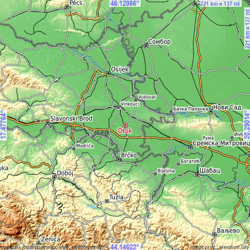
| Width | 6.89 km = 4.3 mi | 13.79 km = 8.6 mi | 220.6 km = 137.1 mi |
| Height | 6.89 km = 4.3 mi | 13.78 km = 8.6 mi | 220.5 km = 137 mi |
| ↑Max Latitude | 45.177656° | 45.208625° | 46.12986° |
| Latitude at center | 45.14667° | 45.14667° | 45.14667° |
| ↓Min Latitude | 45.115667° | 45.084648° | 44.14622° |
| ← Min Longitude | 18.839945° | 18.795999° | 17.47764° |
| Longitude center | 18.88389° | 18.88389° | 18.88389° |
| →Max Longitude | 18.927835° | 18.971781° | 20.29014° |
Nearby cities:
Cities around Otok sort by population:
• Vinkovci elevation 91 m
16.9 km,  338°
338°
• Županja 81 m
16.5 km,  242°
242°
• Bošnjaci 82 m
14.7 km,  223°
223°
• Cerna 79 m
15.7 km,  284°
284°
• Privlaka 81 m
6.5 km,  325°
325°
• Gradište 85 m
13.9 km,  270°
270°
• Mirkovci 92 m
13.9 km,  349°
349°
• Andrijaševci 81 m
14.3 km,  307°
307°
• Rokovci 81 m
14.4 km, 310°
• Nijemci 86 m
11.9 km,  93°
93°
• Komletinci 88 m
5.1 km, 86°
• Stari Jankovci 101 m
13 km,  10°
10°
Multilingual:
 En español:
Otok elevación 90 m.
 En France:
Otok élévation 90 m.


Sources and notes:
- [note 1] Map square and city borders are not equal. Map elevation data is calculated only from area inside that square.
- [src 1] Elevation data from geonames database provided with same terms of usage.
- [src 2] The elevation map of Otok is generated using elevation data from NASA's 3 arcsec (90m) resolution SRTM data.
- [src 3] Base (background) map © OpenStreetMap contributors tiles are generated by Geofabrik and OpenTopoMap.
Copyright & License:
This Otok Elevation Map is licensed under CC BY-SA. You may reuse any part from this page, if you give a proper credit by linking to this URL:
 More info on terms of use page.