Poreč elevation
Poreč (Istria, Grad Poreč), Croatia elevation is 4 meters and Poreč elevation in feet is 13 ft above sea level [src 1]. Poreč is a seat of a second-order administrative division (feature code) with elevation that is 150 meters (492 ft) smaller than average city elevation in Croatia.
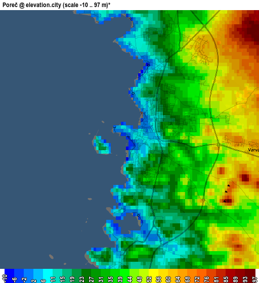
Below is the Elevation map of Poreč, which displays elevation range with different colors. Scale of the first map is from -10 to 97 m (-33 to 318 ft) with average elevation of 36.6 meters (=120 ft) [note 1]
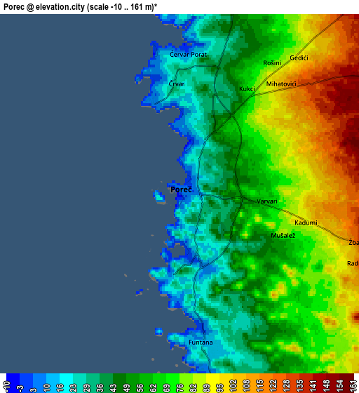
These maps also provides idea of topography and contour of this city, they are displayed at different zoom levels. More info about maps, scale and edge coordinates you can find below images.
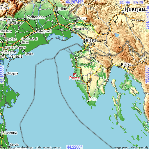
| \ | Map #1 | Map #2 | Topo.Map |
| Scale [m] | -10..97 m | -10..161 m | × |
| Scale [ft] | -33..318 ft | -33..528 ft | × |
| Average | 36.6 m = 120 ft | 64.1 m = 210 ft | × |
| Width | 6.88 km = 4.3 mi | 13.77 km = 8.6 mi | 220.3 km = 136.9 mi |
| Height | 6.88 km = 4.3 mi | 13.77 km = 8.6 mi | 220.2 km = 136.8 mi |
| ↑Max Latitude | 45.256613° | 45.287539° | 46.20749° |
| Latitude at center | 45.22567° | 45.22567° | 45.22567° |
| ↓Min Latitude | 45.19471° | 45.163734° | 44.2266° |
| ← Min Longitude | 13.551165° | 13.507219° | 12.18886° |
| Longitude center | 13.59511° | 13.59511° | 13.59511° |
| →Max Longitude | 13.639055° | 13.683001° | 15.00136° |
Nearby cities:
Cities around Poreč sort by population:
• Rovinj elevation 9 m
16.6 km,  167°
167°
• Novigrad 2 m
10.3 km,  343°
343°
• Vrsar 15 m
8.5 km, 174°
• Karojba 275 m
19.7 km,  64°
64°
• Tar 104 m
8.7 km,  15°
15°
• Funtana 8 m
5.7 km, 172°
• Brtonigla 111 m
17.5 km,  8°
8°
• Tinjan 313 m
19.2 km,  92°
92°
• Vižinada 260 m
17.2 km,  47°
47°
• Sveti Lovreč Pazenatički 184 m
12.8 km,  115°
115°
• Visignano 233 m
11.3 km, 60°
• Kaštelir 227 m
11.2 km,  39°
39°
Multilingual:
 En español:
Poreč elevación 4 m.
 En France:
Poreč élévation 4 m.


Sources and notes:
- [note 1] Map square and city borders are not equal. Map elevation data is calculated only from area inside that square.
- [src 1] Elevation data from geonames database provided with same terms of usage.
- [src 2] The elevation map of Poreč is generated using elevation data from NASA's 3 arcsec (90m) resolution SRTM data.
- [src 3] Base (background) map © OpenStreetMap contributors tiles are generated by Geofabrik and OpenTopoMap.
Copyright & License:
This Poreč Elevation Map is licensed under CC BY-SA. You may reuse any part from this page, if you give a proper credit by linking to this URL:
 More info on terms of use page.