Prelog elevation
Prelog (Međimurska), Croatia elevation is 148 meters and Prelog elevation in feet is 486 ft above sea level [src 1]. Prelog is a seat of a second-order administrative division (feature code) with elevation that is 6 meters (20 ft) smaller than average city elevation in Croatia.
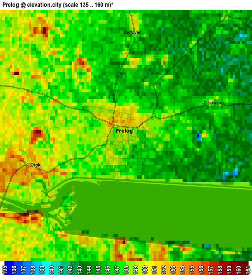
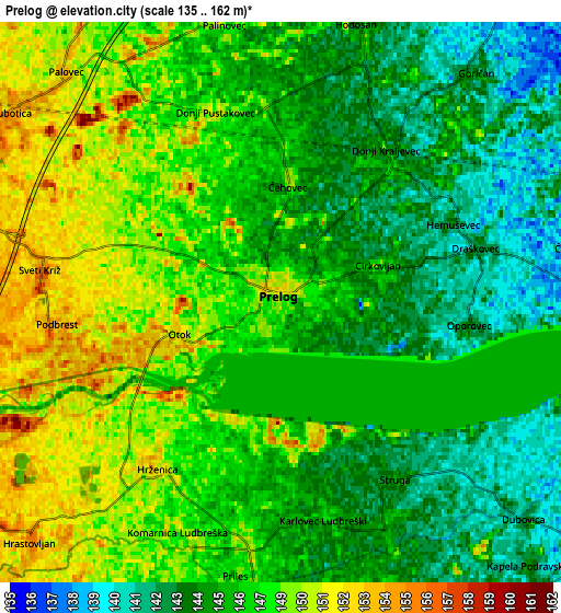
Below is the Elevation map of Prelog, which displays elevation range with different colors. Scale of the first map is from 135 to 160 m (443 to 525 ft) with average elevation of 147.2 meters (=483 ft) [note 1]
These maps also provides idea of topography and contour of this city, they are displayed at different zoom levels. More info about maps, scale and edge coordinates you can find below images.
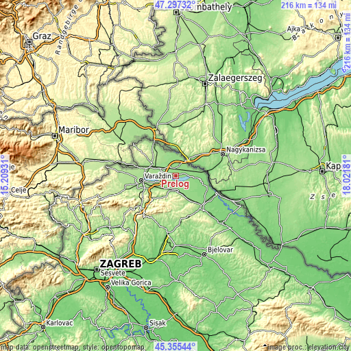
| \ | Map #1 | Map #2 | Topo.Map |
| Scale [m] | 135..160 m | 135..162 m | × |
| Scale [ft] | 443..525 ft | 443..531 ft | × |
| Average | 147.2 m = 483 ft | 146.7 m = 481 ft | × |
| Width | 6.75 km = 4.2 mi | 13.49 km = 8.4 mi | 215.9 km = 134.2 mi |
| Height | 6.75 km = 4.2 mi | 13.49 km = 8.4 mi | 215.9 km = 134.2 mi |
| ↑Max Latitude | 46.365333° | 46.39565° | 47.29732° |
| Latitude at center | 46.335° | 46.335° | 46.335° |
| ↓Min Latitude | 46.30465° | 46.274283° | 45.35544° |
| ← Min Longitude | 16.571615° | 16.527669° | 15.20931° |
| Longitude center | 16.61556° | 16.61556° | 16.61556° |
| →Max Longitude | 16.659505° | 16.703451° | 18.02181° |
Nearby cities:
Cities around Prelog sort by population:
• Ludbreg elevation 157 m
9.2 km,  180°
180°
• Goričan 141 m
7.4 km,  42°
42°
• Belica 153 m
10.7 km,  315°
315°
• Mala Subotica 154 m
8.1 km,  304°
304°
• Domašinec 146 m
10.9 km,  353°
353°
• Orehovica 159 m
8.3 km,  267°
267°
• Hodošan 144 m
7 km,  17°
17°
• Sveta Marija 139 m
9.7 km,  89°
89°
• Martijanec 153 m
9.6 km,  217°
217°
• Veliki Bukovec 141 m
8.7 km,  121°
121°
• Sveti Ðurđ 148 m
5.7 km,  188°
188°
• Donji Kraljevec 142 m
4.5 km, 39°
Multilingual:
 En español:
Prelog elevación 148 m.
 En France:
Prelog élévation 148 m.


Sources and notes:
- [note 1] Map square and city borders are not equal. Map elevation data is calculated only from area inside that square.
- [src 1] Elevation data from geonames database provided with same terms of usage.
- [src 2] The elevation map of Prelog is generated using elevation data from NASA's 3 arcsec (90m) resolution SRTM data.
- [src 3] Base (background) map © OpenStreetMap contributors tiles are generated by Geofabrik and OpenTopoMap.
Copyright & License:
This Prelog Elevation Map is licensed under CC BY-SA. You may reuse any part from this page, if you give a proper credit by linking to this URL:
 More info on terms of use page.