Požega elevation
Požega (Požeško-Slavonska, Grad Požega), Croatia elevation is 140 meters and Požega elevation in feet is 459 ft above sea level [src 1]. Požega is a seat of a first-order administrative division (feature code) with elevation that is 14 meters (46 ft) smaller than average city elevation in Croatia.
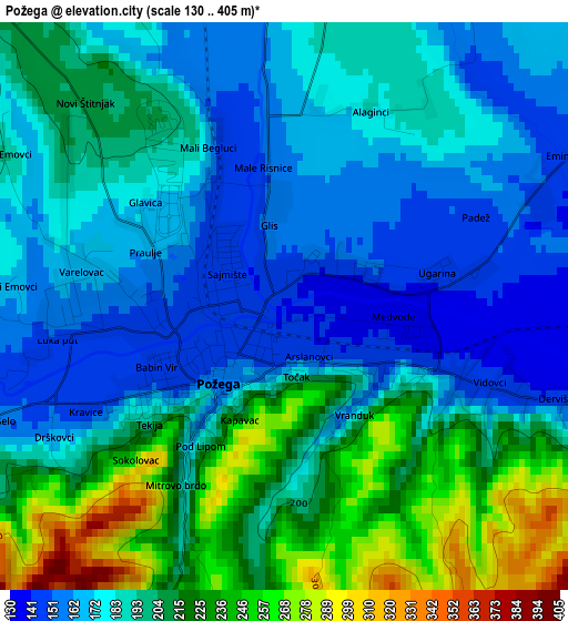
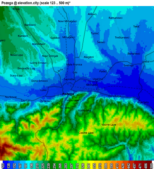
Below is the Elevation map of Požega, which displays elevation range with different colors. Scale of the first map is from 130 to 405 m (427 to 1329 ft) with average elevation of 192.7 meters (=632 ft) [note 1]
These maps also provides idea of topography and contour of this city, they are displayed at different zoom levels. More info about maps, scale and edge coordinates you can find below images.
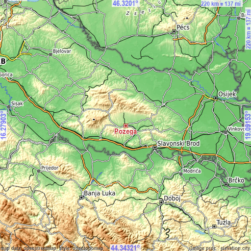
| \ | Map #1 | Map #2 | Topo.Map |
| Scale [m] | 130..405 m | 123..500 m | × |
| Scale [ft] | 427..1329 ft | 404..1640 ft | × |
| Average | 192.7 m = 632 ft | 216.5 m = 710 ft | × |
| Width | 6.87 km = 4.3 mi | 13.74 km = 8.5 mi | 219.8 km = 136.6 mi |
| Height | 6.87 km = 4.3 mi | 13.74 km = 8.5 mi | 219.8 km = 136.6 mi |
| ↑Max Latitude | 45.371161° | 45.402024° | 46.3201° |
| Latitude at center | 45.34028° | 45.34028° | 45.34028° |
| ↓Min Latitude | 45.309383° | 45.278468° | 44.34321° |
| ← Min Longitude | 17.641335° | 17.597389° | 16.27903° |
| Longitude center | 17.68528° | 17.68528° | 17.68528° |
| →Max Longitude | 17.729225° | 17.773171° | 19.09153° |
Nearby cities:
Cities around Požega sort by population:
• Pleternica elevation 117 m
11.1 km,  121°
121°
• Kutjevo 229 m
18.1 km,  58°
58°
• Velika 252 m
12.8 km,  351°
351°
• Oriovac 120 m
20.2 km,  163°
163°
• Jakšić 174 m
6.5 km,  72°
72°
• Vidovci 144 m
2.5 km,  110°
110°
• Kaptol 245 m
11 km,  16°
16°
• Lužani 92 m
19.2 km,  174°
174°
• Batrina 102 m
16.8 km,  185°
185°
• Staro Petrovo Selo 126 m
17.7 km,  226°
226°
• Nova Kapela 113 m
16.1 km, 192°
• Brestovac 164 m
7 km,  261°
261°
Multilingual:
 En español:
Požega elevación 140 m.
 En France:
Požega élévation 140 m.


Sources and notes:
- [note 1] Map square and city borders are not equal. Map elevation data is calculated only from area inside that square.
- [src 1] Elevation data from geonames database provided with same terms of usage.
- [src 2] The elevation map of Požega is generated using elevation data from NASA's 3 arcsec (90m) resolution SRTM data.
- [src 3] Base (background) map © OpenStreetMap contributors tiles are generated by Geofabrik and OpenTopoMap.
Copyright & License:
This Požega Elevation Map is licensed under CC BY-SA. You may reuse any part from this page, if you give a proper credit by linking to this URL:
 More info on terms of use page.