Sračinec elevation
Sračinec (Varaždinska), Croatia elevation is 178 meters and Sračinec elevation in feet is 584 ft above sea level [src 1]. Sračinec is a seat of a second-order administrative division (feature code) with elevation that is 24 meters (79 ft) bigger than average city elevation in Croatia.
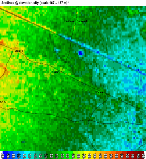
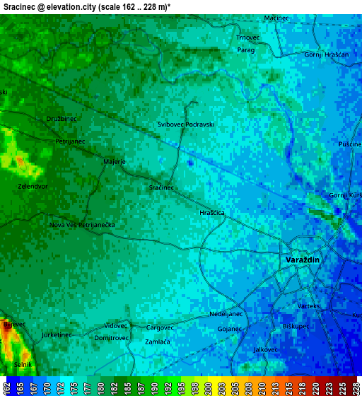
Below is the Elevation map of Sračinec, which displays elevation range with different colors. Scale of the first map is from 167 to 187 m (548 to 614 ft) with average elevation of 175.9 meters (=577 ft) [note 1]
These maps also provides idea of topography and contour of this city, they are displayed at different zoom levels. More info about maps, scale and edge coordinates you can find below images.
| \ | Map #1 | Map #2 | Topo.Map |
| Scale [m] | 167..187 m | 162..228 m | × |
| Scale [ft] | 548..614 ft | 531..748 ft | × |
| Average | 175.9 m = 577 ft | 176.4 m = 579 ft | × |
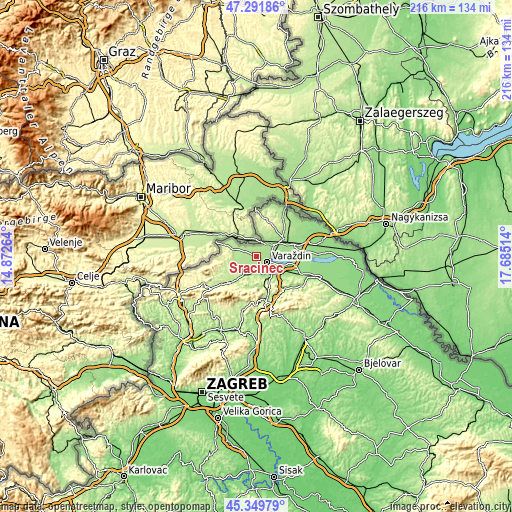
| Width | 6.75 km = 4.2 mi | 13.5 km = 8.4 mi | 215.9 km = 134.2 mi |
| Height | 6.75 km = 4.2 mi | 13.5 km = 8.4 mi | 215.9 km = 134.2 mi |
| ↑Max Latitude | 46.359776° | 46.390096° | 47.29186° |
| Latitude at center | 46.32944° | 46.32944° | 46.32944° |
| ↓Min Latitude | 46.299087° | 46.268717° | 45.34979° |
| ← Min Longitude | 16.234945° | 16.190999° | 14.87264° |
| Longitude center | 16.27889° | 16.27889° | 16.27889° |
| →Max Longitude | 16.322835° | 16.366781° | 17.68514° |
Nearby cities:
Cities around Sračinec sort by population:
• Varaždin elevation 173 m
5.3 km,  121°
121°
• Kuršanec 165 m
9.4 km,  89°
89°
• Nedeljanec 174 m
4.6 km,  175°
175°
• Petrijanec 184 m
4.7 km,  297°
297°
• Kućan Marof 165 m
8.4 km, 121°
• Jalkovec 169 m
6.2 km,  149°
149°
• Hrašćica 176 m
1.3 km,  112°
112°
• Donje Ladanje 214 m
9.2 km,  249°
249°
• Beretinec 192 m
9 km,  169°
169°
• Tužno 182 m
8.8 km,  202°
202°
• Vidovec 175 m
5.9 km,  209°
209°
• Maruševec 211 m
8.6 km,  238°
238°
Multilingual:
 En español:
Sračinec elevación 178 m.
 En France:
Sračinec élévation 178 m.
 Auf Deutsch:
Sračinec höhe über dem Meeresspiegel ist 178 m.

Sources and notes:
- [note 1] Map square and city borders are not equal. Map elevation data is calculated only from area inside that square.
- [src 1] Elevation data from geonames database provided with same terms of usage.
- [src 2] The elevation map of Sračinec is generated using elevation data from NASA's 3 arcsec (90m) resolution SRTM data.
- [src 3] Base (background) map © OpenStreetMap contributors tiles are generated by Geofabrik and OpenTopoMap.
Copyright & License:
This Sračinec Elevation Map is licensed under CC BY-SA. You may reuse any part from this page, if you give a proper credit by linking to this URL:
 More info on terms of use page.