Unešić elevation
Unešić (Šibensko-Kniniska), Croatia elevation is 358 meters and Unešić elevation in feet is 1175 ft above sea level [src 1]. Unešić is a seat of a second-order administrative division (feature code) with elevation that is 204 meters (669 ft) bigger than average city elevation in Croatia.
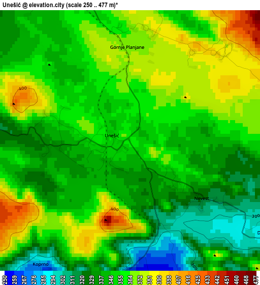
Below is the Elevation map of Unešić, which displays elevation range with different colors. Scale of the first map is from 250 to 477 m (820 to 1565 ft) with average elevation of 351.5 meters (=1153 ft) [note 1]
These maps also provides idea of topography and contour of this city, they are displayed at different zoom levels. More info about maps, scale and edge coordinates you can find below images.
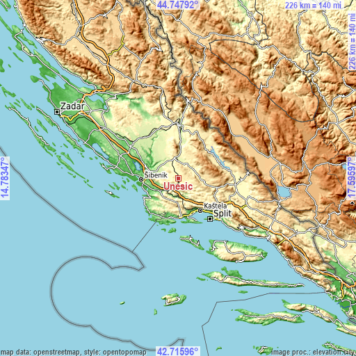
| \ | Map #1 | Topo.Map |
| Scale [m] | 250..477 m | × |
| Scale [ft] | 820..1565 ft | × |
| Average | 351.5 m = 1153 ft | × |
| Width | 7.06 km = 4.4 mi | 225.9 km = 140.4 mi |
| Height | 7.06 km = 4.4 mi | 225.9 km = 140.4 mi |
| ↑Max Latitude | 43.772301° | 44.74792° |
| Latitude at center | 43.74056° | 43.74056° |
| ↓Min Latitude | 43.708802° | 42.71596° |
| ← Min Longitude | 16.145775° | 14.78347° |
| Longitude center | 16.18972° | 16.18972° |
| →Max Longitude | 16.233665° | 17.59597° |
Nearby cities:
Cities around Unešić sort by population:
• Šibenik elevation 54 m
22.9 km,  266°
266°
• Kaštel Stari 25 m
24.8 km,  148°
148°
• Kaštel Novi 5 m
24.1 km, 151°
• Drniš 295 m
13.8 km,  348°
348°
• Kaštel Štafilić 5 m
24.1 km, 151°
• Brodarica 11 m
22.7 km,  252°
252°
• Skradin 2 m
23.1 km,  292°
292°
• Oklaj 261 m
24.9 km,  339°
339°
• Lećevica 407 m
16.9 km,  130°
130°
• Prgomet 344 m
15.3 km,  168°
168°
• Primorski Dolac 156 m
12.2 km,  185°
185°
• Ružić 308 m
10.7 km,  30°
30°
Multilingual:
 En español:
Unešić elevación 358 m.
 En France:
Unešić élévation 358 m.


Sources and notes:
- [note 1] Map square and city borders are not equal. Map elevation data is calculated only from area inside that square.
- [src 1] Elevation data from geonames database provided with same terms of usage.
- [src 2] The elevation map of Unešić is generated using elevation data from NASA's 3 arcsec (90m) resolution SRTM data.
- [src 3] Base (background) map © OpenStreetMap contributors tiles are generated by Geofabrik and OpenTopoMap.
Copyright & License:
This Unešić Elevation Map is licensed under CC BY-SA. You may reuse any part from this page, if you give a proper credit by linking to this URL:
 More info on terms of use page.