Vukovar elevation
Vukovar (Vukovar-Sirmium), Croatia elevation is 70 meters and Vukovar elevation in feet is 230 ft above sea level [src 1]. Vukovar is a seat of a first-order administrative division (feature code) with elevation that is 84 meters (276 ft) smaller than average city elevation in Croatia.
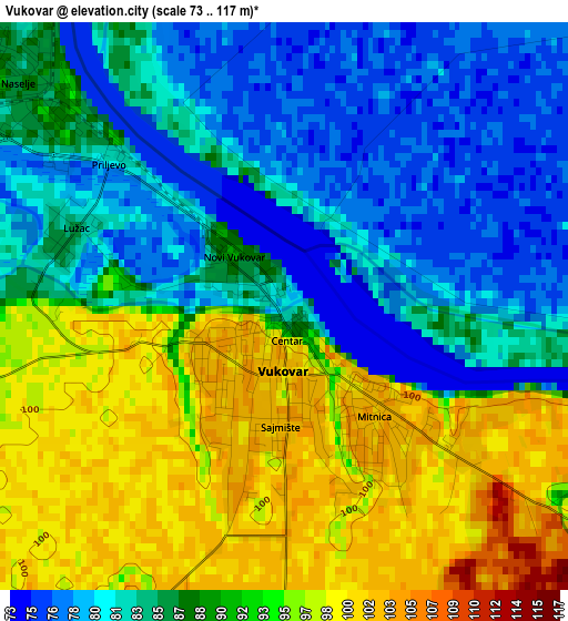
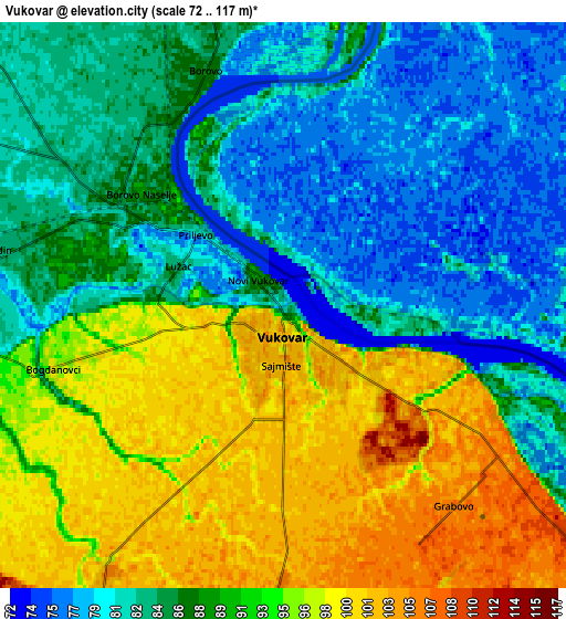
Below is the Elevation map of Vukovar, which displays elevation range with different colors. Scale of the first map is from 73 to 117 m (240 to 384 ft) with average elevation of 88.4 meters (=290 ft) [note 1]
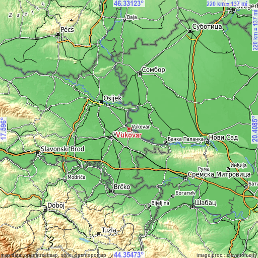
These maps also provides idea of topography and contour of this city, they are displayed at different zoom levels. More info about maps, scale and edge coordinates you can find below images.
| \ | Map #1 | Map #2 | Topo.Map |
| Scale [m] | 73..117 m | 72..117 m | × |
| Scale [ft] | 240..384 ft | 236..384 ft | × |
| Average | 88.4 m = 290 ft | 88.8 m = 291 ft | × |
| Width | 6.87 km = 4.3 mi | 13.74 km = 8.5 mi | 219.8 km = 136.6 mi |
| Height | 6.87 km = 4.3 mi | 13.74 km = 8.5 mi | 219.8 km = 136.6 mi |
| ↑Max Latitude | 45.382484° | 45.413342° | 46.33123° |
| Latitude at center | 45.35161° | 45.35161° | 45.35161° |
| ↓Min Latitude | 45.320719° | 45.289811° | 44.35473° |
| ← Min Longitude | 18.958305° | 18.914359° | 17.596° |
| Longitude center | 19.00225° | 19.00225° | 19.00225° |
| →Max Longitude | 19.046195° | 19.090141° | 20.4085° |
Nearby cities:
Cities around Vukovar sort by population:
• Borovo elevation 86 m
3.9 km,  314°
314°
• Dalj 73 m
14.8 km,  355°
355°
• Nuštar 88 m
12.7 km,  260°
260°
• Trpinja 86 m
11 km, 313°
• Bobota 84 m
13.9 km,  303°
303°
• Negoslavci 107 m
8 km,  183°
183°
• Cerić 98 m
12.3 km,  248°
248°
• Bršadin 85 m
7.2 km,  279°
279°
• Bogdanovci 97 m
5.7 km, 257°
• Stari Jankovci 101 m
12.1 km,  214°
214°
• Borovo Selo 86 m
6.3 km,  340°
340°
• Tompojevci 113 m
14.9 km,  151°
151°
Multilingual:
 En español:
Vukovar elevación 70 m.
 En France:
Vukovar élévation 70 m.


Sources and notes:
- [note 1] Map square and city borders are not equal. Map elevation data is calculated only from area inside that square.
- [src 1] Elevation data from geonames database provided with same terms of usage.
- [src 2] The elevation map of Vukovar is generated using elevation data from NASA's 3 arcsec (90m) resolution SRTM data.
- [src 3] Base (background) map © OpenStreetMap contributors tiles are generated by Geofabrik and OpenTopoMap.
Copyright & License:
This Vukovar Elevation Map is licensed under CC BY-SA. You may reuse any part from this page, if you give a proper credit by linking to this URL:
 More info on terms of use page.