Copán elevation
Copán, Honduras elevation is 583 meters and Copán elevation in feet is 1913 ft above sea level [src 1]. Copán is a populated place (feature code) with elevation that is 40 meters (131 ft) bigger than average city elevation in Honduras.
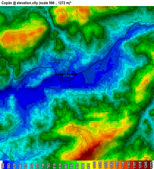
Below is the Elevation map of Copán, which displays elevation range with different colors. Scale of the first map is from 566 to 1272 m (1857 to 4173 ft) with average elevation of 780.9 meters (=2562 ft) [note 1]
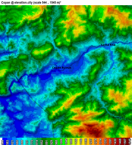
These maps also provides idea of topography and contour of this city, they are displayed at different zoom levels. More info about maps, scale and edge coordinates you can find below images.
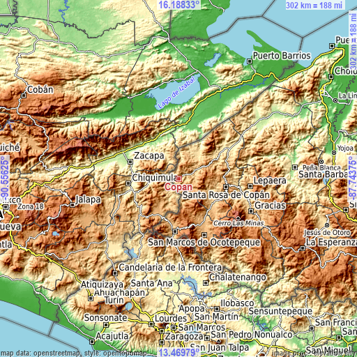
| \ | Map #1 | Map #2 | Topo.Map |
| Scale [m] | 566..1272 m | 544..1545 m | × |
| Scale [ft] | 1857..4173 ft | 1785..5069 ft | × |
| Average | 780.9 m = 2562 ft | 861.7 m = 2827 ft | × |
| Width | 9.45 km = 5.9 mi | 18.89 km = 11.7 mi | 302.3 km = 187.8 mi |
| Height | 9.45 km = 5.9 mi | 18.89 km = 11.7 mi | 302.3 km = 187.8 mi |
| ↑Max Latitude | 14.875807° | 14.918275° | 16.18833° |
| Latitude at center | 14.83333° | 14.83333° | 14.83333° |
| ↓Min Latitude | 14.790845° | 14.748352° | 13.46979° |
| ← Min Longitude | -89.193945° | -89.237891° | -90.55625° |
| Longitude center | -89.15° | -89.15° | -89.15° |
| →Max Longitude | -89.106055° | -89.062109° | -87.74375° |
Nearby cities:
Cities around Copán sort by population:
• Dulce Nombre elevation 1109 m
34.1 km,  86°
86°
• Santa Rita, Copan 724 m
6.6 km,  54°
54°
• San Agustín 1221 m
23.4 km, 94°
• La Encarnación 937 m
19.9 km,  158°
158°
• La Playona 212 m
36.2 km,  29°
29°
• El Corpus 807 m
29.1 km,  120°
120°
• Buenos Aires 956 m
29.7 km,  41°
41°
• San Joaquín 1235 m
36.1 km, 48°
• Dolores 1202 m
34.2 km,  83°
83°
• La Zumbadora 691 m
33.7 km, 52°
• San Jerónimo 793 m
33.9 km,  64°
64°
• San Fernando 1207 m
17.1 km,  167°
167°
Multilingual:
 En español:
Copán elevación 583 m.
 En France:
Copán élévation 583 m.


Sources and notes:
- [note 1] Map square and city borders are not equal. Map elevation data is calculated only from area inside that square.
- [src 1] Elevation data from geonames database provided with same terms of usage.
- [src 2] The elevation map of Copán is generated using elevation data from NASA's 3 arcsec (90m) resolution SRTM data.
- [src 3] Base (background) map © OpenStreetMap contributors tiles are generated by Geofabrik and OpenTopoMap.
Copyright & License:
This Copán Elevation Map is licensed under CC BY-SA. You may reuse any part from this page, if you give a proper credit by linking to this URL:
 More info on terms of use page.