Las Trojes elevation
Las Trojes (El Paraíso), Honduras elevation is 755 meters and Las Trojes elevation in feet is 2477 ft above sea level [src 1]. Las Trojes is a populated place (feature code) with elevation that is 212 meters (696 ft) bigger than average city elevation in Honduras.
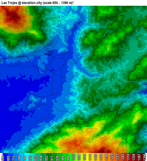
Below is the Elevation map of Las Trojes, which displays elevation range with different colors. Scale of the first map is from 654 to 1396 m (2146 to 4580 ft) with average elevation of 850.7 meters (=2791 ft) [note 1]
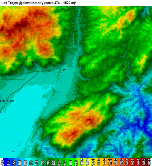
These maps also provides idea of topography and contour of this city, they are displayed at different zoom levels. More info about maps, scale and edge coordinates you can find below images.
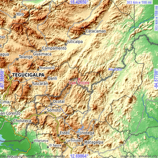
| \ | Map #1 | Map #2 | Topo.Map |
| Scale [m] | 654..1396 m | 474..1522 m | × |
| Scale [ft] | 2146..4580 ft | 1555..4993 ft | × |
| Average | 850.7 m = 2791 ft | 858.6 m = 2817 ft | × |
| Width | 9.48 km = 5.9 mi | 18.96 km = 11.8 mi | 303.3 km = 188.5 mi |
| Height | 9.48 km = 5.9 mi | 18.96 km = 11.8 mi | 303.3 km = 188.5 mi |
| ↑Max Latitude | 14.109294° | 14.151909° | 15.42656° |
| Latitude at center | 14.06667° | 14.06667° | 14.06667° |
| ↓Min Latitude | 14.024038° | 13.981399° | 12.69864° |
| ← Min Longitude | -86.027275° | -86.071221° | -87.38958° |
| Longitude center | -85.98333° | -85.98333° | -85.98333° |
| →Max Longitude | -85.939385° | -85.895439° | -84.57708° |
Nearby cities:
Cities around Las Trojes sort by population:
• San Francisco de Becerra elevation 376 m
64.2 km,  348°
348°
• Ojo de Agua 528 m
39.9 km,  261°
261°
• El Obraje 527 m
49.1 km, 261°
• El Chichicaste 413 m
34.2 km,  270°
270°
• Cuyalí 772 m
64.5 km,  251°
251°
• San Nicolás 408 m
60.9 km,  331°
331°
• San Diego 585 m
52.2 km, 267°
• Quebrada Larga 474 m
41.5 km,  275°
275°
• Araulí 749 m
62.5 km, 258°
• Jutiapa 484 m
45.9 km, 258°
• El Benque 563 m
52.3 km, 265°
• El Rusio 632 m
60.7 km,  317°
317°
Multilingual:
 En español:
Las Trojes elevación 755 m.
 En France:
Las Trojes élévation 755 m.
 Auf Deutsch:
Las Trojes höhe über dem Meeresspiegel ist 755 m.

Sources and notes:
- [note 1] Map square and city borders are not equal. Map elevation data is calculated only from area inside that square.
- [src 1] Elevation data from geonames database provided with same terms of usage.
- [src 2] The elevation map of Las Trojes is generated using elevation data from NASA's 3 arcsec (90m) resolution SRTM data.
- [src 3] Base (background) map © OpenStreetMap contributors tiles are generated by Geofabrik and OpenTopoMap.
Copyright & License:
This Las Trojes Elevation Map is licensed under CC BY-SA. You may reuse any part from this page, if you give a proper credit by linking to this URL:
 More info on terms of use page.