Nueva Ocotepeque elevation
Nueva Ocotepeque (Ocotepeque), Honduras elevation is 808 meters and Nueva Ocotepeque elevation in feet is 2651 ft above sea level [src 1]. Nueva Ocotepeque is a seat of a first-order administrative division (feature code) with elevation that is 265 meters (869 ft) bigger than average city elevation in Honduras.
Below is the Elevation map of Nueva Ocotepeque, which displays elevation range with different colors. Scale of the first map is from 716 to 2099 m (2349 to 6886 ft) with average elevation of 997.3 meters (=3272 ft) [note 1]
These maps also provides idea of topography and contour of this city, they are displayed at different zoom levels. More info about maps, scale and edge coordinates you can find below images.
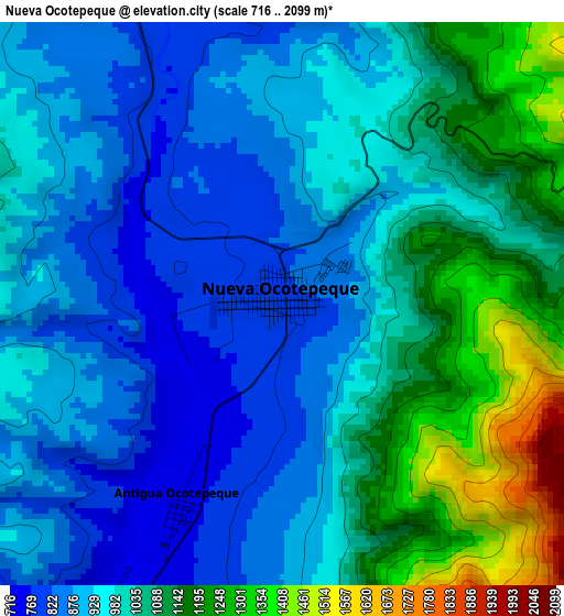
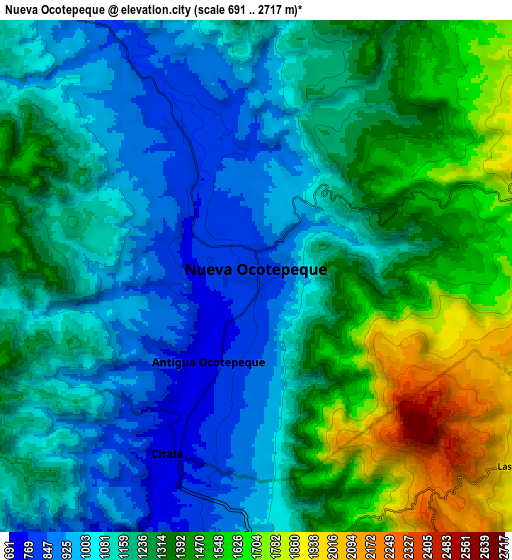
| \ | Map #1 | Map #2 | Topo.Map |
| Scale [m] | 716..2099 m | 691..2717 m | × |
| Scale [ft] | 2349..6886 ft | 2267..8914 ft | × |
| Average | 997.3 m = 3272 ft | 1239 m = 4065 ft | × |
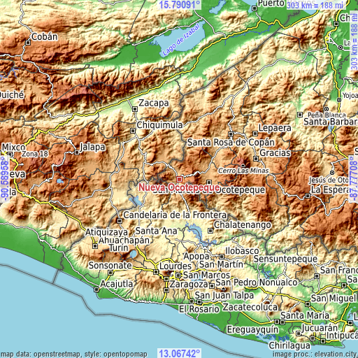
| Width | 9.46 km = 5.9 mi | 18.93 km = 11.8 mi | 302.8 km = 188.2 mi |
| Height | 9.46 km = 5.9 mi | 18.93 km = 11.8 mi | 302.8 km = 188.2 mi |
| ↑Max Latitude | 14.475884° | 14.51843° | 15.79091° |
| Latitude at center | 14.43333° | 14.43333° | 14.43333° |
| ↓Min Latitude | 14.390768° | 14.348197° | 13.06742° |
| ← Min Longitude | -89.227275° | -89.271221° | -90.58958° |
| Longitude center | -89.18333° | -89.18333° | -89.18333° |
| →Max Longitude | -89.139385° | -89.095439° | -87.77708° |
Nearby cities:
Cities around Nueva Ocotepeque sort by population:
• San Marcos elevation 991 m
25.4 km,  98°
98°
• Sinuapa 847 m
1.9 km,  0°
0°
• San Francisco del Valle 899 m
25.1 km,  90°
90°
• Antigua Ocotepeque 751 m
4.1 km,  205°
205°
• Sensenti 872 m
27.5 km,  78°
78°
• La Encarnación 937 m
28.1 km,  22°
22°
• Lucerna 842 m
29.9 km,  64°
64°
• La Labor 997 m
20.5 km,  74°
74°
• Santa Lucía 738 m
2.6 km,  224°
224°
• San Francisco de Cones 1218 m
31.9 km, 73°
• San Fernando 1207 m
28.7 km,  14°
14°
• El Tránsito 1098 m
29.3 km, 100°
Multilingual:
 En español:
Nueva Ocotepeque elevación 808 m.
 En France:
Nueva Ocotepeque élévation 808 m.
 Auf Deutsch:
Nueva Ocotepeque höhe über dem Meeresspiegel ist 808 m.

Sources and notes:
- [note 1] Map square and city borders are not equal. Map elevation data is calculated only from area inside that square.
- [src 1] Elevation data from geonames database provided with same terms of usage.
- [src 2] The elevation map of Nueva Ocotepeque is generated using elevation data from NASA's 3 arcsec (90m) resolution SRTM data.
- [src 3] Base (background) map © OpenStreetMap contributors tiles are generated by Geofabrik and OpenTopoMap.
Copyright & License:
This Nueva Ocotepeque Elevation Map is licensed under CC BY-SA. You may reuse any part from this page, if you give a proper credit by linking to this URL:
 More info on terms of use page.