Peña Blanca elevation
Peña Blanca (Cortés, San Pedro Sula), Honduras elevation is 256 meters and Peña Blanca elevation in feet is 840 ft above sea level [src 1]. Peña Blanca is a populated place (feature code) with elevation that is 287 meters (942 ft) smaller than average city elevation in Honduras.
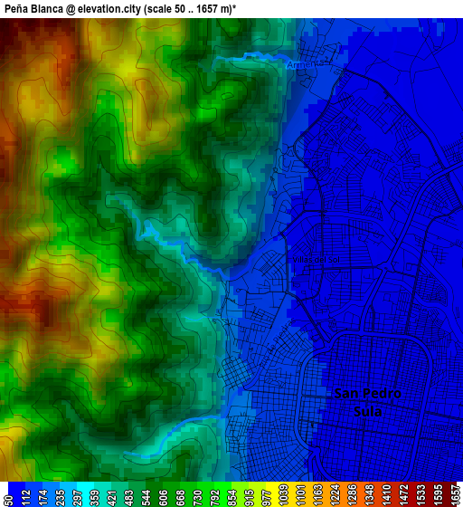
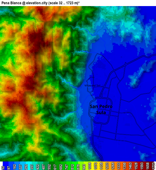
Below is the Elevation map of Peña Blanca, which displays elevation range with different colors. Scale of the first map is from 50 to 1657 m (164 to 5436 ft) with average elevation of 457.8 meters (=1502 ft) [note 1]
These maps also provides idea of topography and contour of this city, they are displayed at different zoom levels. More info about maps, scale and edge coordinates you can find below images.
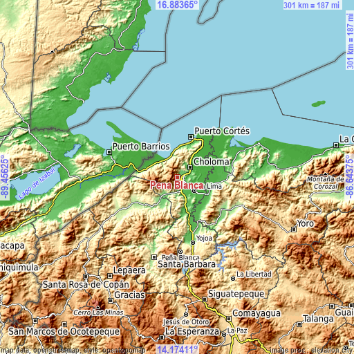
| \ | Map #1 | Map #2 | Topo.Map |
| Scale [m] | 50..1657 m | 32..1723 m | × |
| Scale [ft] | 164..5436 ft | 105..5653 ft | × |
| Average | 457.8 m = 1502 ft | 539.6 m = 1770 ft | × |
| Width | 9.42 km = 5.9 mi | 18.83 km = 11.7 mi | 301.3 km = 187.2 mi |
| Height | 9.42 km = 5.9 mi | 18.83 km = 11.7 mi | 301.3 km = 187.2 mi |
| ↑Max Latitude | 15.575666° | 15.617993° | 16.88365° |
| Latitude at center | 15.53333° | 15.53333° | 15.53333° |
| ↓Min Latitude | 15.490985° | 15.448632° | 14.17411° |
| ← Min Longitude | -88.093945° | -88.137891° | -89.45625° |
| Longitude center | -88.05° | -88.05° | -88.05° |
| →Max Longitude | -88.006055° | -87.962109° | -86.64375° |
Nearby cities:
Cities around Peña Blanca sort by population:
• San Pedro Sula elevation 92 m
4.2 km,  140°
140°
• Choloma 41 m
13.8 km,  49°
49°
• La Lima 33 m
18.1 km,  127°
127°
• La Jutosa 156 m
12.3 km,  25°
25°
• Armenta 191 m
3.7 km,  180°
180°
• El Zapotal del Norte 179 m
1.9 km, 180°
• Quebrada Seca 89 m
18.3 km,  35°
35°
• Nuevo Chamelecón 361 m
17.1 km,  167°
167°
• El Milagro 38 m
17.3 km,  148°
148°
• El Marañón 140 m
14.8 km, 180°
• Chotepe 37 m
14.8 km, 151°
• El Rancho 89 m
18.3 km, 35°
Multilingual:
 En español:
Peña Blanca elevación 256 m.
 En France:
Peña Blanca élévation 256 m.
 Auf Deutsch:
Peña Blanca höhe über dem Meeresspiegel ist 256 m.

Sources and notes:
- [note 1] Map square and city borders are not equal. Map elevation data is calculated only from area inside that square.
- [src 1] Elevation data from geonames database provided with same terms of usage.
- [src 2] The elevation map of Peña Blanca is generated using elevation data from NASA's 3 arcsec (90m) resolution SRTM data.
- [src 3] Base (background) map © OpenStreetMap contributors tiles are generated by Geofabrik and OpenTopoMap.
Copyright & License:
This Peña Blanca Elevation Map is licensed under CC BY-SA. You may reuse any part from this page, if you give a proper credit by linking to this URL:
 More info on terms of use page.