Villanueva elevation
Villanueva (Cortés), Honduras elevation is 151 meters and Villanueva elevation in feet is 495 ft above sea level [src 1]. Villanueva is a populated place (feature code) with elevation that is 392 meters (1286 ft) smaller than average city elevation in Honduras.
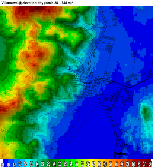
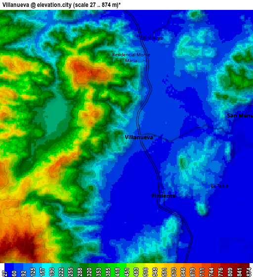
Below is the Elevation map of Villanueva, which displays elevation range with different colors. Scale of the first map is from 38 to 744 m (125 to 2441 ft) with average elevation of 208.5 meters (=684 ft) [note 1]
These maps also provides idea of topography and contour of this city, they are displayed at different zoom levels. More info about maps, scale and edge coordinates you can find below images.
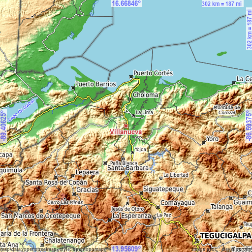
| \ | Map #1 | Map #2 | Topo.Map |
| Scale [m] | 38..744 m | 27..874 m | × |
| Scale [ft] | 125..2441 ft | 89..2867 ft | × |
| Average | 208.5 m = 684 ft | 221.8 m = 728 ft | × |
| Width | 9.43 km = 5.9 mi | 18.85 km = 11.7 mi | 301.6 km = 187.4 mi |
| Height | 9.43 km = 5.9 mi | 18.85 km = 11.7 mi | 301.6 km = 187.4 mi |
| ↑Max Latitude | 15.35905° | 15.401422° | 16.66846° |
| Latitude at center | 15.31667° | 15.31667° | 15.31667° |
| ↓Min Latitude | 15.274281° | 15.231884° | 13.95609° |
| ← Min Longitude | -88.043945° | -88.087891° | -89.40625° |
| Longitude center | -88° | -88° | -88° |
| →Max Longitude | -87.956055° | -87.912109° | -86.59375° |
Nearby cities:
Cities around Villanueva sort by population:
• La Lima elevation 33 m
15.8 km,  34°
34°
• Potrerillos 92 m
9.9 km,  158°
158°
• Pimienta Vieja 92 m
9.9 km, 158°
• Agua Blanca Sur 49 m
14.5 km,  120°
120°
• San Manuel 44 m
9.1 km,  78°
78°
• Pueblo Nuevo 116 m
4.1 km,  205°
205°
• El Plan 66 m
5.1 km,  136°
136°
• Nuevo Chamelecón 361 m
7.6 km,  346°
346°
• El Milagro 38 m
9.9 km,  21°
21°
• El Marañón 140 m
10.7 km,  329°
329°
• Chotepe 37 m
11.3 km,  9°
9°
• La Sabana 100 m
9.1 km,  52°
52°
Multilingual:
 En español:
Villanueva elevación 151 m.
 En France:
Villanueva élévation 151 m.
 Auf Deutsch:
Villanueva höhe über dem Meeresspiegel ist 151 m.

Sources and notes:
- [note 1] Map square and city borders are not equal. Map elevation data is calculated only from area inside that square.
- [src 1] Elevation data from geonames database provided with same terms of usage.
- [src 2] The elevation map of Villanueva is generated using elevation data from NASA's 3 arcsec (90m) resolution SRTM data.
- [src 3] Base (background) map © OpenStreetMap contributors tiles are generated by Geofabrik and OpenTopoMap.
Copyright & License:
This Villanueva Elevation Map is licensed under CC BY-SA. You may reuse any part from this page, if you give a proper credit by linking to this URL:
 More info on terms of use page.