Ngong Ping elevation
Ngong Ping (Islands), Hong Kong elevation is 435 meters and Ngong Ping elevation in feet is 1427 ft above sea level [src 1]. Ngong Ping is a populated place (feature code) with elevation that is 363 meters (1191 ft) bigger than average city elevation in Hong Kong.
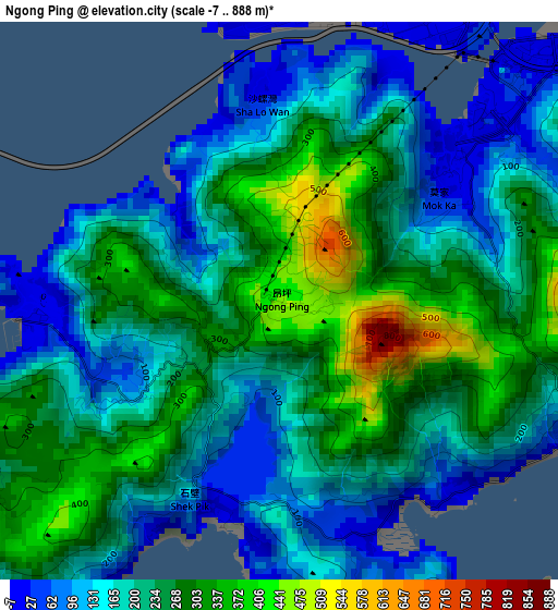
Below is the Elevation map of Ngong Ping, which displays elevation range with different colors. Scale of the first map is from -7 to 888 m (-23 to 2913 ft) with average elevation of 213.9 meters (=702 ft) [note 1]
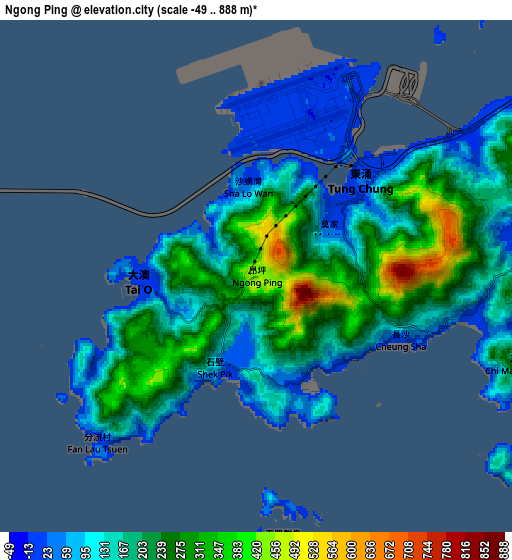
These maps also provides idea of topography and contour of this city, they are displayed at different zoom levels. More info about maps, scale and edge coordinates you can find below images.
| \ | Map #1 | Map #2 | Topo.Map |
| Scale [m] | -7..888 m | -49..888 m | × |
| Scale [ft] | -23..2913 ft | -161..2913 ft | × |
| Average | 213.9 m = 702 ft | 185.6 m = 609 ft | × |
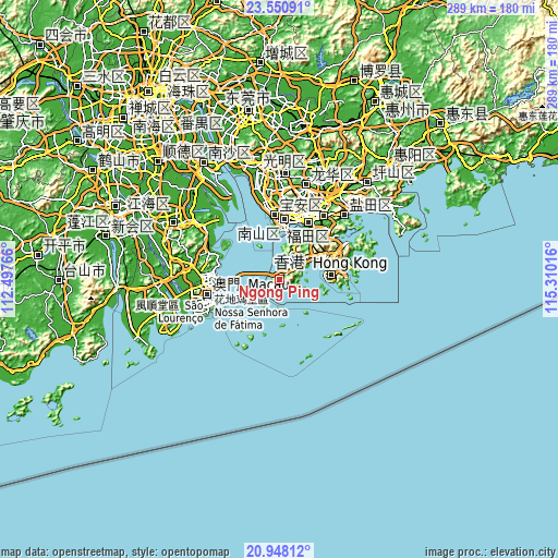
| Width | 9.04 km = 5.6 mi | 18.09 km = 11.2 mi | 289.4 km = 179.8 mi |
| Height | 9.04 km = 5.6 mi | 18.09 km = 11.2 mi | 289.4 km = 179.8 mi |
| ↑Max Latitude | 22.296226° | 22.336879° | 23.55091° |
| Latitude at center | 22.25556° | 22.25556° | 22.25556° |
| ↓Min Latitude | 22.214883° | 22.174193° | 20.94812° |
| ← Min Longitude | 113.859965° | 113.816019° | 112.49766° |
| Longitude center | 113.90391° | 113.90391° | 113.90391° |
| →Max Longitude | 113.947855° | 113.991801° | 115.31016° |
Nearby cities:
Cities around Ngong Ping sort by population:
• Hong Kong elevation 60 m
28 km,  84°
84°
• Kowloon 92 m
29.5 km, 76°
• Tsuen Wan 1 m
25.1 km,  59°
59°
• Yuen Long Kau Hui 4 m
25.4 km,  31°
31°
• Tung Chung 45 m
5.3 km,  47°
47°
• Tuen Mun 7 m
16.7 km,  24°
24°
• Yung Shue Wan 19 m
21.7 km,  98°
98°
• Sok Kwu Wan 37 m
24.1 km, 103°
• Tai O 4 m
4.2 km,  269°
269°
• Wan Chai 40 m
27.8 km, 84°
• Sham Shui Po 10 m
27.6 km,  72°
72°
• Central 29 m
26.4 km, 83°
Multilingual:
 En español:
Ngong Ping elevación 435 m.
 En France:
Ngong Ping élévation 435 m.
 Auf Deutsch:
Ngong Ping höhe über dem Meeresspiegel ist 435 m.

Sources and notes:
- [note 1] Map square and city borders are not equal. Map elevation data is calculated only from area inside that square.
- [src 1] Elevation data from geonames database provided with same terms of usage.
- [src 2] The elevation map of Ngong Ping is generated using elevation data from NASA's 3 arcsec (90m) resolution SRTM data.
- [src 3] Base (background) map © OpenStreetMap contributors tiles are generated by Geofabrik and OpenTopoMap.
Copyright & License:
This Ngong Ping Elevation Map is licensed under CC BY-SA. You may reuse any part from this page, if you give a proper credit by linking to this URL:
 More info on terms of use page.