Jocotenango elevation
Jocotenango (Sacatepéquez), Guatemala elevation is 1590 meters and Jocotenango elevation in feet is 5217 ft above sea level [src 1]. Jocotenango is a seat of a second-order administrative division (feature code) with elevation that is 323 meters (1060 ft) bigger than average city elevation in Guatemala.
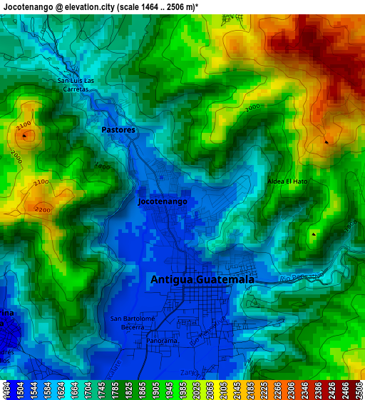
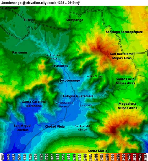
Below is the Elevation map of Jocotenango, which displays elevation range with different colors. Scale of the first map is from 1464 to 2506 m (4803 to 8222 ft) with average elevation of 1794.1 meters (=5886 ft) [note 1]
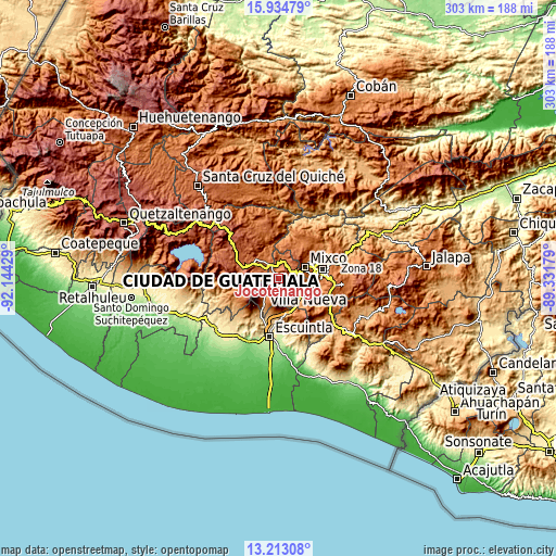
These maps also provides idea of topography and contour of this city, they are displayed at different zoom levels. More info about maps, scale and edge coordinates you can find below images.
| \ | Map #1 | Map #2 | Topo.Map |
| Scale [m] | 1464..2506 m | 1393..2619 m | × |
| Scale [ft] | 4803..8222 ft | 4570..8593 ft | × |
| Average | 1794.1 m = 5886 ft | 1856.8 m = 6092 ft | × |
| Width | 9.46 km = 5.9 mi | 18.92 km = 11.8 mi | 302.6 km = 188 mi |
| Height | 9.46 km = 5.9 mi | 18.92 km = 11.8 mi | 302.7 km = 188.1 mi |
| ↑Max Latitude | 14.620666° | 14.663185° | 15.93479° |
| Latitude at center | 14.57814° | 14.57814° | 14.57814° |
| ↓Min Latitude | 14.535605° | 14.493063° | 13.21308° |
| ← Min Longitude | -90.781985° | -90.825931° | -92.14429° |
| Longitude center | -90.73804° | -90.73804° | -90.73804° |
| →Max Longitude | -90.694095° | -90.650149° | -89.33179° |
Nearby cities:
Cities around Jocotenango sort by population:
• Antigua Guatemala elevation 1539 m
1.9 km,  168°
168°
• Ciudad Vieja 1580 m
6.6 km,  204°
204°
• Santiago Sacatepéquez 2033 m
9.2 km,  46°
46°
• Sumpango 1897 m
7.6 km,  3°
3°
• Santa Lucía Milpas Altas 1939 m
6.6 km,  91°
91°
• Pastores 1603 m
2.5 km,  315°
315°
• Parramos 1740 m
7.8 km,  296°
296°
• San Miguel Dueñas 1459 m
9.1 km,  226°
226°
• San Antonio Aguas Calientes 1503 m
5.8 km, 232°
• San Bartolomé Milpas Altas 2115 m
7.2 km,  63°
63°
• Magdalena Milpas Altas 2029 m
7.6 km,  116°
116°
• Santa Catarina Barahona 1556 m
6 km,  239°
239°
Multilingual:
 En español:
Jocotenango elevación 1590 m.
 En France:
Jocotenango élévation 1590 m.
 Auf Deutsch:
Jocotenango höhe über dem Meeresspiegel ist 1590 m.

Sources and notes:
- [note 1] Map square and city borders are not equal. Map elevation data is calculated only from area inside that square.
- [src 1] Elevation data from geonames database provided with same terms of usage.
- [src 2] The elevation map of Jocotenango is generated using elevation data from NASA's 3 arcsec (90m) resolution SRTM data.
- [src 3] Base (background) map © OpenStreetMap contributors tiles are generated by Geofabrik and OpenTopoMap.
Copyright & License:
This Jocotenango Elevation Map is licensed under CC BY-SA. You may reuse any part from this page, if you give a proper credit by linking to this URL:
 More info on terms of use page.