San Cristóbal Totonicapán elevation
San Cristóbal Totonicapán (Totonicapán), Guatemala elevation is 2397 meters and San Cristóbal Totonicapán elevation in feet is 7864 ft above sea level [src 1]. San Cristóbal Totonicapán is a seat of a second-order administrative division (feature code) with elevation that is 1130 meters (3707 ft) bigger than average city elevation in Guatemala.
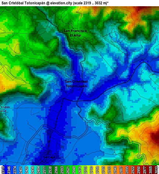
Below is the Elevation map of San Cristóbal Totonicapán, which displays elevation range with different colors. Scale of the first map is from 2319 to 3032 m (7608 to 9948 ft) with average elevation of 2500.1 meters (=8202 ft) [note 1]
These maps also provides idea of topography and contour of this city, they are displayed at different zoom levels. More info about maps, scale and edge coordinates you can find below images.
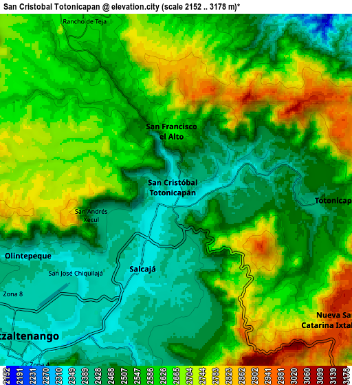
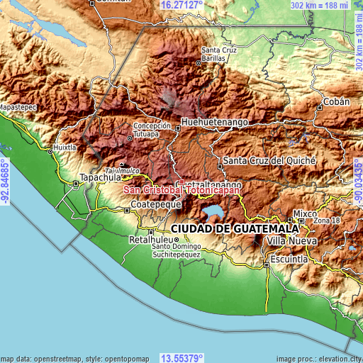
| \ | Map #1 | Map #2 | Topo.Map |
| Scale [m] | 2319..3032 m | 2152..3178 m | × |
| Scale [ft] | 7608..9948 ft | 7060..10427 ft | × |
| Average | 2500.1 m = 8202 ft | 2576 m = 8451 ft | × |
| Width | 9.44 km = 5.9 mi | 18.89 km = 11.7 mi | 302.2 km = 187.8 mi |
| Height | 9.44 km = 5.9 mi | 18.89 km = 11.7 mi | 302.2 km = 187.8 mi |
| ↑Max Latitude | 14.95928° | 15.001732° | 16.27127° |
| Latitude at center | 14.91682° | 14.91682° | 14.91682° |
| ↓Min Latitude | 14.874351° | 14.831875° | 13.55379° |
| ← Min Longitude | -91.484545° | -91.528491° | -92.84685° |
| Longitude center | -91.4406° | -91.4406° | -91.4406° |
| →Max Longitude | -91.396655° | -91.352709° | -90.03435° |
Nearby cities:
Cities around San Cristóbal Totonicapán sort by population:
• Quetzaltenango elevation 2344 m
12.4 km,  222°
222°
• Totonicapán 2499 m
8.6 km,  93°
93°
• San Francisco El Alto 2582 m
3.1 km,  355°
355°
• Momostenango 2215 m
14.6 km,  13°
13°
• Cantel 2296 m
11.8 km,  187°
187°
• La Esperanza 2455 m
13.9 km,  248°
248°
• San Andrés Xecul 2420 m
4.8 km, 253°
• Salcajá 2349 m
4.5 km,  203°
203°
• Almolonga 2322 m
12.6 km,  207°
207°
• San Carlos Sija 2730 m
13.9 km,  302°
302°
• San Francisco la Unión 2749 m
10.9 km,  273°
273°
• Olintepeque 2384 m
8.7 km, 246°
Multilingual:
 En español:
San Cristóbal Totonicapán elevación 2397 m.
 En France:
San Cristóbal Totonicapán élévation 2397 m.
 Auf Deutsch:
San Cristóbal Totonicapán höhe über dem Meeresspiegel ist 2397 m.
 На русском:
San Cristóbal Totonicapán высота над уровнем моря 2397 м
Sources and notes:
- [note 1] Map square and city borders are not equal. Map elevation data is calculated only from area inside that square.
- [src 1] Elevation data from geonames database provided with same terms of usage.
- [src 2] The elevation map of San Cristóbal Totonicapán is generated using elevation data from NASA's 3 arcsec (90m) resolution SRTM data.
- [src 3] Base (background) map © OpenStreetMap contributors tiles are generated by Geofabrik and OpenTopoMap.
Copyright & License:
This San Cristóbal Totonicapán Elevation Map is licensed under CC BY-SA. You may reuse any part from this page, if you give a proper credit by linking to this URL:
 More info on terms of use page.