Villa Nueva elevation
Villa Nueva (Guatemala), Guatemala elevation is 1363 meters and Villa Nueva elevation in feet is 4472 ft above sea level [src 1]. Villa Nueva is a seat of a second-order administrative division (feature code) with elevation that is 96 meters (315 ft) bigger than average city elevation in Guatemala.
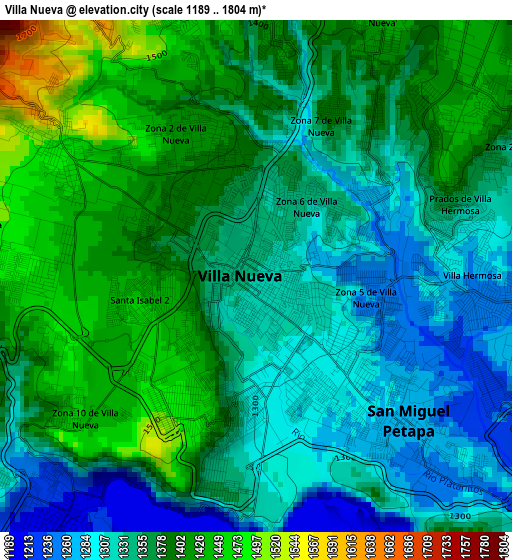
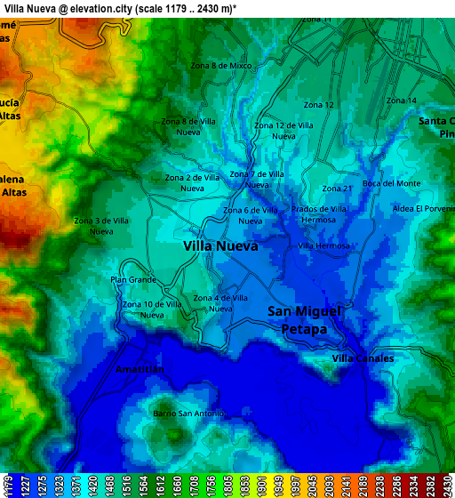
Below is the Elevation map of Villa Nueva, which displays elevation range with different colors. Scale of the first map is from 1189 to 1804 m (3901 to 5919 ft) with average elevation of 1363.5 meters (=4473 ft) [note 1]
These maps also provides idea of topography and contour of this city, they are displayed at different zoom levels. More info about maps, scale and edge coordinates you can find below images.
| \ | Map #1 | Map #2 | Topo.Map |
| Scale [m] | 1189..1804 m | 1179..2430 m | × |
| Scale [ft] | 3901..5919 ft | 3868..7972 ft | × |
| Average | 1363.5 m = 4473 ft | 1484.5 m = 4870 ft | × |
| Width | 9.46 km = 5.9 mi | 18.92 km = 11.8 mi | 302.7 km = 188.1 mi |
| Height | 9.46 km = 5.9 mi | 18.92 km = 11.8 mi | 302.7 km = 188.1 mi |
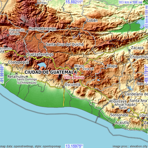
| ↑Max Latitude | 14.567657° | 14.610185° | 15.88211° |
| Latitude at center | 14.52512° | 14.52512° | 14.52512° |
| ↓Min Latitude | 14.482575° | 14.440022° | 13.15975° |
| ← Min Longitude | -90.629385° | -90.673331° | -91.99169° |
| Longitude center | -90.58544° | -90.58544° | -90.58544° |
| →Max Longitude | -90.541495° | -90.497549° | -89.17919° |
Nearby cities:
Cities around Villa Nueva sort by population:
• Guatemala City elevation 1508 m
15 km,  31°
31°
• Mixco 1692 m
12 km,  348°
348°
• Petapa 1269 m
3.6 km,  135°
135°
• Villa Canales 1259 m
7.2 km,  130°
130°
• Amatitlán 1219 m
7.5 km,  225°
225°
• Santa Catarina Pinula 1520 m
10.6 km,  61°
61°
• San Lucas Sacatepéquez 2087 m
12.2 km,  321°
321°
• Santa María de Jesús 2060 m
13.9 km,  255°
255°
• Santa Lucía Milpas Altas 1939 m
11.3 km,  300°
300°
• San Vicente Pacaya 1582 m
13.4 km,  203°
203°
• San Bartolomé Milpas Altas 2115 m
13.5 km,  312°
312°
• Magdalena Milpas Altas 2029 m
9.9 km,  284°
284°
Multilingual:
 En español:
Villa Nueva elevación 1363 m.
 En France:
Villa Nueva élévation 1363 m.
 Auf Deutsch:
Villa Nueva höhe über dem Meeresspiegel ist 1363 m.

Sources and notes:
- [note 1] Map square and city borders are not equal. Map elevation data is calculated only from area inside that square.
- [src 1] Elevation data from geonames database provided with same terms of usage.
- [src 2] The elevation map of Villa Nueva is generated using elevation data from NASA's 3 arcsec (90m) resolution SRTM data.
- [src 3] Base (background) map © OpenStreetMap contributors tiles are generated by Geofabrik and OpenTopoMap.
Copyright & License:
This Villa Nueva Elevation Map is licensed under CC BY-SA. You may reuse any part from this page, if you give a proper credit by linking to this URL:
 More info on terms of use page.