Édessa elevation
Édessa (Central Macedonia, Nomós Péllis), Greece elevation is 312 meters and Édessa elevation in feet is 1024 ft above sea level [src 1]. Édessa is a seat of a second-order administrative division (feature code) with elevation that is 161 meters (528 ft) bigger than average city elevation in Greece.
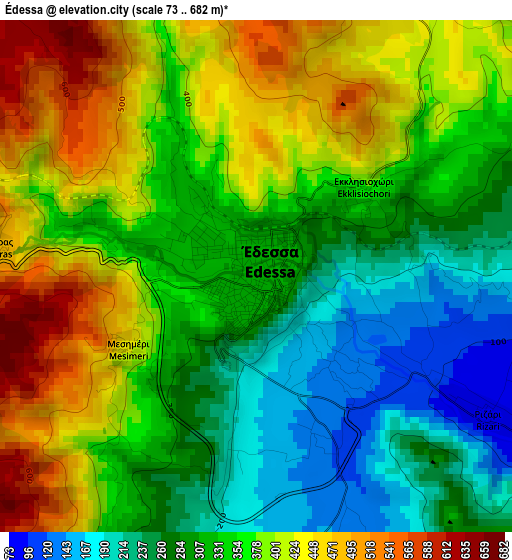
Below is the Elevation map of Édessa, which displays elevation range with different colors. Scale of the first map is from 73 to 682 m (240 to 2238 ft) with average elevation of 346.2 meters (=1136 ft) [note 1]
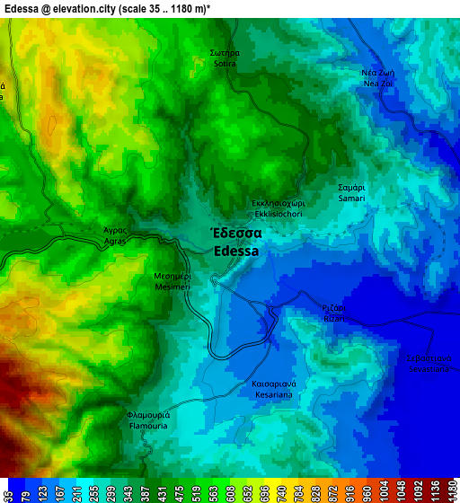
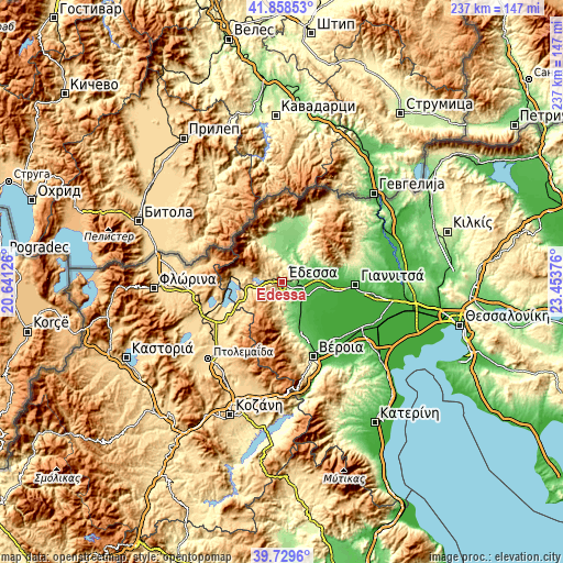
These maps also provides idea of topography and contour of this city, they are displayed at different zoom levels. More info about maps, scale and edge coordinates you can find below images.
| \ | Map #1 | Map #2 | Topo.Map |
| Scale [m] | 73..682 m | 35..1180 m | × |
| Scale [ft] | 240..2238 ft | 115..3871 ft | × |
| Average | 346.2 m = 1136 ft | 379.4 m = 1245 ft | × |
| Width | 7.4 km = 4.6 mi | 14.79 km = 9.2 mi | 236.7 km = 147.1 mi |
| Height | 7.4 km = 4.6 mi | 14.79 km = 9.2 mi | 236.7 km = 147.1 mi |
| ↑Max Latitude | 40.835857° | 40.869097° | 41.85853° |
| Latitude at center | 40.8026° | 40.8026° | 40.8026° |
| ↓Min Latitude | 40.769327° | 40.736036° | 39.7296° |
| ← Min Longitude | 22.003565° | 21.959619° | 20.64126° |
| Longitude center | 22.04751° | 22.04751° | 22.04751° |
| →Max Longitude | 22.091455° | 22.135401° | 23.45376° |
Nearby cities:
Cities around Édessa sort by population:
• Skýdra elevation 37 m
9.6 km,  114°
114°
• Kalí 37 m
11.1 km,  80°
80°
• Sevastianá 47 m
7.4 km,  120°
120°
• Arsénio 43 m
13.6 km,  136°
136°
• Profítis Ilías 37 m
9.7 km, 82°
• Ápsalos 151 m
10 km,  4°
4°
• Rizó 48 m
10.8 km, 135°
• Rizári 81 m
4 km, 121°
• Marína 132 m
13.1 km,  159°
159°
• Káto Lipochóri 26 m
12.2 km, 114°
• Mavrovoúni 37 m
9.4 km,  103°
103°
• Polykárpi 154 m
14 km,  349°
349°
Multilingual:
 En español:
Édessa elevación 312 m.
 En France:
Édessa élévation 312 m.


Sources and notes:
- [note 1] Map square and city borders are not equal. Map elevation data is calculated only from area inside that square.
- [src 1] Elevation data from geonames database provided with same terms of usage.
- [src 2] The elevation map of Édessa is generated using elevation data from NASA's 3 arcsec (90m) resolution SRTM data.
- [src 3] Base (background) map © OpenStreetMap contributors tiles are generated by Geofabrik and OpenTopoMap.
Copyright & License:
This Édessa Elevation Map is licensed under CC BY-SA. You may reuse any part from this page, if you give a proper credit by linking to this URL:
 More info on terms of use page.