Komotiní elevation
Komotiní (East Macedonia and Thrace, Nomós Rodópis), Greece elevation is 41 meters and Komotiní elevation in feet is 135 ft above sea level [src 1]. Komotiní is a seat of a first-order administrative division (feature code) with elevation that is 110 meters (361 ft) smaller than average city elevation in Greece.
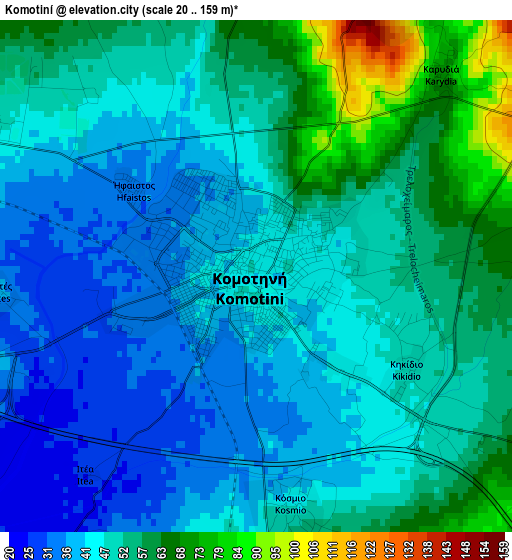
Below is the Elevation map of Komotiní, which displays elevation range with different colors. Scale of the first map is from 20 to 159 m (66 to 522 ft) with average elevation of 49 meters (=161 ft) [note 1]
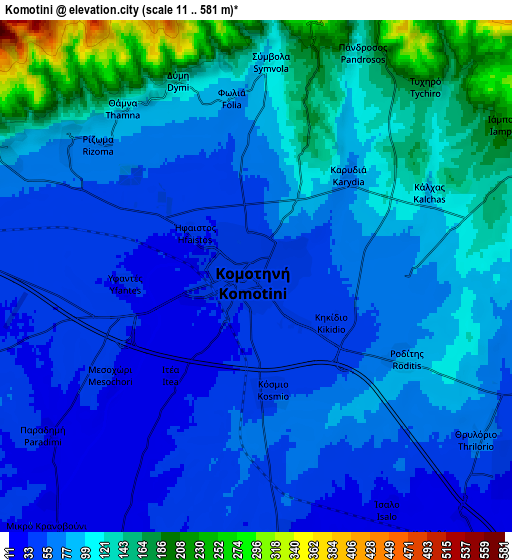
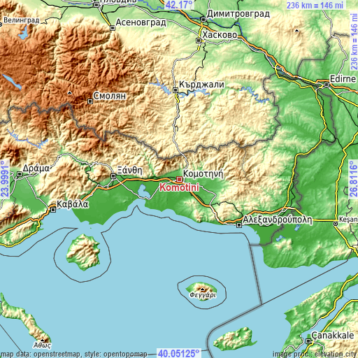
These maps also provides idea of topography and contour of this city, they are displayed at different zoom levels. More info about maps, scale and edge coordinates you can find below images.
| \ | Map #1 | Map #2 | Topo.Map |
| Scale [m] | 20..159 m | 11..581 m | × |
| Scale [ft] | 66..522 ft | 36..1906 ft | × |
| Average | 49 m = 161 ft | 86.5 m = 284 ft | × |
| Width | 7.36 km = 4.6 mi | 14.72 km = 9.1 mi | 235.6 km = 146.4 mi |
| Height | 7.36 km = 4.6 mi | 14.72 km = 9.1 mi | 235.6 km = 146.4 mi |
| ↑Max Latitude | 41.152268° | 41.185348° | 42.17° |
| Latitude at center | 41.11917° | 41.11917° | 41.11917° |
| ↓Min Latitude | 41.086056° | 41.052925° | 40.05125° |
| ← Min Longitude | 25.361405° | 25.317459° | 23.9991° |
| Longitude center | 25.40535° | 25.40535° | 25.40535° |
| →Max Longitude | 25.449295° | 25.493241° | 26.8116° |
Nearby cities:
Cities around Komotiní sort by population:
• Sápes elevation 120 m
26.1 km,  112°
112°
• Kimméria 77 m
39.2 km,  274°
274°
• Íasmos 27 m
18.4 km, 272°
• Echínos 322 m
40.2 km,  295°
295°
• Sélero 72 m
34.5 km, 272°
• Genisséa 26 m
37.7 km,  260°
260°
• Xylaganí 44 m
16.1 km,  175°
175°
• Arrianá 58 m
24.6 km,  99°
99°
• Áratos 34 m
13 km, 108°
• Lýkeio 56 m
24.3 km, 104°
• Arísvi 38 m
16.4 km, 109°
• Fillýra 75 m
19.1 km,  90°
90°
Multilingual:
 En español:
Komotiní elevación 41 m.
 En France:
Komotiní élévation 41 m.


Sources and notes:
- [note 1] Map square and city borders are not equal. Map elevation data is calculated only from area inside that square.
- [src 1] Elevation data from geonames database provided with same terms of usage.
- [src 2] The elevation map of Komotiní is generated using elevation data from NASA's 3 arcsec (90m) resolution SRTM data.
- [src 3] Base (background) map © OpenStreetMap contributors tiles are generated by Geofabrik and OpenTopoMap.
Copyright & License:
This Komotiní Elevation Map is licensed under CC BY-SA. You may reuse any part from this page, if you give a proper credit by linking to this URL:
 More info on terms of use page.