Neochoroúda elevation
Neochoroúda (Central Macedonia, Nomós Thessaloníkis), Greece elevation is 215 meters and Neochoroúda elevation in feet is 705 ft above sea level [src 1]. Neochoroúda is a populated place (feature code) with elevation that is 64 meters (210 ft) bigger than average city elevation in Greece.
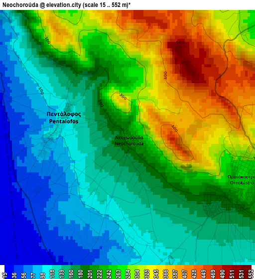
Below is the Elevation map of Neochoroúda, which displays elevation range with different colors. Scale of the first map is from 15 to 552 m (49 to 1811 ft) with average elevation of 211.6 meters (=694 ft) [note 1]
These maps also provides idea of topography and contour of this city, they are displayed at different zoom levels. More info about maps, scale and edge coordinates you can find below images.
| \ | Map #1 | Topo.Map |
| Scale [m] | 15..552 m | × |
| Scale [ft] | 49..1811 ft | × |
| Average | 211.6 m = 694 ft | × |
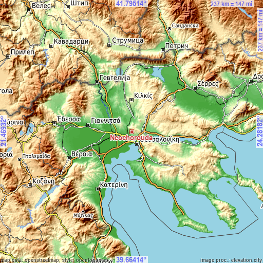
| Width | 7.4 km = 4.6 mi | 236.9 km = 147.2 mi |
| Height | 7.4 km = 4.6 mi | 236.9 km = 147.2 mi |
| ↑Max Latitude | 40.771459° | 41.79514° |
| Latitude at center | 40.73817° | 40.73817° |
| ↓Min Latitude | 40.704864° | 39.66414° |
| ← Min Longitude | 22.831625° | 21.46932° |
| Longitude center | 22.87557° | 22.87557° |
| →Max Longitude | 22.919515° | 24.28182° |
Nearby cities:
Cities around Neochoroúda sort by population:
• Meneméni elevation 7 m
9.1 km,  168°
168°
• Oraiókastro 269 m
3.6 km,  103°
103°
• Diavatá 15 m
5.8 km,  194°
194°
• Néa Magnisía 17 m
6.1 km,  204°
204°
• Efkarpía 109 m
8.6 km,  130°
130°
• Lití 134 m
8.8 km,  84°
84°
• Néa Mesimvría 108 m
9.1 km,  279°
279°
• Pentálofos 120 m
2 km,  285°
285°
• Drymós 189 m
8.5 km,  55°
55°
• Melissochóri 221 m
5.6 km,  53°
53°
• Stavroúpoli 45 m
9.3 km,  145°
145°
• Évosmos 43 m
8 km,  159°
159°
Multilingual:
 En español:
Neochoroúda elevación 215 m.
 En France:
Neochoroúda élévation 215 m.
 Auf Deutsch:
Neochoroúda höhe über dem Meeresspiegel ist 215 m.

Sources and notes:
- [note 1] Map square and city borders are not equal. Map elevation data is calculated only from area inside that square.
- [src 1] Elevation data from geonames database provided with same terms of usage.
- [src 2] The elevation map of Neochoroúda is generated using elevation data from NASA's 3 arcsec (90m) resolution SRTM data.
- [src 3] Base (background) map © OpenStreetMap contributors tiles are generated by Geofabrik and OpenTopoMap.
Copyright & License:
This Neochoroúda Elevation Map is licensed under CC BY-SA. You may reuse any part from this page, if you give a proper credit by linking to this URL:
 More info on terms of use page.