Panórama elevation
Panórama (Central Macedonia, Nomós Thessaloníkis), Greece elevation is 368 meters and Panórama elevation in feet is 1207 ft above sea level [src 1]. Panórama is a seat of a third-order administrative division (feature code) with elevation that is 217 meters (712 ft) bigger than average city elevation in Greece.
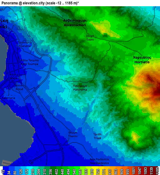
Below is the Elevation map of Panórama, which displays elevation range with different colors. Scale of the first map is from 11 to 568 m (36 to 1864 ft) with average elevation of 239.9 meters (=787 ft) [note 1]
These maps also provides idea of topography and contour of this city, they are displayed at different zoom levels. More info about maps, scale and edge coordinates you can find below images.

| \ | Map #1 | Map #2 | Topo.Map |
| Scale [m] | 11..568 m | -12..1185 m | × |
| Scale [ft] | 36..1864 ft | -39..3888 ft | × |
| Average | 239.9 m = 787 ft | 279.5 m = 917 ft | × |
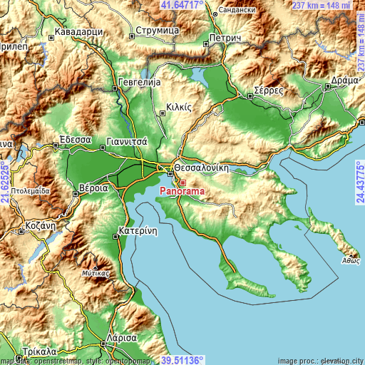
| Width | 7.42 km = 4.6 mi | 14.84 km = 9.2 mi | 237.5 km = 147.6 mi |
| Height | 7.42 km = 4.6 mi | 14.84 km = 9.2 mi | 237.5 km = 147.6 mi |
| ↑Max Latitude | 40.621154° | 40.654502° | 41.64717° |
| Latitude at center | 40.58779° | 40.58779° | 40.58779° |
| ↓Min Latitude | 40.554409° | 40.521012° | 39.51136° |
| ← Min Longitude | 22.987555° | 22.943609° | 21.62525° |
| Longitude center | 23.0315° | 23.0315° | 23.0315° |
| →Max Longitude | 23.075445° | 23.119391° | 24.43775° |
Nearby cities:
Cities around Panórama sort by population:
• Thessaloníki elevation 8 m
10.5 km,  306°
306°
• Kalamariá 39 m
6.9 km,  265°
265°
• Sykiés 115 m
9.7 km,  315°
315°
• Neapoli 82 m
10.5 km, 313°
• Pylaía 90 m
4 km,  288°
288°
• Thérmi 54 m
4.6 km,  192°
192°
• Triandría 71 m
5.6 km,  302°
302°
• Ágios Pávlos 145 m
8.4 km, 314°
• Asvestochóri 357 m
6 km,  354°
354°
• Chortiátis 551 m
6.3 km,  67°
67°
• Néo Rýsi 43 m
10.8 km,  199°
199°
• Péfka 250 m
8.4 km,  337°
337°
Multilingual:
 En español:
Panórama elevación 368 m.
 En France:
Panórama élévation 368 m.
 Auf Deutsch:
Panórama höhe über dem Meeresspiegel ist 368 m.

Sources and notes:
- [note 1] Map square and city borders are not equal. Map elevation data is calculated only from area inside that square.
- [src 1] Elevation data from geonames database provided with same terms of usage.
- [src 2] The elevation map of Panórama is generated using elevation data from NASA's 3 arcsec (90m) resolution SRTM data.
- [src 3] Base (background) map © OpenStreetMap contributors tiles are generated by Geofabrik and OpenTopoMap.
Copyright & License:
This Panórama Elevation Map is licensed under CC BY-SA. You may reuse any part from this page, if you give a proper credit by linking to this URL:
 More info on terms of use page.